Trip Archives: Up the Brahmaputra

Travelling in Bangladesh, India, and Nepal in the winter/spring of 2014.

Siliguri – Charaali

Spent the morning in the city waiting for my Indian SIM card to be activated. For some reason this had to be done in the shop where I bought it yesterday.

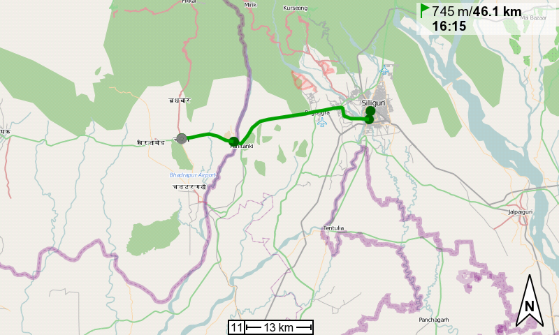
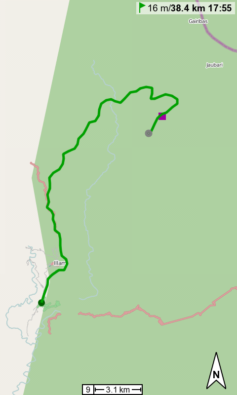
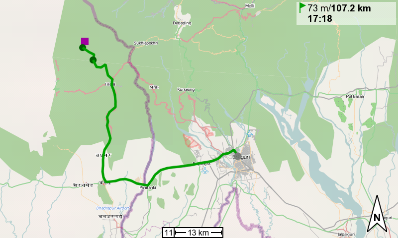
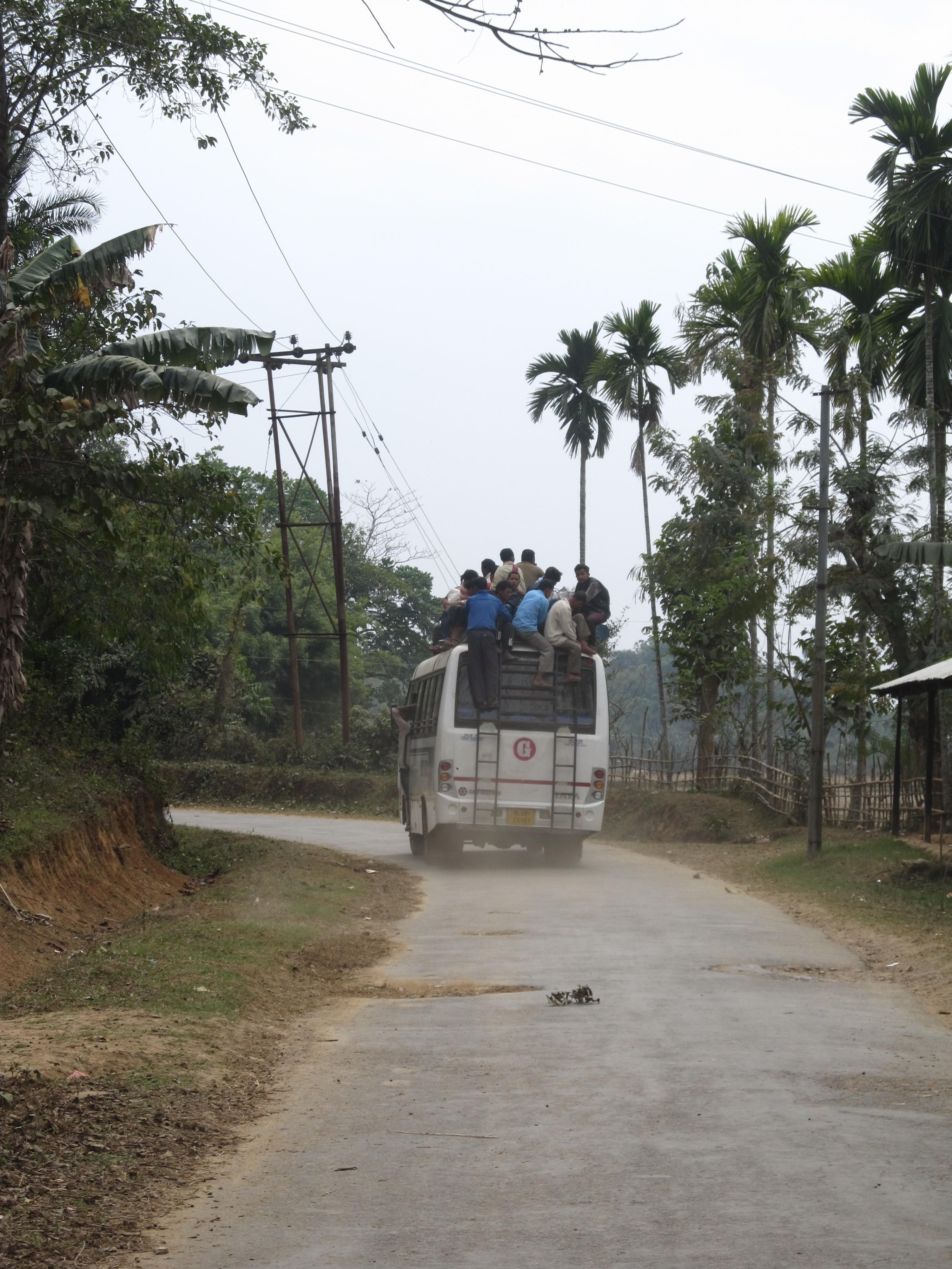
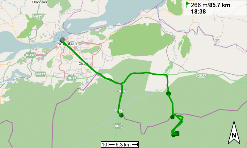
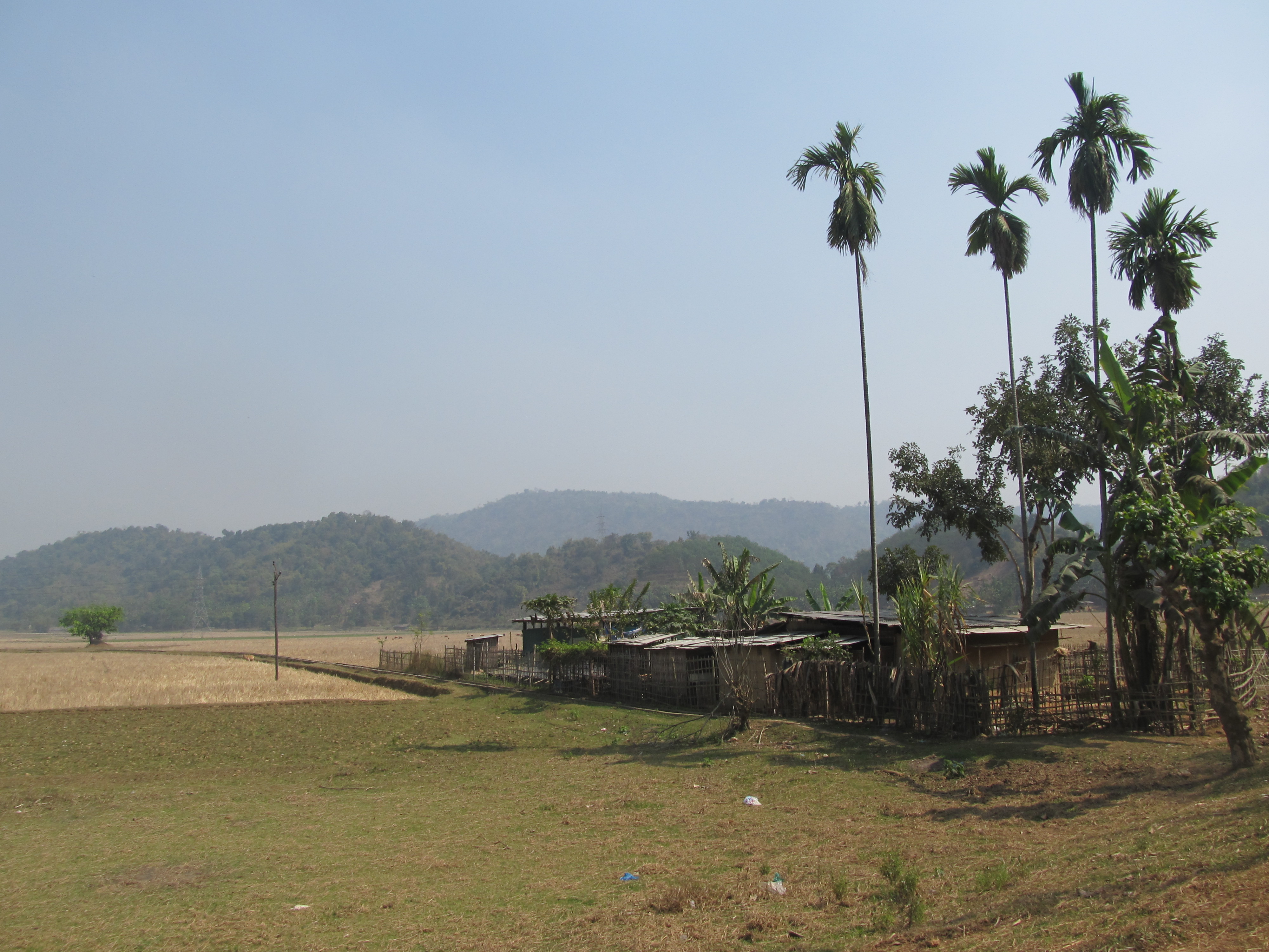
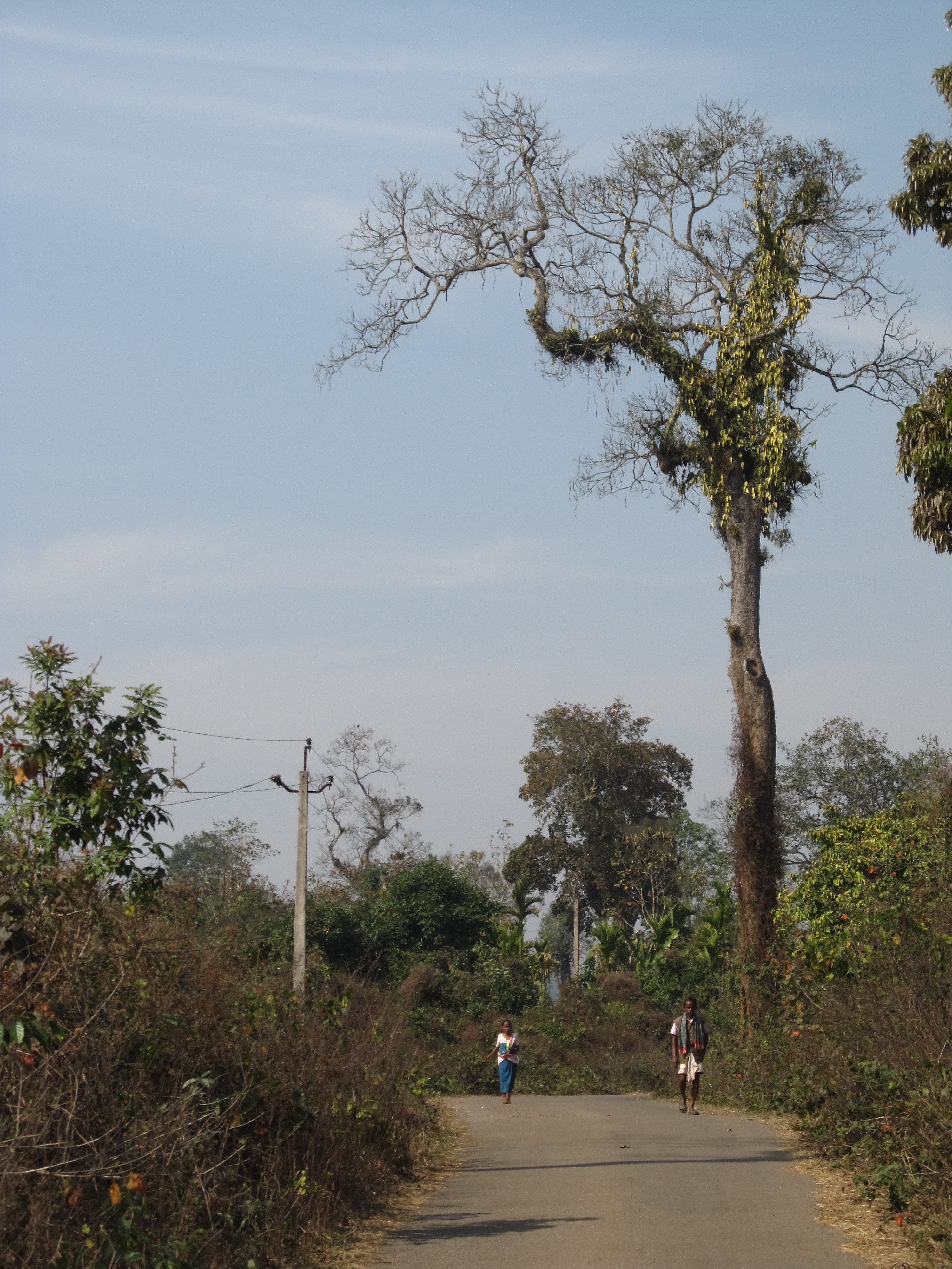
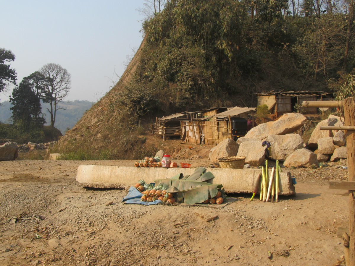
I left Siliguri around noon and cycled straight westward, to the Nepali border.

At the Indian checkpoint I met a group of German cyclists. They were on an organized tour and were waiting for their bikes. They had tried to cross at a different crossing further north, which is closed for foreigners. I don’t know why, but instead of cycling down they’d rented a car that took their bikes down to this crossing.
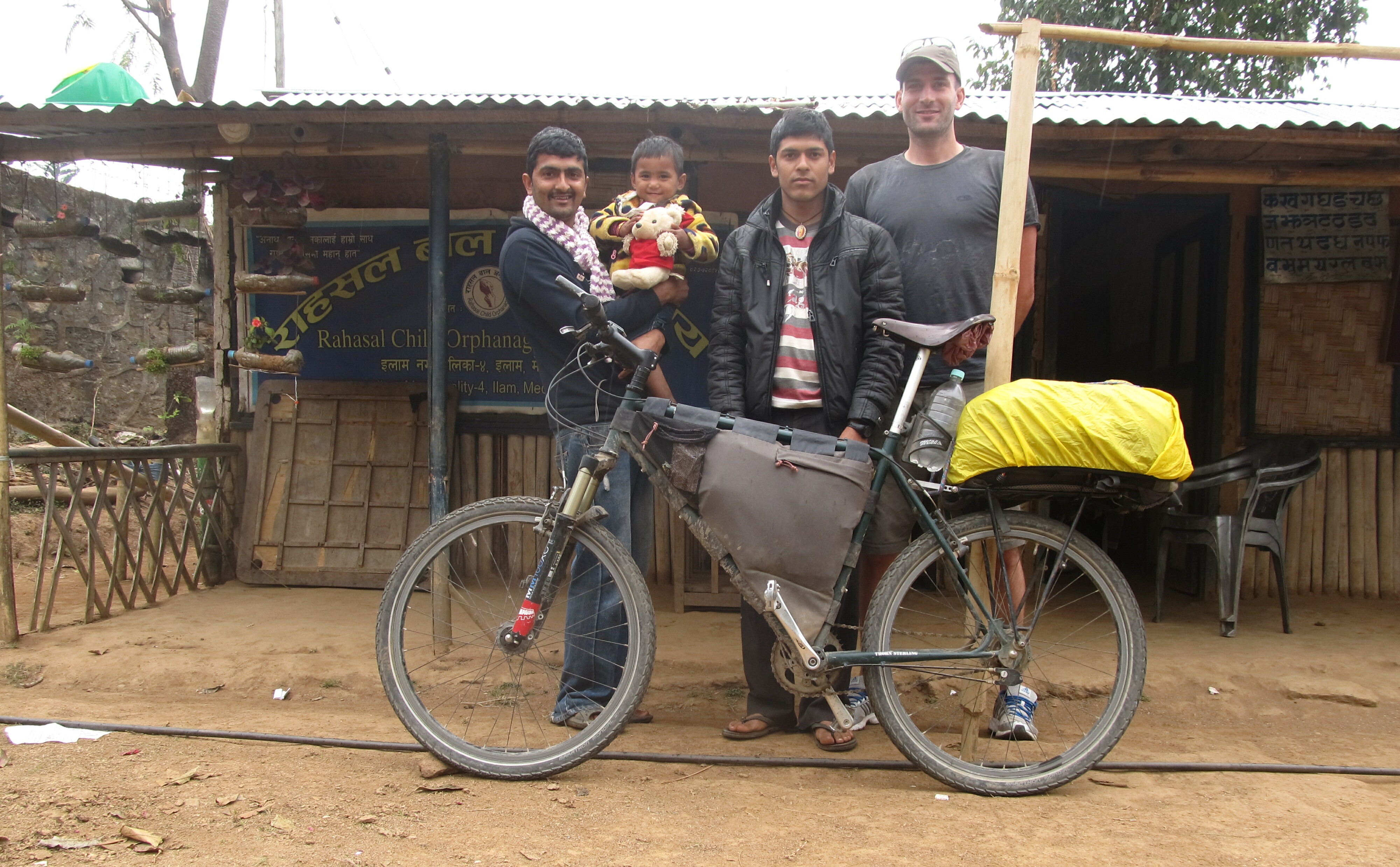
One of the guys asked me about my framebag, and where to get one. Unfortunately, I had to tell him that my business is not up and running yet…

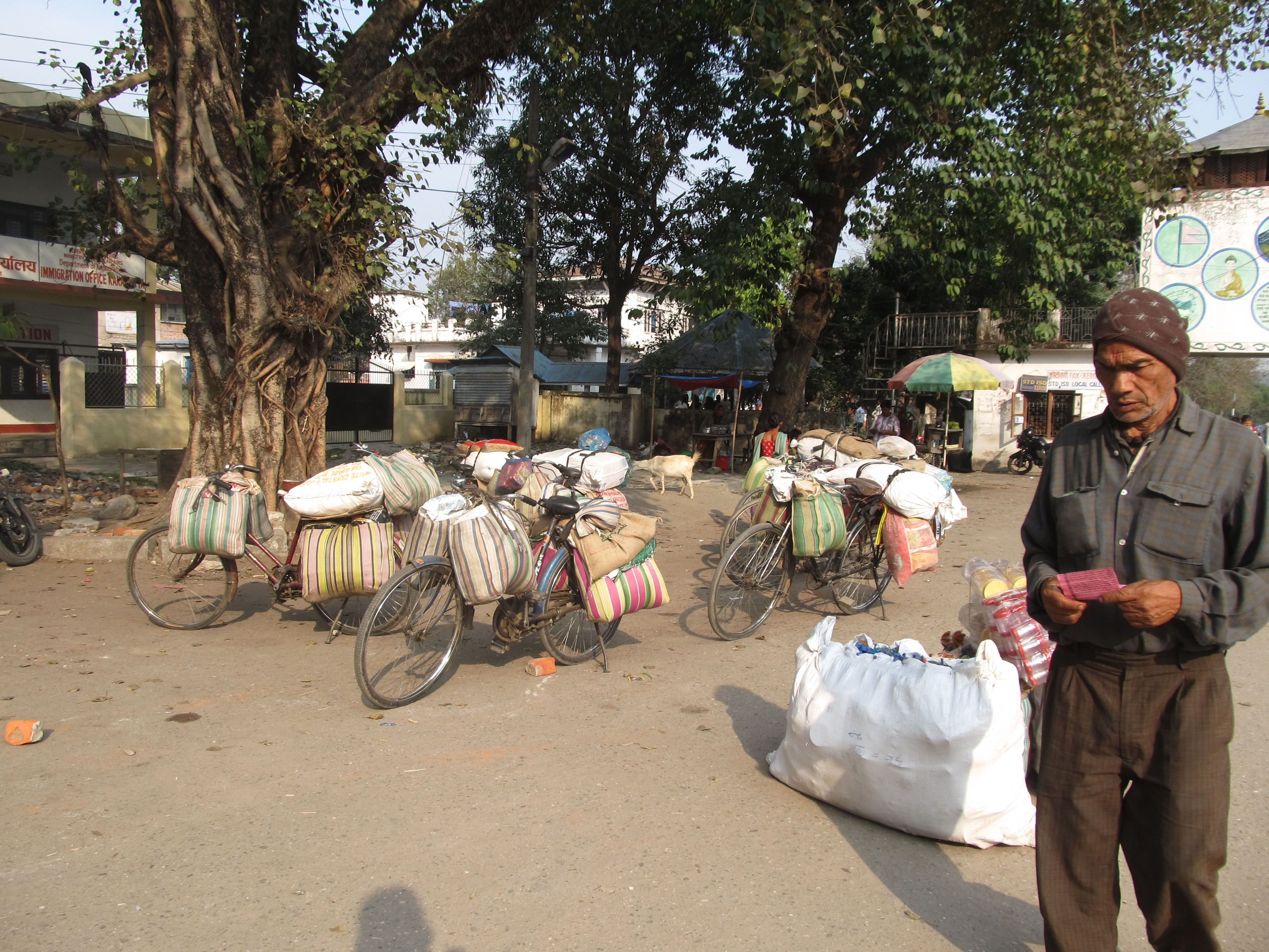
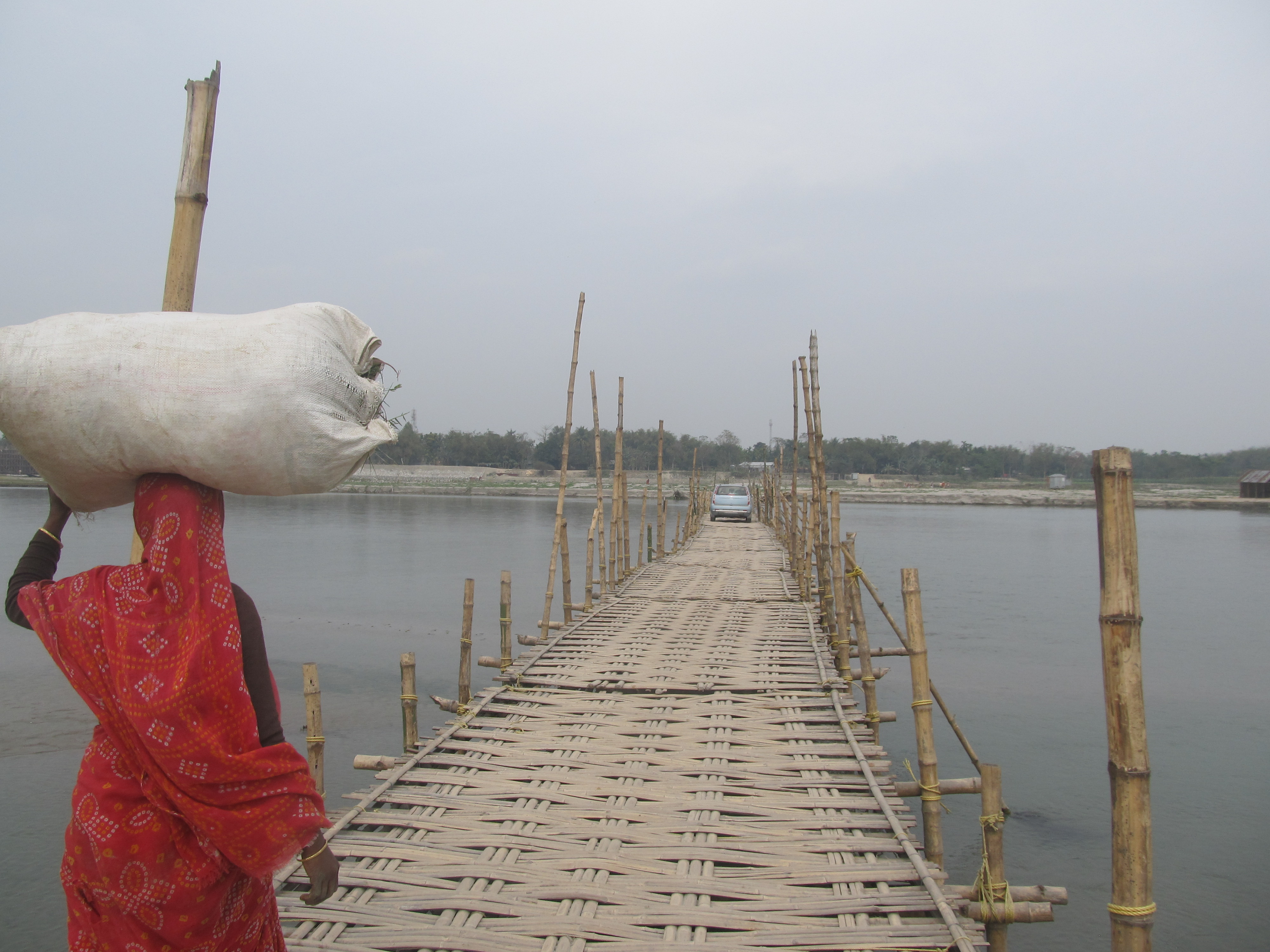
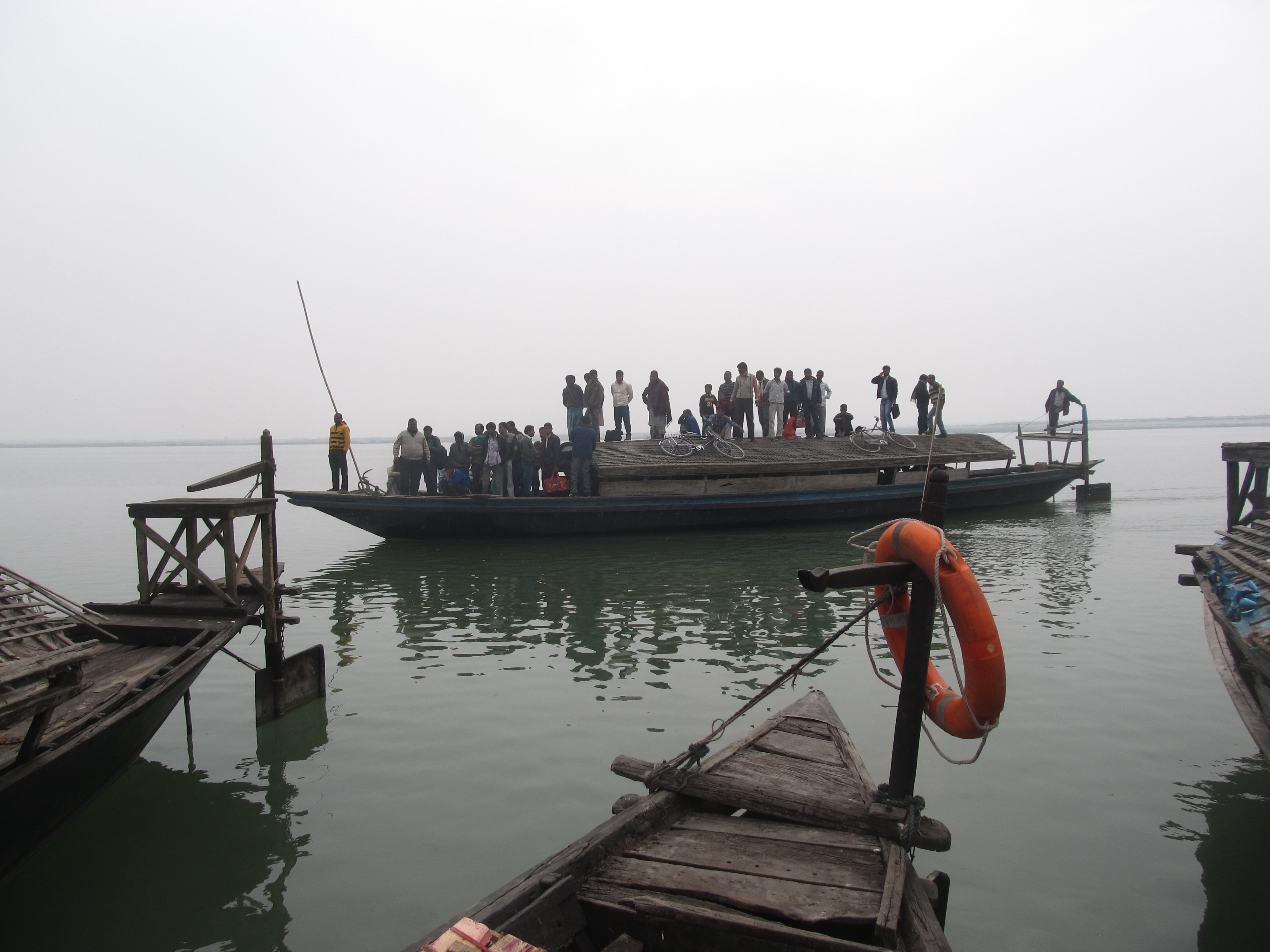
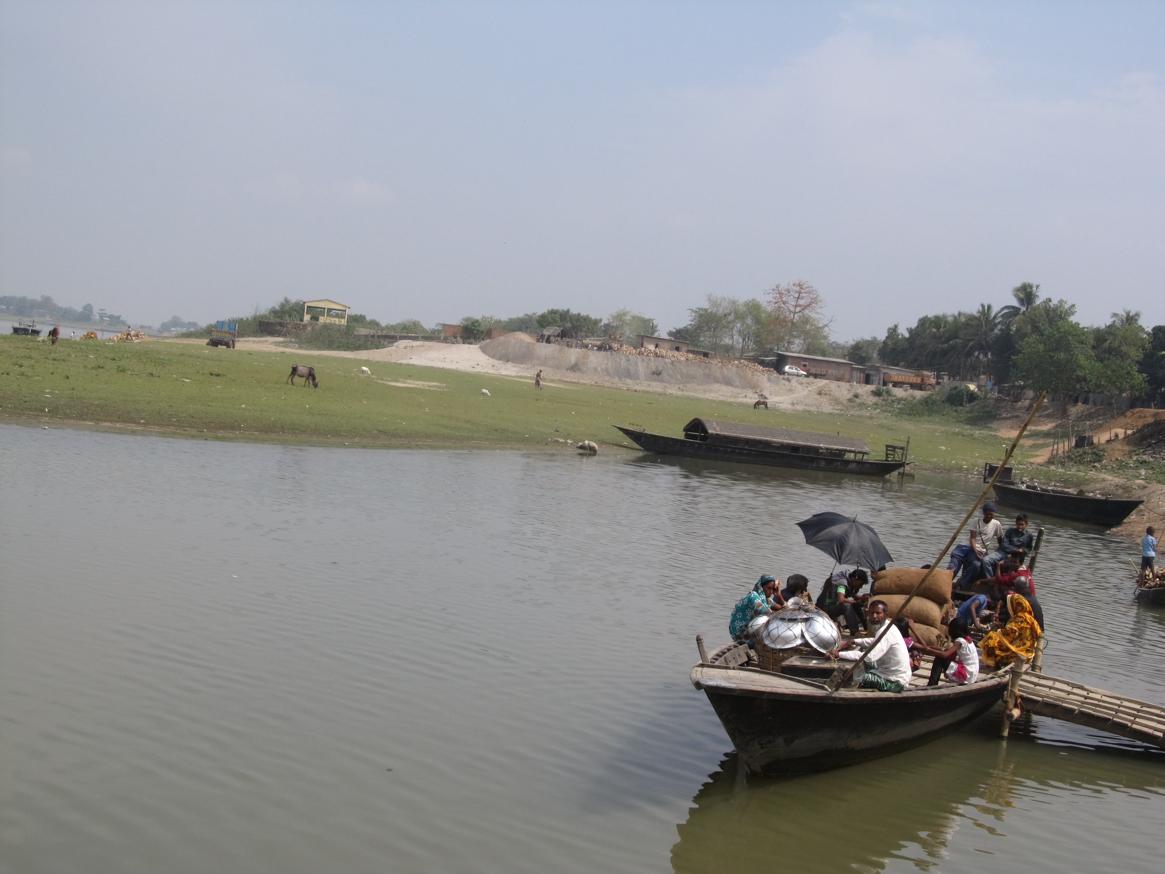
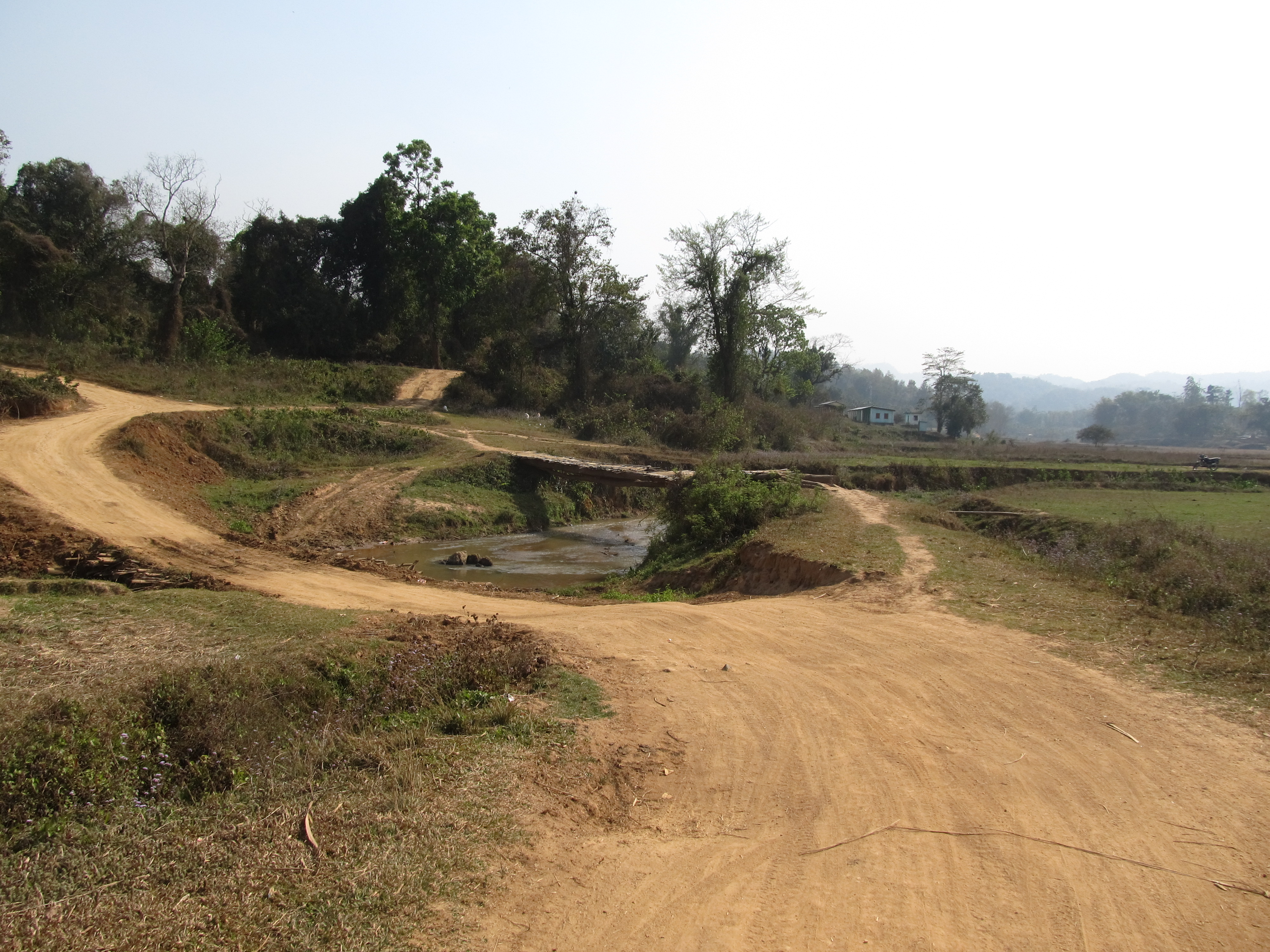
On the Nepali side, on the western bank of the Mechi river, the immigration and customs situation was a bit unclear. It doesn’t seem to be customary here (as in, on the Indian sub-continent?) to have toll road-like immigration offices. Indians and Nepalis, who make up most of the border traffic here, can cross the border unrestricted, that is, without any document checks (and maybe even without any documents at all). Immigration offices are therefore placed somewhere at the side of the road and especially in Nepal it felt like I could have cycled past without anyone taking notice.
I did stop, of course, and bought my 15-day visa-on-arrival for US$ 25.

Fun fact of the day: While Indian Rupees are legal tender in Nepal, for reasons unknown the Indian 500 and 1000 Rupee notes are not only not accepted in Nepal, it is also illegal to carry them around or to try to change them. What can I say, most of my cash is in notes of 500 Indian Rupees.

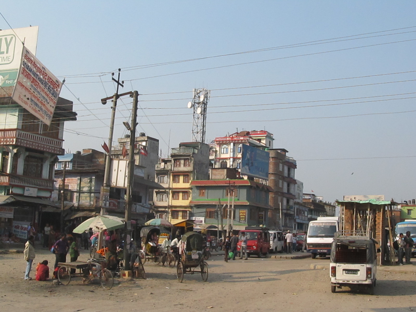
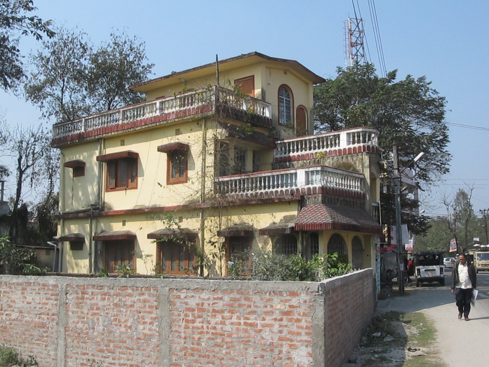
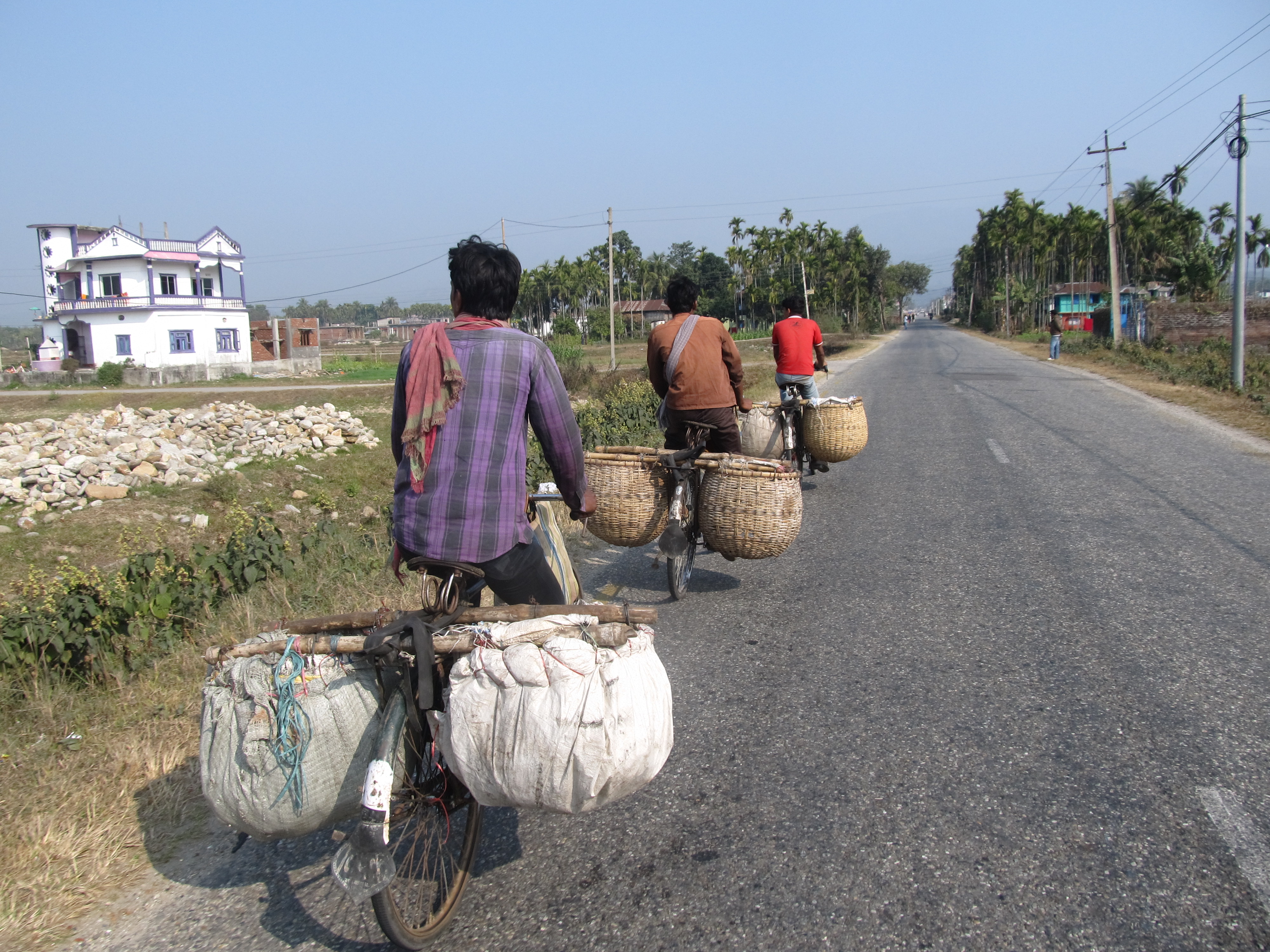
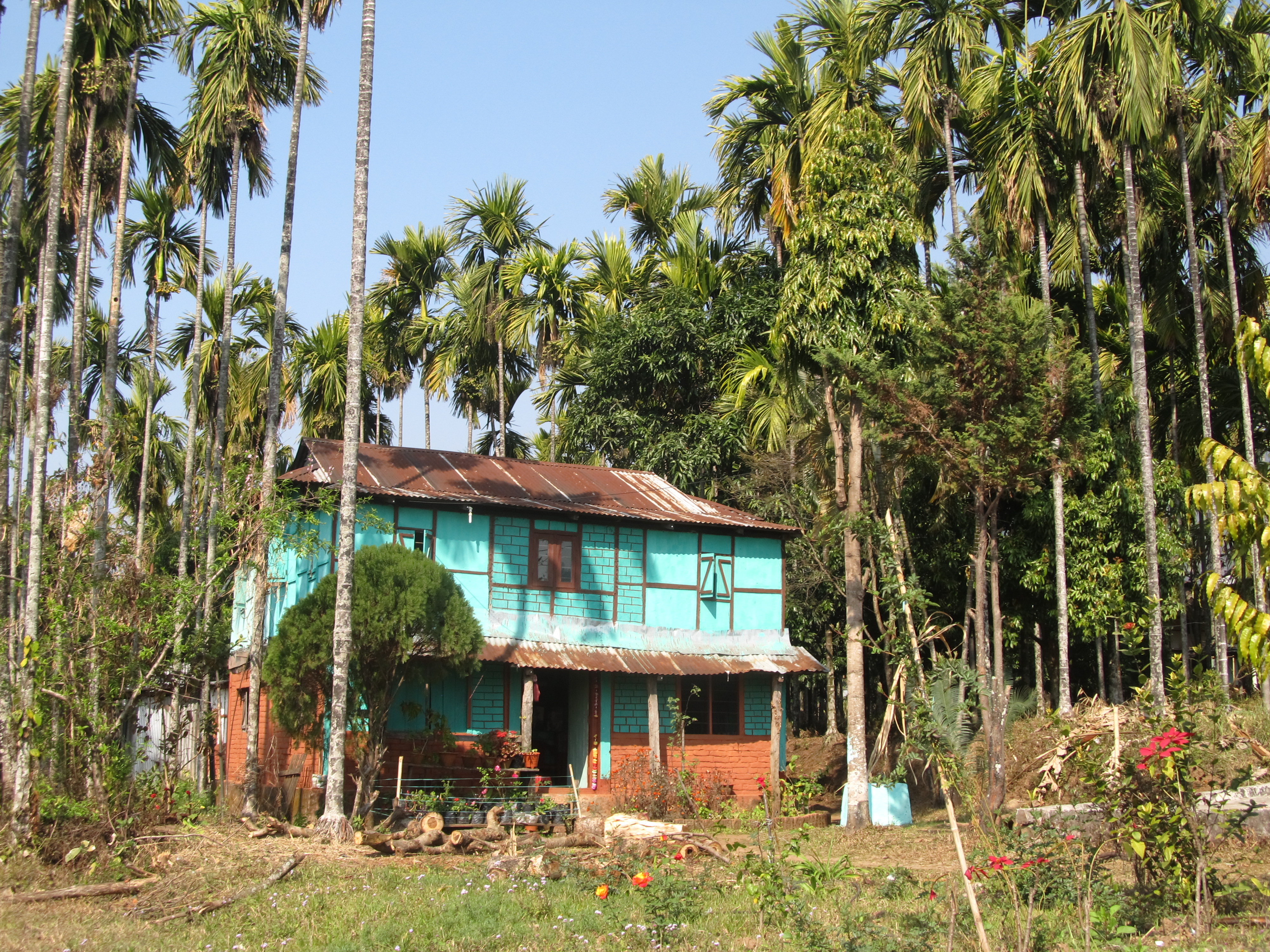
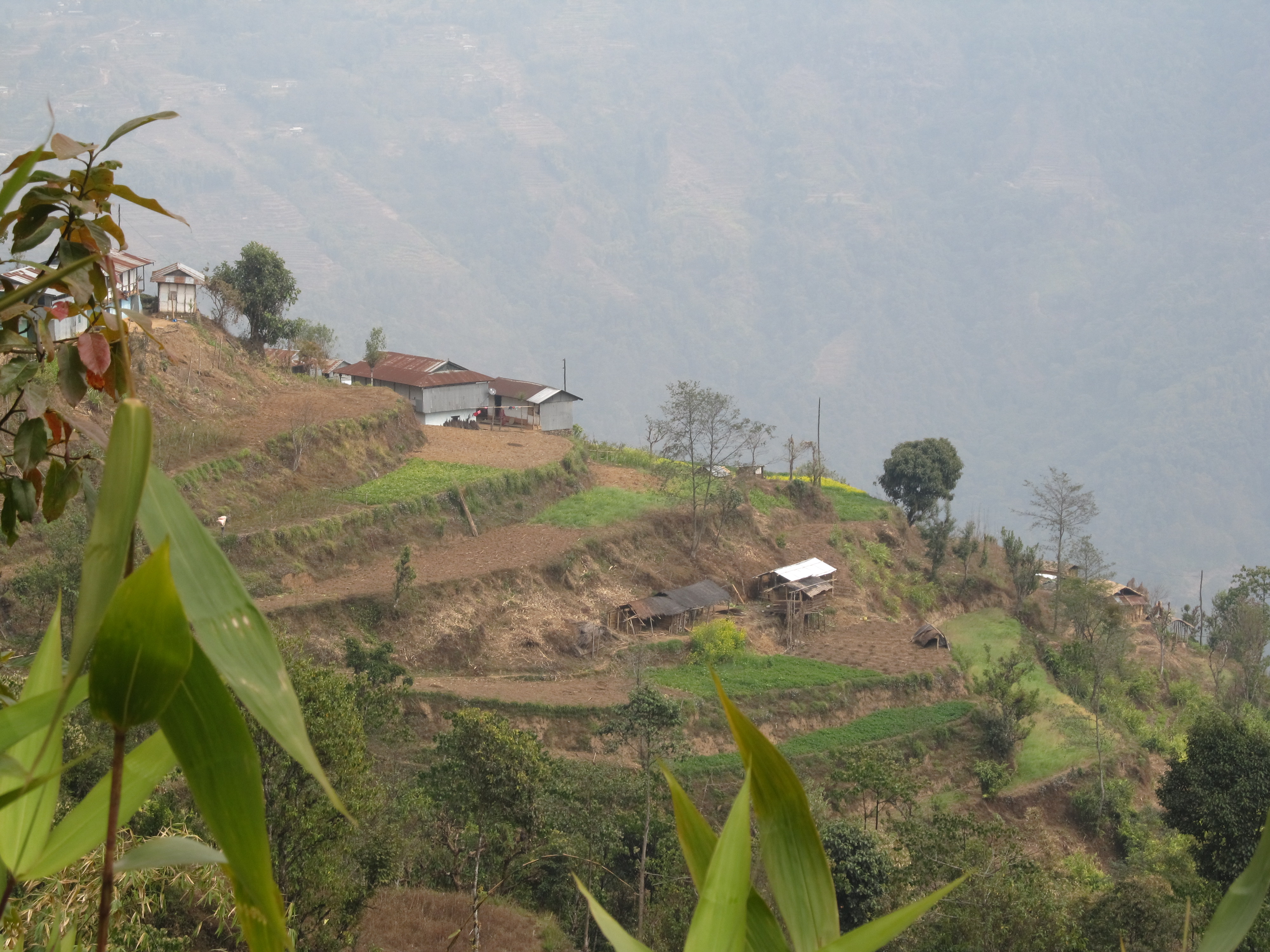
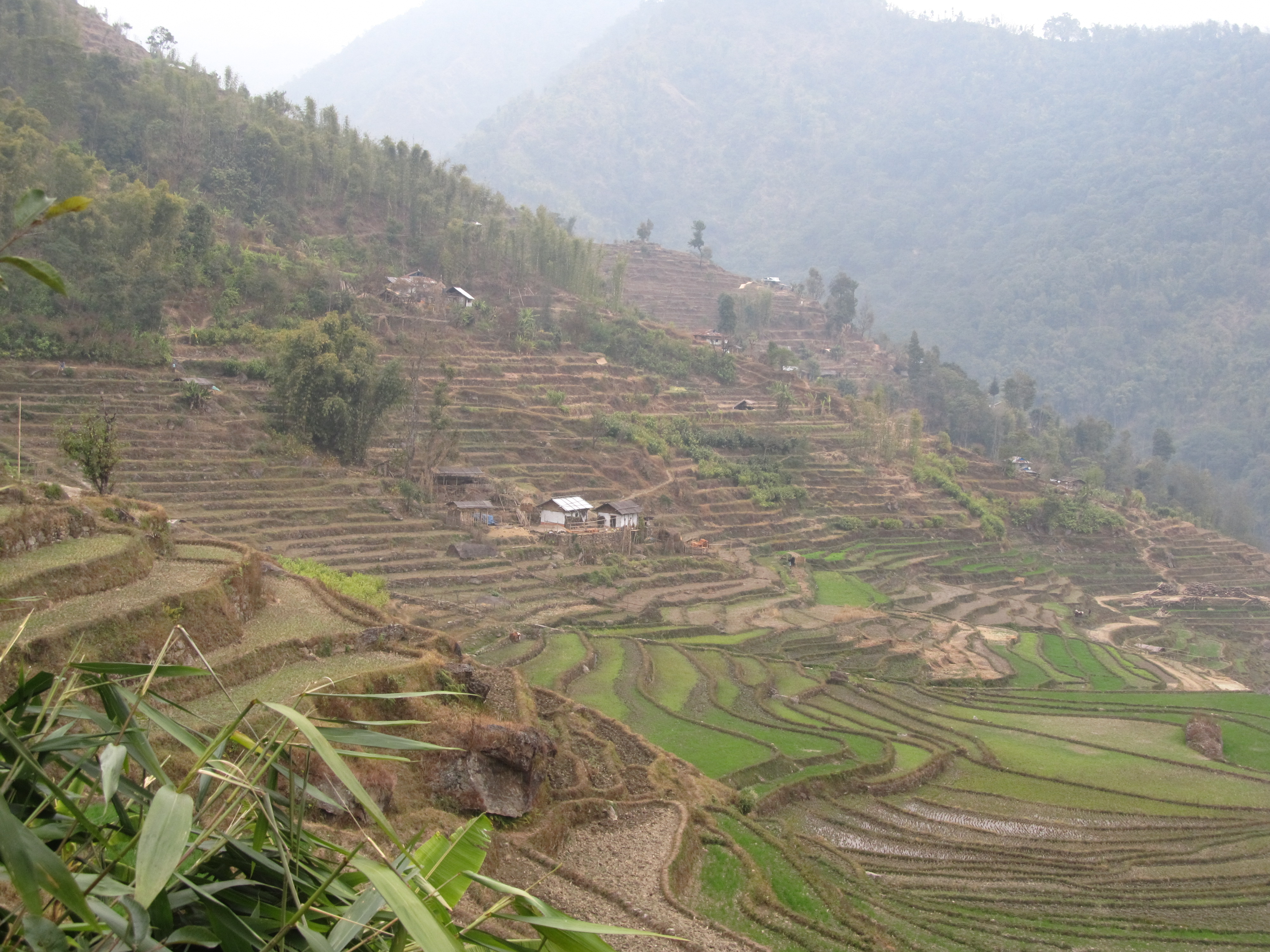
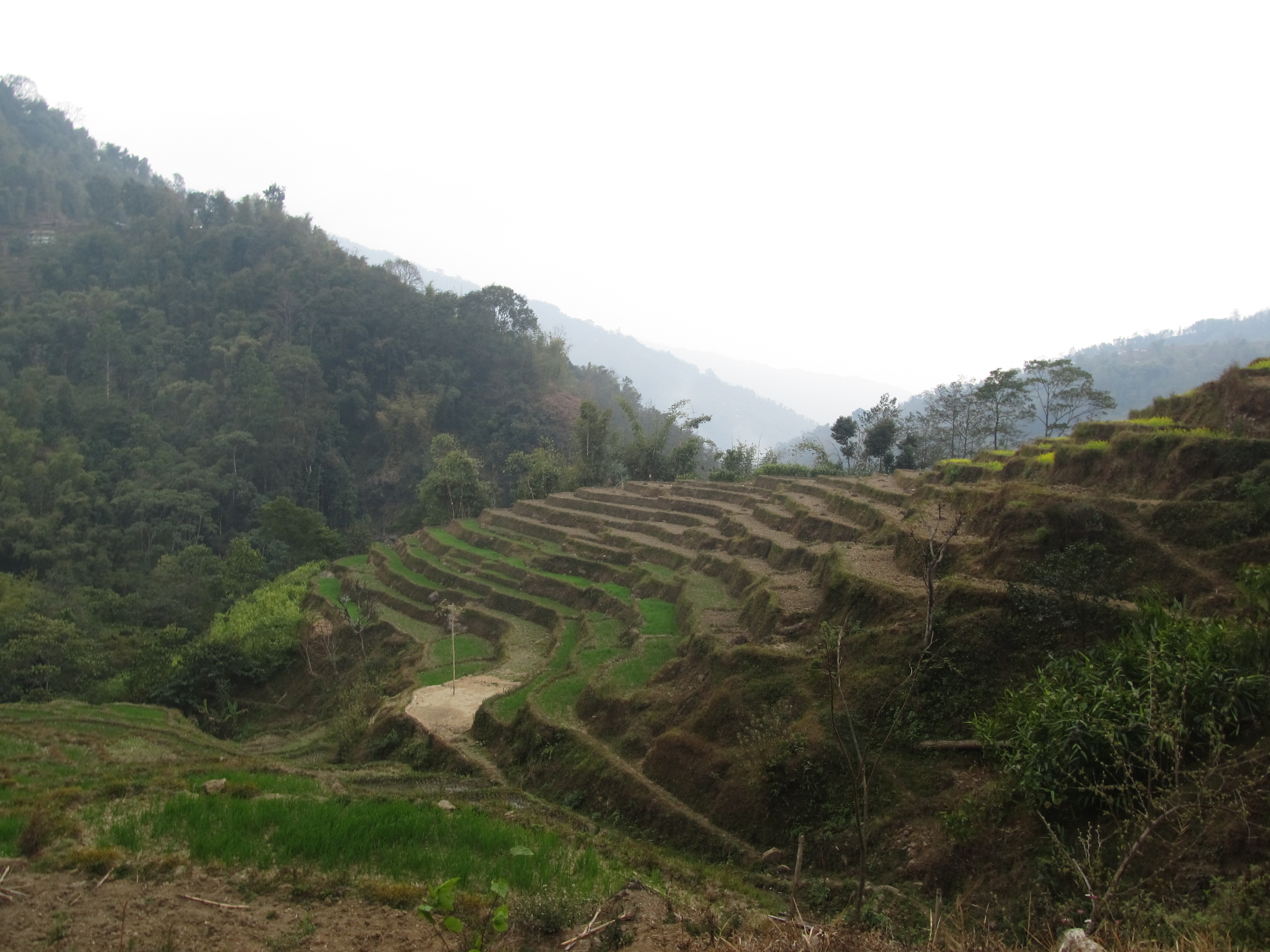
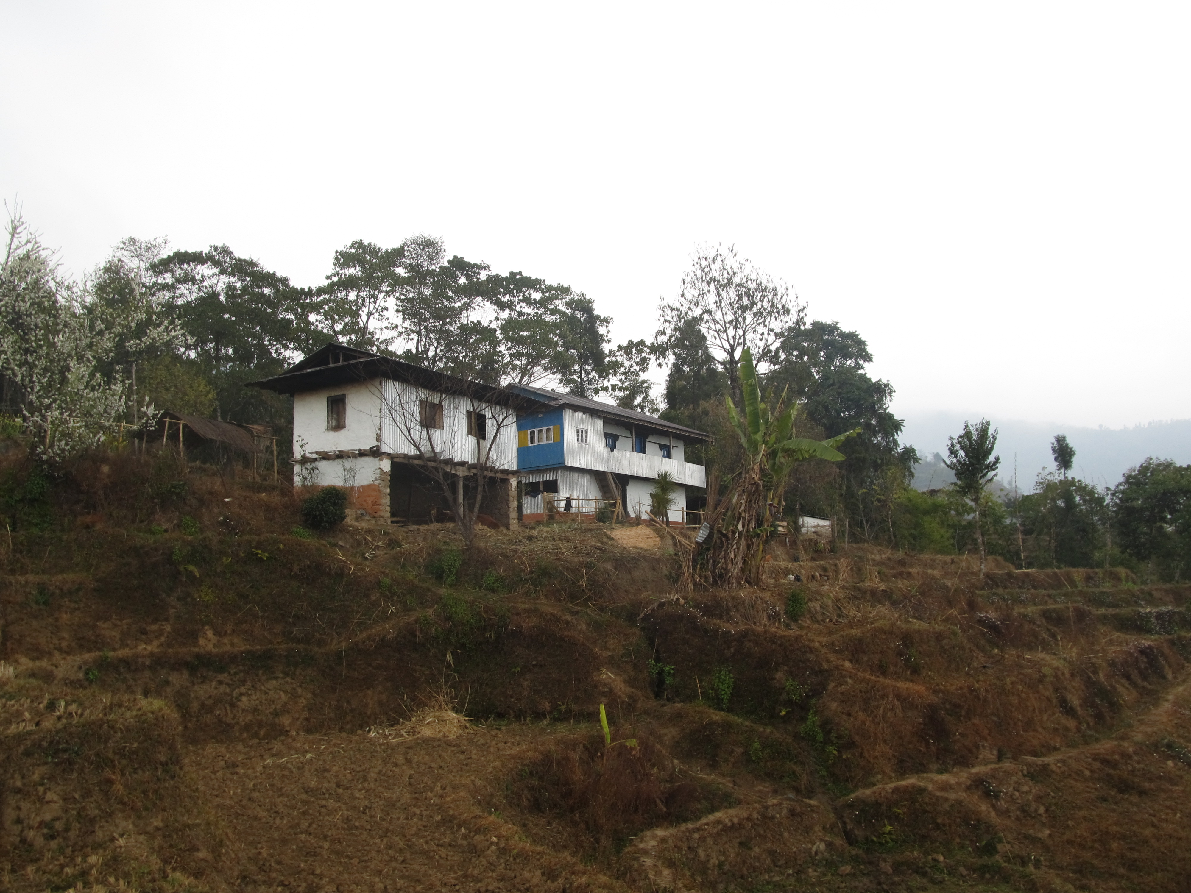
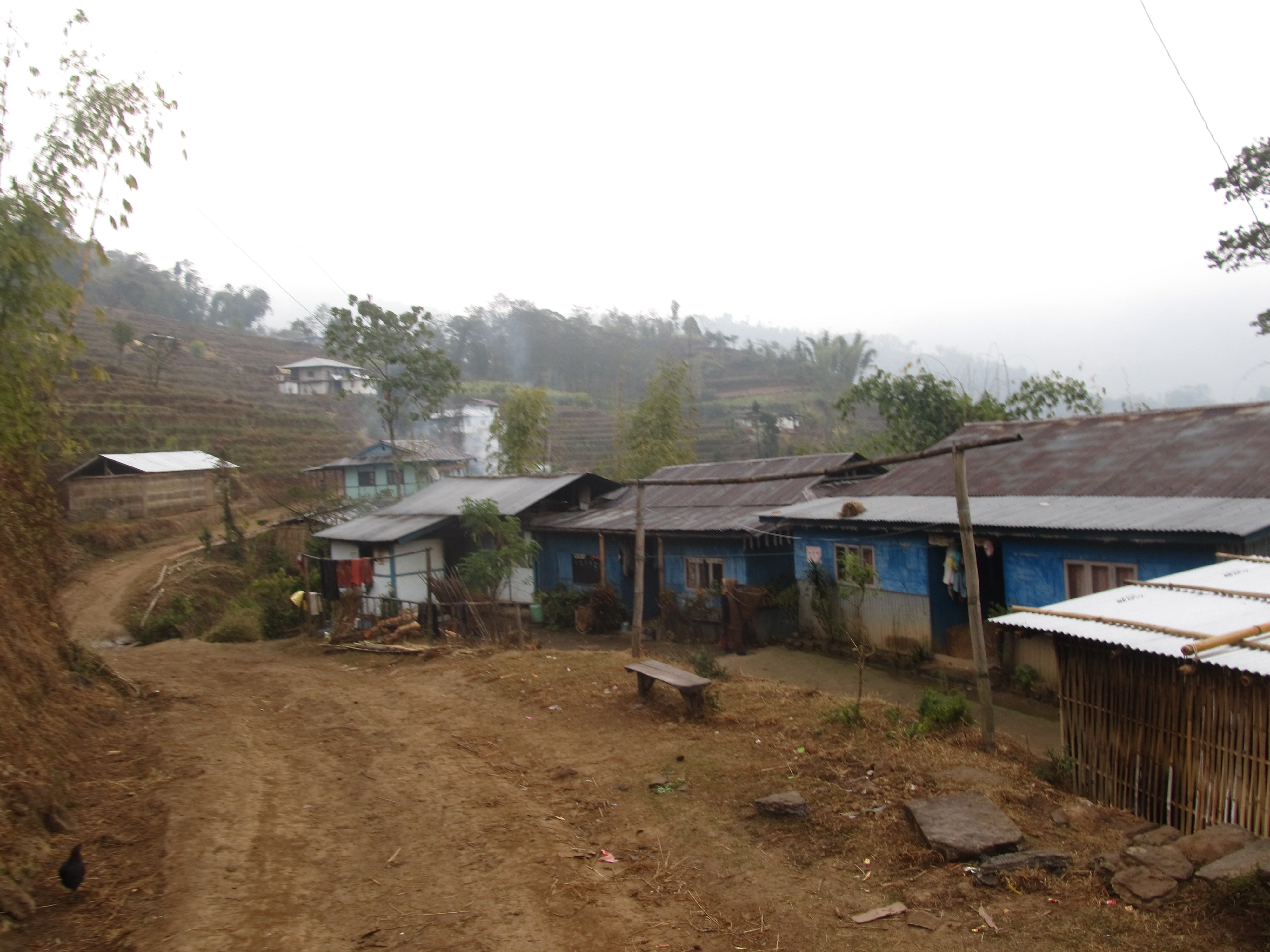
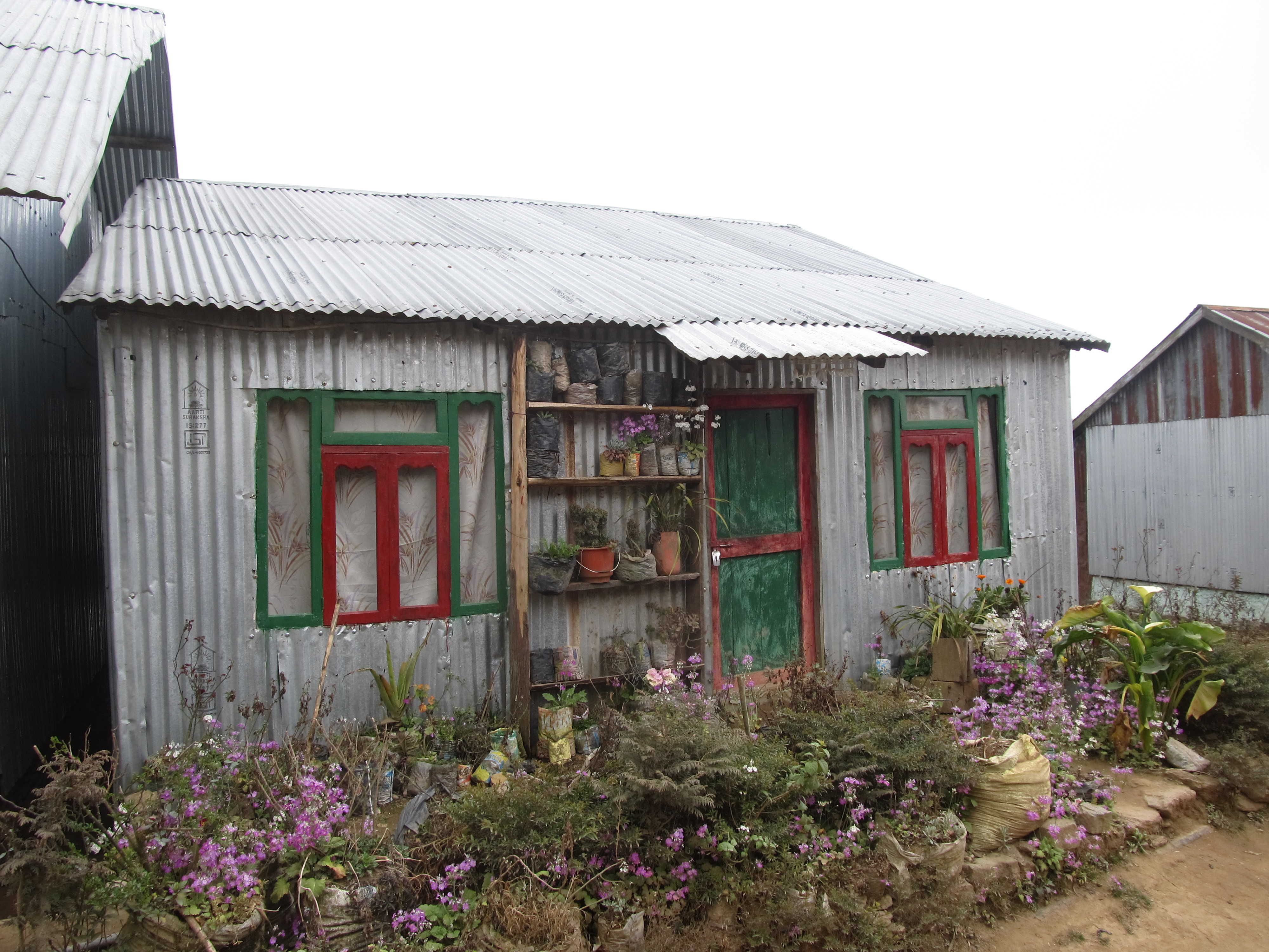
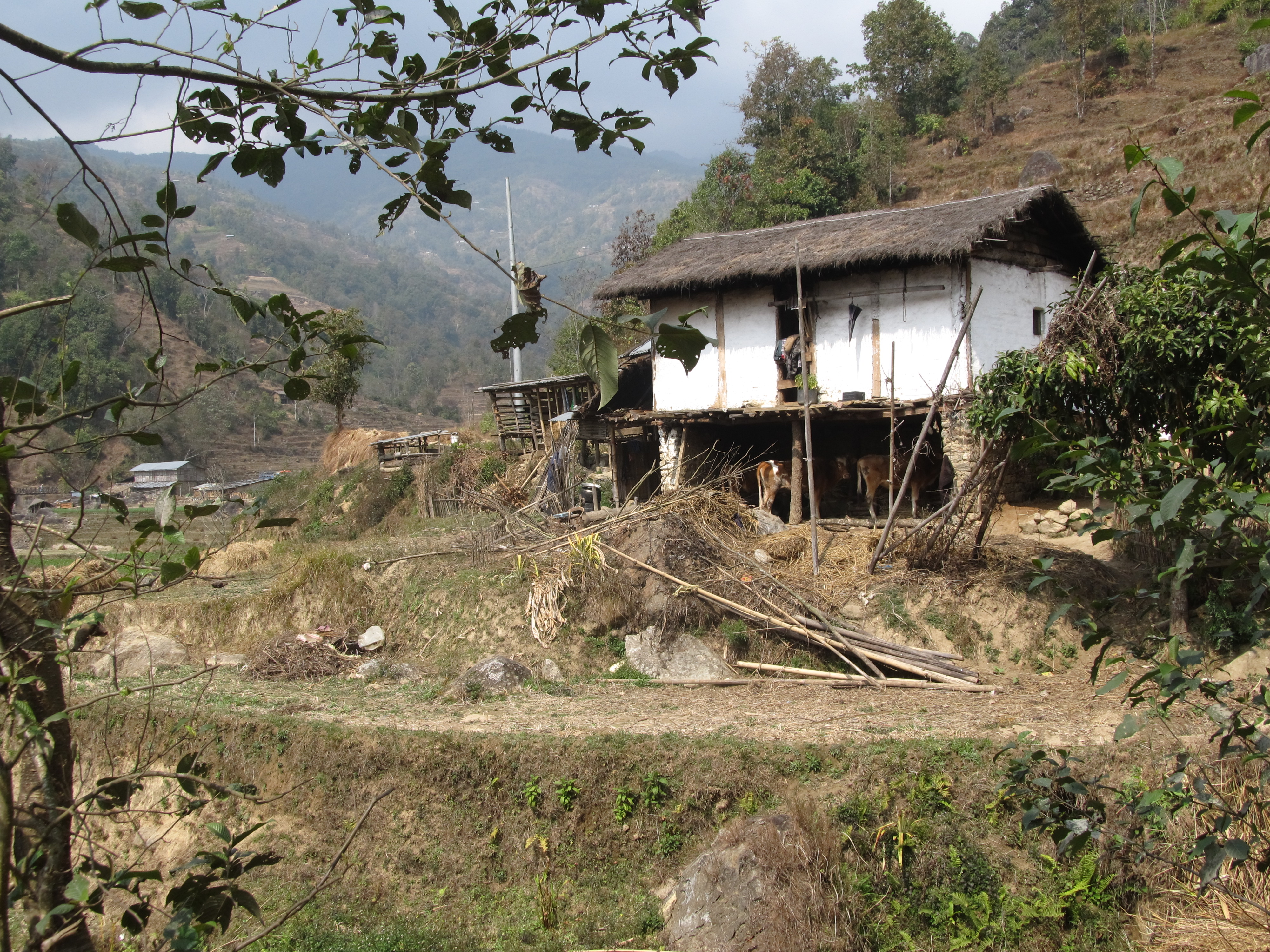
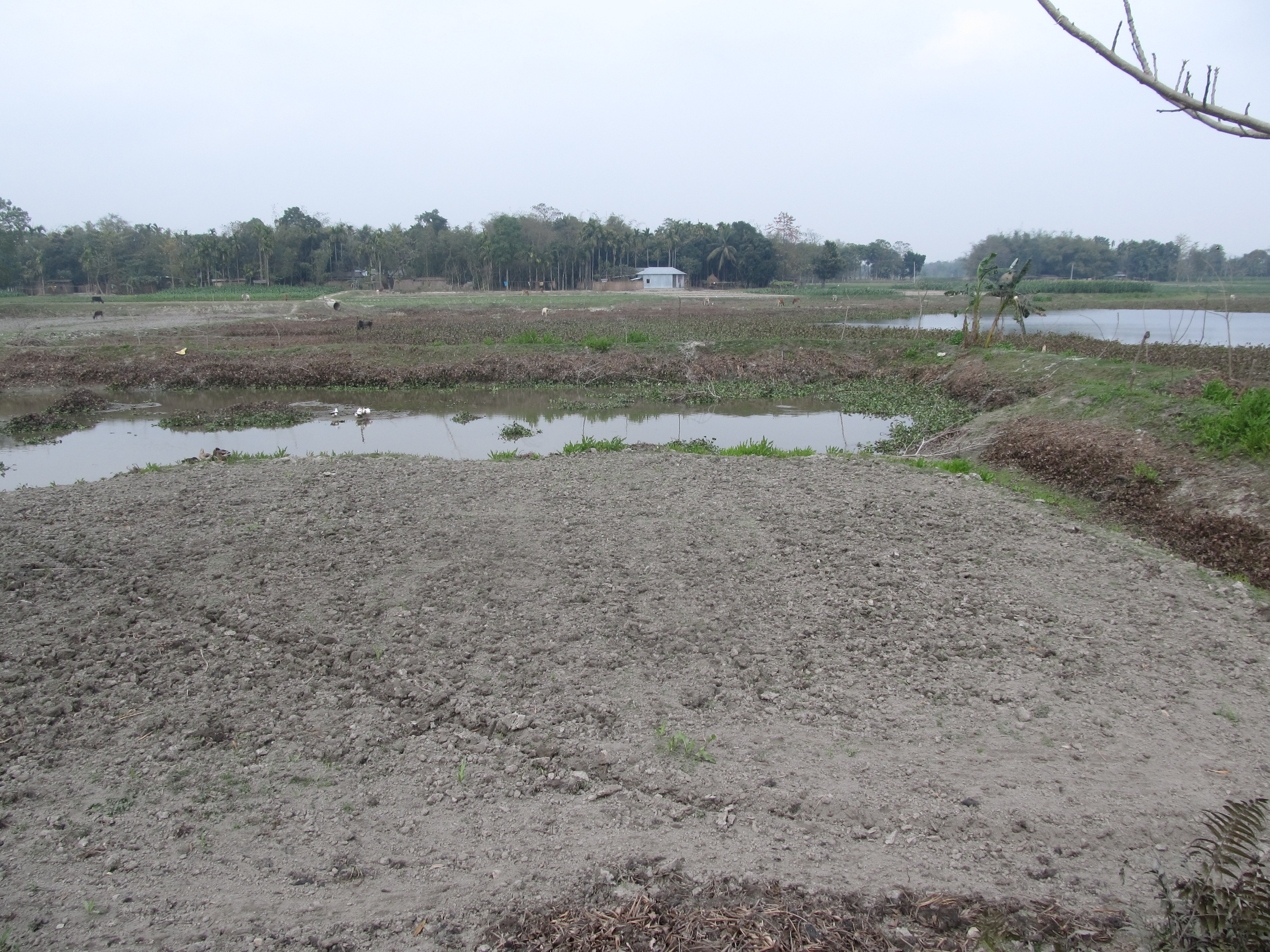
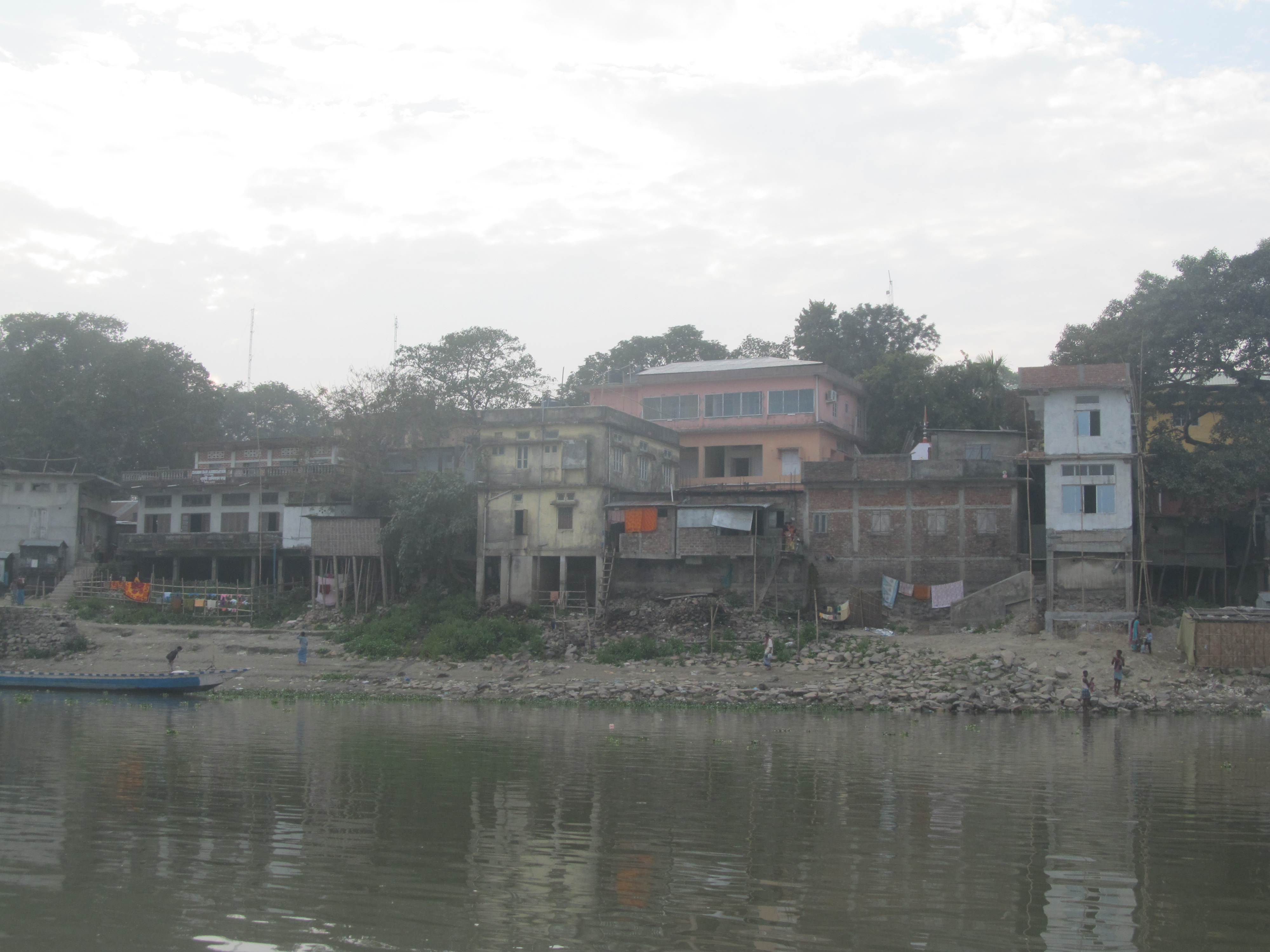
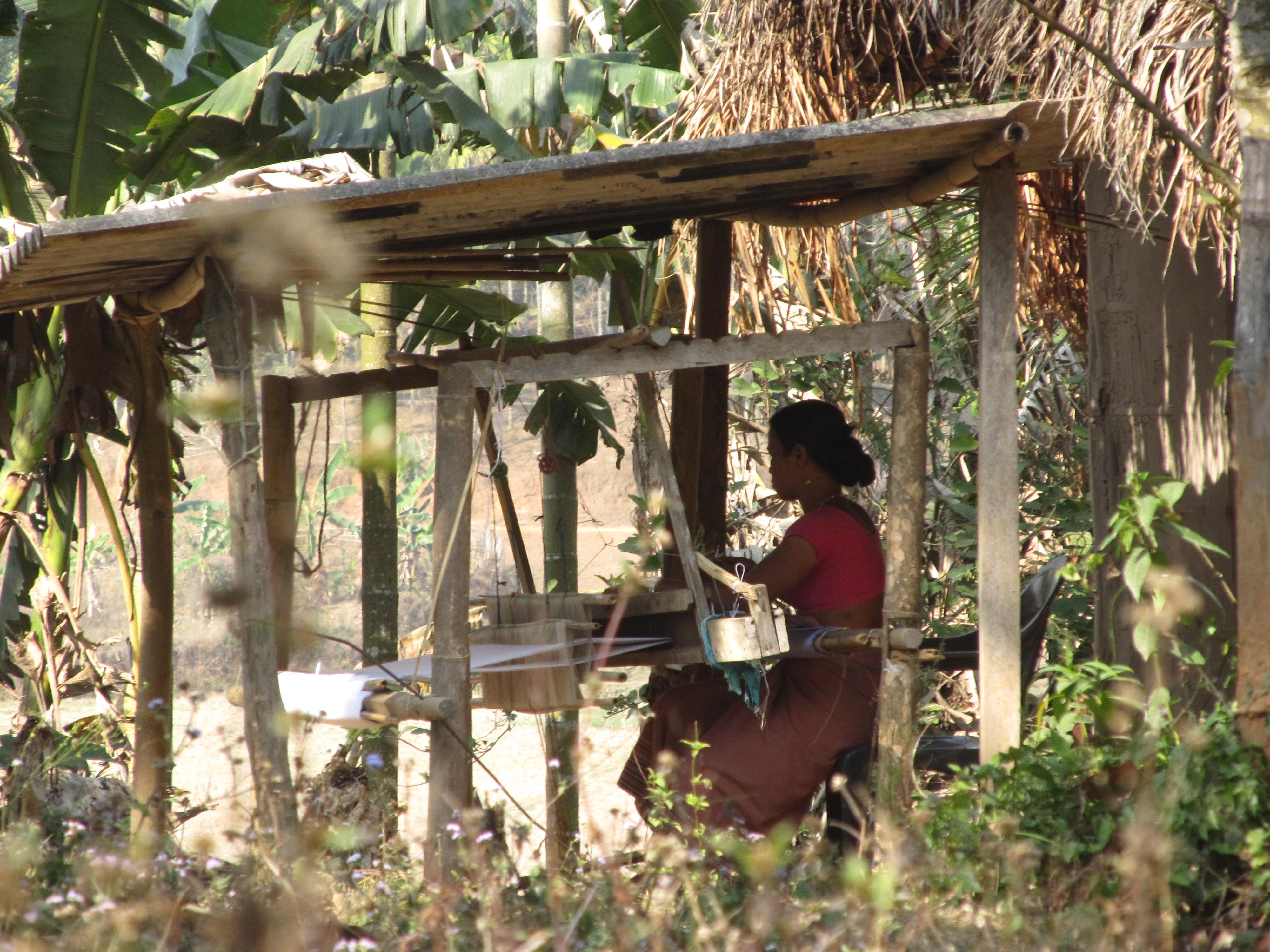
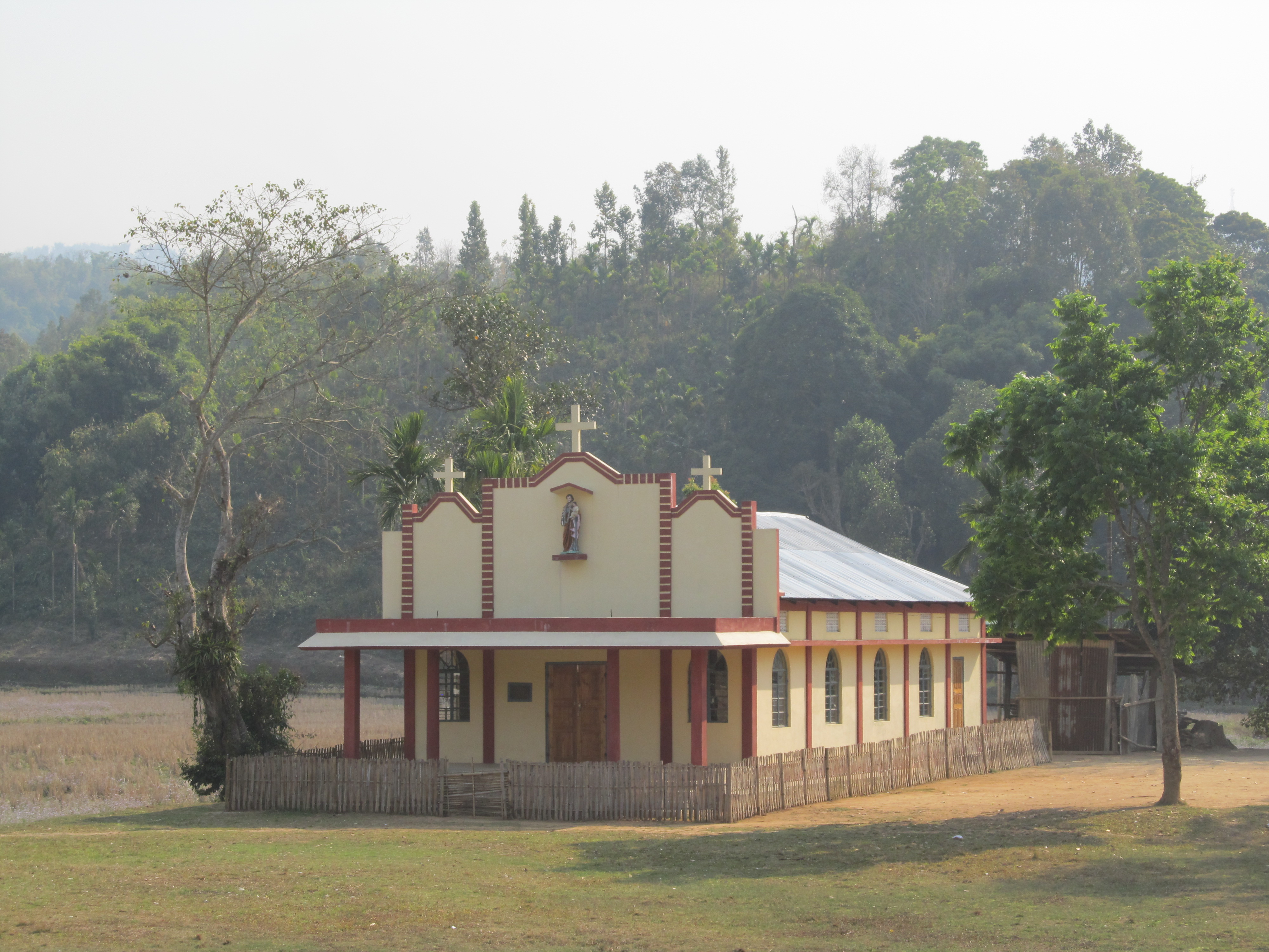
My first impression of Nepal: it is more colorful. The houses, at least, are.

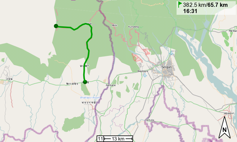
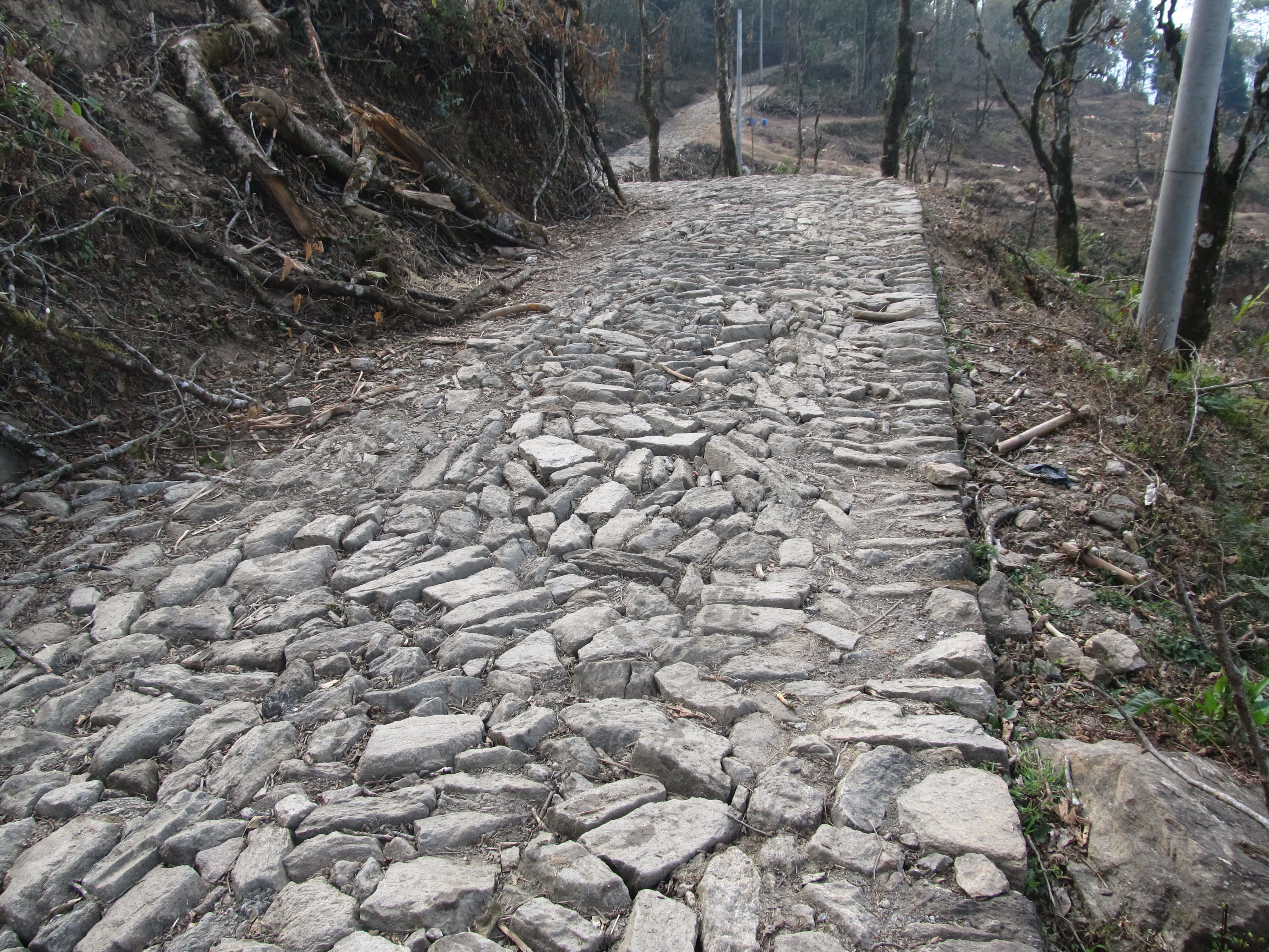
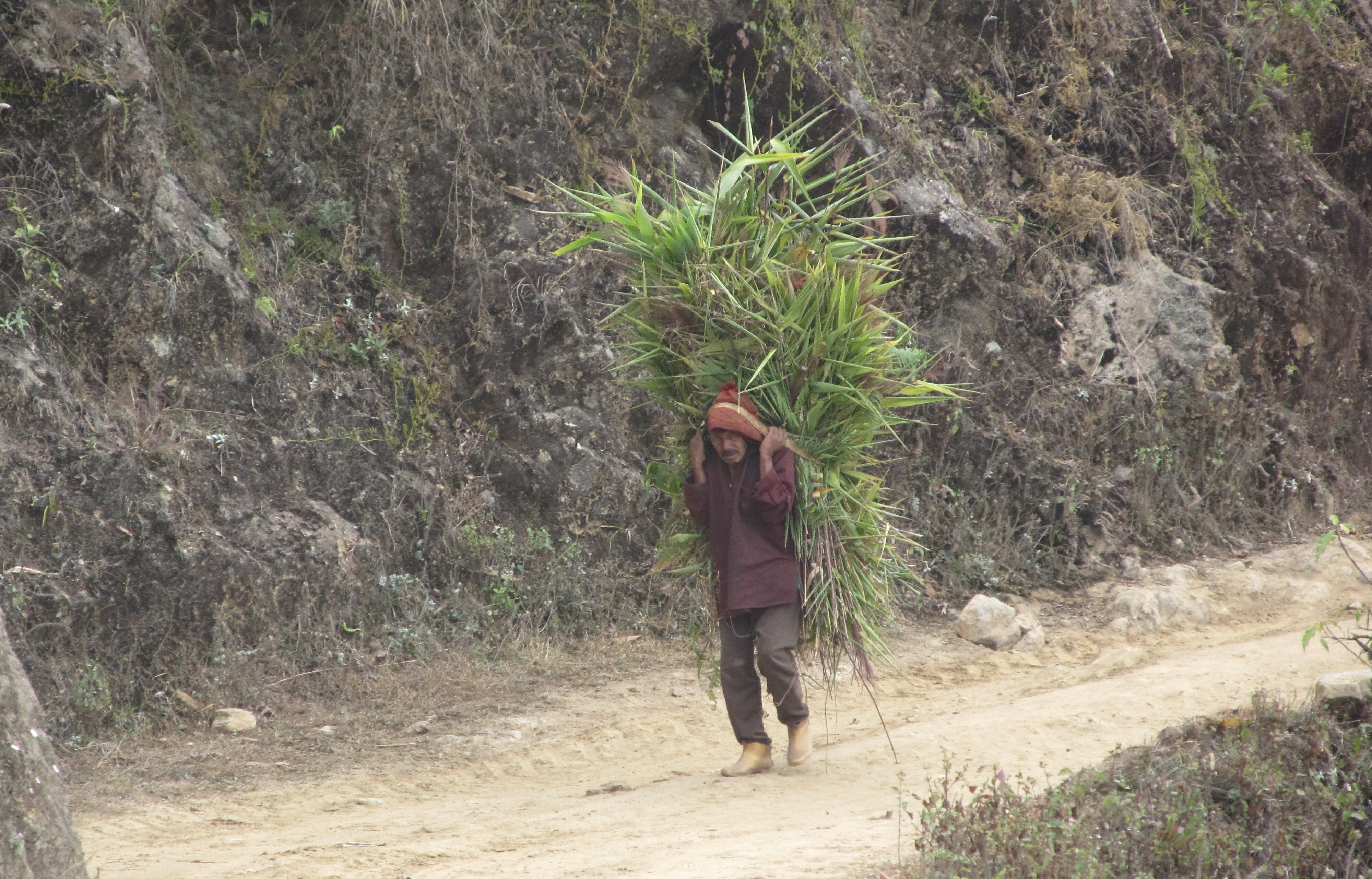
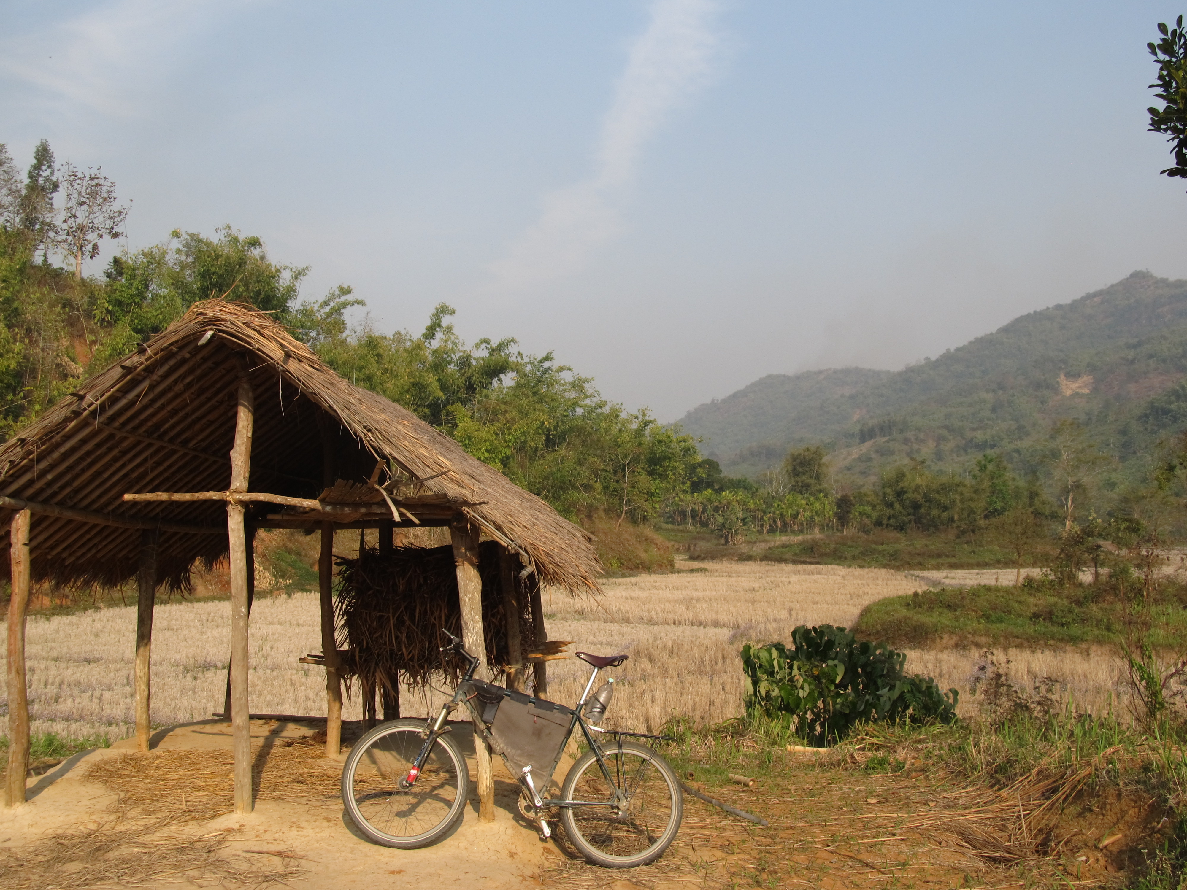
I kept cycling westward for a dozen or so kilometers and found a simple place to sleep at the junction from where I will head north tomorrow, into the Himalayas.

Cycled: 52km

Trip: Up the Brahmaputra | Country: , | Comments Off on Siliguri – Charaali

Charaali – Rahasal Child Orphanage, near Ilam

I left Charaali to the north. It was a misty day again, like pretty much every day since I landed in Dhaka 4.5 weeks ago.
After 6 kilometers the first mountains appeared in ‘the distance’, layer after layer. What I saw were only the first ‘hills’, not the the high peaks of the Himalayas. After 10 kilometers the road started to climb and I was leaving the plains behind me.

I climbed up to 1700m, slowly, and then down a little to a place called Phikkal at 1500, where the road turned west. If everything goes according to plan, I will come back here from a different direction (roughly northish) in a couple of days. The road followed a ridge with slight declines, before going down into a river valey to 500m. That part of the road was an awesome ride. Then it went back up.

A few kilometers before Ilam, my destination for the day, I was stopped by a young man who invited me to stay the night at a child orphanage he was volunteering at. He had seen me a while back coming back up from the plains (he had brought a Danish volunteer to the airport who’d been at the orphanage for 3 months). He and his brother are taking care of 6 little kids, the youngest just 2 years old. She had been found abandoned in a public bus.

I received a fine dinner and before going to bed we watched a Nepali movie about domestic violence, in which one of the girls had starred.

Electricity is a luxury here. It is usually available from 6pm to 6.30, and then from 7pm through the night. The orphanage had just moved into a new building that was semi-finished (the kitchen and a 2nd storey were still missing). It is being funded by donations and government as well as municipality help.

Cycled: 72km

Trip: Up the Brahmaputra | Country: | Comments Off on Charaali – Rahasal Child Orphanage, near Ilam

Rahasal Child Orphanage, near Ilam – Pyang

The plan was to reach 27N88E, an unvisited degree confluence, today, and then go as far as Phikkal, which I had come through yesterday. According to one of my maps the confluence is located not far from the road connecting the villages of Jamuna and Pyang.
Straight line distances between all the places are not huge, a few kilometers here, a few there. But the winding roads easily double that.

So I continued on the paved main road, which climbed up to Ilam, then near Barbote I took a right turn onto an unpaved track. It was quite stony but not too steep and ok to ride, albeit slowly. It then descended quite steeply into a valey where a bridge crossed a river. I felt very happy to go down this way, not up. On the other side the track climbed up, and impossibly steep so. Every now and then I had to get off the bike and push.

The sun was setting already when I finally cycled past the confluence. It was 150 meters off the track, on a steep hillside. But for today, finding a place to sleep had priority. Locals had told me that there was a hotel in Pyang, not far ahead. I did find it, roughly 2km from the confluence.

The hotel is more of a homestay. I’m sleeping in the same room as my host. The same thing happened in Iran, where the guy dragged the mattress from his bedroom to the living room to sleep in the same room with me. I don’t know whether that is a sign of respect, or if they think I might run away with their possessions during the night.

His brother showed up after dinner and told me that they’d rarely seen any westerners here, if at all. Especially none on a bike. He also asked me how long I wanted to stay, and that they’d like to show me a Red Panda. Apparently that’s a rare species found in the mountains near-by, but I hadn’t heard of it. They said that tomorrow was impossible, maybe the day after would work, and I should stay a little longer. Why it was impossible they didn’t say.

Cycled: 40km

Trip: Up the Brahmaputra | Country: | Comments Off on Rahasal Child Orphanage, near Ilam – Pyang

Pyang

After a sweet coffee for breakfast (I’m lookig forward to real coffee, by the way, but this one is great, too) I left the house for a quick stroll around the village in beautiful sunshine. Soon I was picked up by an elderly lady (Komala, as I learned later), who showed me the Hindu chamber in her house (even though she said she was Buddist) as well as a Hindu temple on a little hill (which, btw, is the only place where I have reliable mobile signal). The air was a little clearer than yesterday and the view over to Jamuna was amazing. Unbelievable that I had cycled all along those mountains yesterday. The distance, as the crow flies, is really just a few kilometers, but in between there are 2 river valleys that needed to be descended to and climbed out of again.

It was market day today, so the place was crowded and colorful.

I got to taste tin pani, the local ‘wine’, literally ‘three waters’, because it is somehow distilled by stacking three bowls on top of each other.

I also tasted chulri, a snack made of milk fat.

Occasionally, (not just here) people ask me how much my bike costs. I’m down to US$ 500, which is way off but still a freaking lot for the people in the countries I tend to travel in. If my maths don’t fail me, the Nepali Rupee is worth less than the Indian one, which makes traveling here incredibly cheap. I’m paying 325 Nepali Rupees per day here (granted, I don’t have my own room and share all facilities), which includes food (100 for the bed only). That’s a bit more than 2 Euros per day (about 70 eurocents for the bed)! I hope (for them) that there is an error somewhere in my calculation.

It is warm here during the day if the sun shines. But it gets quite chilly in the evening when the sun sets (around 6pm). It’s less than 10 degrees now and if nothing else, the temperatures make me want to go back down to the plains. My clothes are not suited for this.

Houses here don’t have any fire places or other ways of heating. And no insulation, either. They have lovely earthen stoves, but those are used for cooking only. Electricity is available at night only. I was told yesterday that the villagers feel very underprivileged, understandably, and many would like to migrate. The road to here is fun for me, but it is no fun if it’s the only connection to the outside world. Supplies for the local shops are brought in by pack horse from Phikkal.

There is very little light pollution and the night sky is so full of stars.

Trip: Up the Brahmaputra | Country: | Comments Off on Pyang

Tracking the Red Panda & visiting 27N88E

Last night I shared the room with a brother of my host Jiwan. He is development officer for the village. I’m not sure what that means, exactly.

I had tea at Kolama’s, then breakfast at Jiwan’s, and then was rushed on a motorbike with Tonka, teacher at a primary school in the Jamuna community. I was told he would help me find a guide to track down the Red Panda. The ride went past the degree confluence again. I do understand now why yesterday everyone said it’s a dangerous road. It certainly is more dangerous on a motorbike than on a bicycle. After a few kilometers he stopped, locked up his motorbike in a shed at the roadside, and we climbed up on beautifully narrow and steep footpaths to his school, between terraces and people’s houses. He said it’s a 20 minute walk and he does it every day. The weather was lovely and the kids where taught outside the building in the sun. Elderly ladies with weathered faces sitting near-by, chatting
The guide, Tonka said, would come over ‘after some time’.

The guide and a boy and I left at noon and walked up to the forest. We had a short rest at someone’s house where they had a glass of alcohol each. To my surprise the path we followed was paved.
We climbed around in the forest, through young bamboo and between old trees. But all we found was the ‘Red Panda toilet’ and orchids.

Tonka had finished his classes and took me back on his motorbike. I asked him to drop me off near the confluence, 27N88E. It was just some 150m away, on the slope above me. I set out through terraced fields and across overgrown terraces. I stumbled on a man-made path which led me directly to the confluence. The GPS was still a little shaken from the motorbike ride and the trees didn’t help with getting a good fix, but I can say with some certainty that I was either directly at 27N88E or at least within a small radius. I was not the first person at the spot, for sure, but the first with the intention of visiting it for the Degree Confluence Project. I took the pictures required by the DCP and walked back to Pyang.

These confluence visits are getting more and more awesome. They keep bringing me to places that I wouldn’t have visited on my own and which few, if any, other travellers go to. The resulting experiences are fantastic.

Back in Pyang I said hi to Kolama and had one of her wonderful teas. She said I shouldn’t have taken a guide and I can see now why that is. Next time I will know where to look for the Red Panda, and when (in the morning!). Then I got invited from house to house for a glass of Tin Pani. Last but not least I had one at Jiwan’s before dinner.

I shall leave Pyang tomorrow, towards Phikkal. I really like this place and I will visit again should I ever come back to Nepal.

Trip: Up the Brahmaputra | Country: | Comments Off on Tracking the Red Panda & visiting 27N88E

Pyang – Siliguri

The departure from Pyang was moving. The people are really great.

The rest is not really worth mentioning. From Pyang at approx. 1850m I climbed up to 2000, then descended down to about 1200, then climbed back to 1700, all on a dirt track of questionable quality but with a lot of personality, then went down to the plains to about 150m on the same road I had already come up on. So much fun to be the fastest by far. I crossed the border to India at the crossing I already knew and am now back in Siliguri.

Oh, India, land of the horns.

Cycled: 116km
Max speed: 74kph (I’d hoped for more…)

Trip: Up the Brahmaputra | Country: , | Comments Off on Pyang – Siliguri

Siliguri

A lazy day off in Siliguri. Ran some errands and enjoyed Indian tea. No action, no photos.

Trip: Up the Brahmaputra | Country: | Comments Off on Siliguri

Siliguri – Cooch Behar

Now this was the worst day of the entire trip (so far). I rode on the bad road again that I had come in on to Siliguri from the Bangladeshi border. It is of bad quality and traffic is heavy.
A couple of times I was forced off the road again by oncoming buses.

After about 30 kilometers, the road was quite ok at this point and I didn’t pay enough attention, I slipped off the asphalt down onto the soft shoulder (a step of some 15 or 20 centimeters). The pedal got stuck and I toppled over and fell into the dirt.

Nothing serious happened and the bike was fine. The Betadine I put on the scratches on my knees made everything look bad, though.

Cycled: approx. 135km

Trip: Up the Brahmaputra | Country: | Comments Off on Siliguri – Cooch Behar

Cooch Behar – Dhubri

Another exhausting day. I managed to do 50km on backcountry roads, but 40km were on bad-quality highways. That part was almost hell again.

There were two small Bangladeshi exclaves on the way. The area of the first one seemed uninhabited, the status of the second was unclear, too.

Crossed the Torsa river on a bridge that was made entirely of bamboo and which was strong enough to be used by cars.

I was stopped by the BSF, Border Security Forces, when I was somewhat close’ish to the Bangladeshi border (the ‘real’ one), in “sensitive area”, but they let me continue after a passport check. They said I’d still have 200km to Dhubri, “about 4 hours”.

Fortunately, I was faster than that.
Dhubri is located at the northern bank of the Brahmaputra, very close to where the river enters Bangladesh. Also, it is located in Assam, one of the northeastern ‘Seven Sister States’.
The river is 9 kilometers wide here. I haven’t been down to the bank yet, but my guess (and hope) is that it is not completely full with water during the dry season (i.e., now).

Cycled: 91km

Trip: Up the Brahmaputra | Country: | Comments Off on Cooch Behar – Dhubri

Visiting 26N90E

The original plan for today was to cross the Brahmaputra by boat and visit degree confluence 26N90E on the way, then cycle into the hills of Meghalaya.

26N90E is located right in the river Brahmaputra. Older satellite images show that it is near or on an island, so I hired a boat to circumnavigate the island right across from Dhubri’s ghat, but it turned out to be too big (the island, that is). The confluence might well be on that island. The river destroys and creates islands every year during the monsoon season and everything looks different now from what is shown on the satellite images.

Unfortunately, in the middle of the river my phone-slash-GPS died and I was blind as far as the confluence is concerned. I returned to Dhubri.

The phone agreed to work again as soon as I was back in town. I had lunch and, later in the afternoon, started a 2nd attempt at visiting the confluence.

I returned to the ghat and asked for a boat to go to the island. I had seen before that every now and then one goes there. There was one ready to leave, but apparently it went somewhere else. I was told that the next one would be going to the island. I went on board – and it left immediately. I had assumed it would wait and take other passengers as well… Arriving at the island, I was quoted a fare of 500 Rupees, which was a ridiculous price for the 5-minute boat ride. We couldn’t agree on a price and agreed that the driver would wait while I went looking for the confluence.

Finding it was easy, a 20-minute thing, all in all. There was a 4WD track from the ghat leading southeast, directly towards the confluence.

This char (river island), unlike the ones I saw in Bangladesh, is not used for agriculture. It consists of sand and there is very little vegetation.

After the return to Dhubri the driver finally agreed to 100 Rupees.

Trip: Up the Brahmaputra | Country: | Comments Off on Visiting 26N90E

Dhubri – Tura

I left early’ish to catch a boat to Phulbari on the southern bank of the Brahmaputra. It left around 10am, when it was full enough.

As mentioned yesterday, the islands in the river erode away and form anew every year with the monsoon. The maps I have and the satellite images are way outdated. That’s also why the trip to Phulbari takes more than 2 hours.

I left Phulbari around half past 12pm towards Rongram. The countryside quickly became hilly and forested. And very beautiful. It must be even more amazing here when it rains more and everything is even greener and not as dry. The riding was good, and the inclines and declines mostly short.

There were very few people on the way, and even fewer villages. Almost all of the little stalls at the roadside were closed. Maybe (hopefully) because it’s Sunday today. I saw a couple of Baptist churches and I remember having read that most people in the state of Meghalaya, which I entered with my arrival in Phulbari, are in fact Christian.

I made it to Rongram and asked at one of the open stalls for a hotel. The guys were just about to point me north, when a black car with three tipsy guys plus a seemingly sober driver stopped next to me. The driver, Francis, explained that Rongram was not a good place for me to stay and that I should continue to Tura, 15km further. In a lower voice he added that there was a lot of terrorism going on here and I shouldn’t stray off the main road.

On the way I had seen (text-only) posters inviting to the ‘1st International Mongoloid Festival’ to some village for this weekend. In Tura I saw more posters about this, this time with pictures, and it is in fact a festival for/with/by tribal people and has nothing to do with the down syndrome genetic disorder (for which mongoloid is a derogatory term in German), as I first thought (and yes, I found the name weird). It’s in a village not far from Tura. I contacted Francis and we went there. Unfortunately, it was mostly over, today being the last day, but it must have been quite a fun party. There were still lots of people and an all-female band was playing various cover songs. “Summer of ’69” was the crowd’s favorite.
Many people were drunk and heavily armed police was patroling the festival area, but it was all peaceful.
I ended up with a bottle of amla wine that I have to squeeze into my luggage, somehow. I don’t know what amla is, but the wine is quite tasty. I do think ‘wine’ is a euphemism in this case, though.

Cycled: 91 hilly kilometers

Trip: Up the Brahmaputra | Country: | Comments Off on Dhubri – Tura

Tura – Williamnagar

Last night I couldn’t quite decide where to go next, and it took me a while this morning to make a final decision.

I decided to go to Williamnagar despite the warnings of terrorist groups that are supposed to have their headquarters there. Tura is quite hilly and I was out of breath and soaked with sweat after the first 500 meters.

I had to backtrack to Rongram. Yesterday, the bridges on the road between Rongram and Tura were guarded by police – maybe because of the festival -, today they were all gone.

From Rongram I went east on a quiet road, which did climb for a while at first, but once over a pass it (mostly) descended gently along the Simsang river.

Williamnagar was interesting. The entire main street – with the exception of the bazar area – seemed to be lined with offices of governmental departments. No signs of terrorists. Although, the only hotel, located somewhat out of town, required a ‘verification and confirmation’ of my personal details ‘from the officer-in charge, Williamnagar Police station’ before they allowed me to check in. So I had to cycle back into town. The officer-in-charge wasn’t at his desk and the other officers on duty were watching a cricket match on TV. A lady in plain clothes eventually copied a previously granted permit.

Cycled: 83km

Trip: Up the Brahmaputra | Country: | Comments Off on Tura – Williamnagar

Williamnagar – 26N91E – Guwahati

This morning’s breakfast was last night’s warmed-up dinner (just as I had asked the chefs to do), plus some extras.

I had the choice between cycling east on roads which, according to some people I had asked, didn’t deserve that designation, – or to go north and visit another Confluence. I chose the latter.

The ride was mostly easy. On the first third or so I left the Garo Hills towards the valley of the Brahmaputra. The road was windy but mostly in good condition. There must be quite a few coal mines in the hills here, as there were coal trucks travelling up and down the road, and piles of the stuff were deposited in the villages along the road. I didn’t see many people.

The village of Dudhnai, already in Assam, at the junction where ‘my’ road joined the east-west highway leading to Guwahati, was a crowded, colourful place. I had only a short break there, skulling a few bottles of some ‘juice’, before I continued eastwards.

Some 20 kilometers later I turned left in a non-descript settlement in pursuit of Confluence 26N91E. The confluence is located in a then-dry field several hundred meters off the road. I left the bike near the road. For some reason it was here that I first used the long cable I’d brought to lock it. The confluence point was easily reached, the required pictures snapped, and off I was again, towards Guwahati.

It was late in the afternoon and the sun began to set. There were no hotel or lodges in sight. I was still 70km from Guwahati when I decided to hop on a bus to get there this evening.

Guwahati is an immensely crowded place (which Indian city is not?) and has a friendly feel to it.

Cycled: 135km

Trip: Up the Brahmaputra | Country: | Comments Off on Williamnagar – 26N91E – Guwahati

Visiting 26N92E

After a lazy day in the city yesterday, today I set out to visit another unvisited Degree Confluence: 26N92E.

The ride lead me out of the city on main roads, but after 30km, in the village of Sonapur, I cycled off into the countryside. And oh, it was so amazingly beautiful! A steep climb brought me out of the Brahmaputra lowlands and onto a high plateau in the Ri-Bhoi district of Meghalaya, where 26N92E is located.

The narrow road wound its way through rice fields, little villages, and the occasional forest. No cars, very few people out, and an amazing countryside. I met a guy who spoke fluent English and lived in one of the villages around. He asked me about my scars on knee and ankle, and when I jokingly said that they were from a tiger, he looked seriously shocked. I found out that there are indeed tigers living in the area and occasionally they come out of their hiding places and attack livestock and even people. From that moment on I looked at the forest with different eyes.

I came past a spot where the road led through a very dense part of a forest and – and that was totally new to me – it exhaled not only cold an fresh air, but also a calm and relaxed feeling that made me appreciate this trip even more.

I made it to 26N92E, which again is located several hundred meters off the main road in a valley used for cultivation of rice. The GPS signal was a bit flaky and it took me a while to close in on the actual spot.

It was already late in day and I had to hurry back to Guwahati. I still had to cycle 50km. I wanted to go back on a different route, cycling west to the Guwahati-Shillong main road. The GPS gave up completely and I could just follow the road that approximately led west, towards the sinking sun. There were no villages any more, and, fortunately, no junctions either, where I’d have to decided which way to go. Just forest left and right. Tiger forest. The sun was disappearing behind the hills.

I somehow made it to the highway with last light, without having seen or heard any tigers. However, true horror was awaiting me there. The highway was busy, and under construction, and the place were I reached it was full with smoke-producing heavy industries (some kind of smelters?). And still 30km to go.

I did survive; I’m not so sure my lungs and eyes did.
I am indescribably happy I have seen the countryside off the main road, and once more grateful to the Degree Confluence Project for making me go there.

Cycled: 114km

Trip: Up the Brahmaputra | Country: | Comments Off on Visiting 26N92E

Guwahati – Umiam

Today easily qualifies as one of the worst riding days ever.

I’ll keep it short. The road, part of which I had ridden on yesterday in the opposite direction when coming back from 26N92E, was again busy with traffic of all sorts. The majority, however, were laden open coal trucks going one way, and empty ones going the other way. The road was being enhanced to dual-carriageways, but most of it was still old, narrow, and of bad quality. On top of all that, the countryside was hilly, the temperatures high, and the cycling slow.

The plan was to reach Shillong, but when the sun set it was clear that this was not going to happen. It was pitch dark when I eventually found a hotel, a kind of resort actually, at the shore of Lake Umiam less than 20km from Shillong.

For those readers who think cycling in ‘these’ countries is dangerous – it is indeed. I nearly died when having a shower because the shower pipe had a leak, from which the water, at the right water pressure, in a steady stream shot directly onto the switch box that fed electricity to the boiler. I hadn’t noticed this, though, and was happily washing off today’s dirt when I suddenly felt a tickling sensation on my skin…

Cycled: 84 hell’ish kilometers

Trip: Up the Brahmaputra | Country: | Comments Off on Guwahati – Umiam