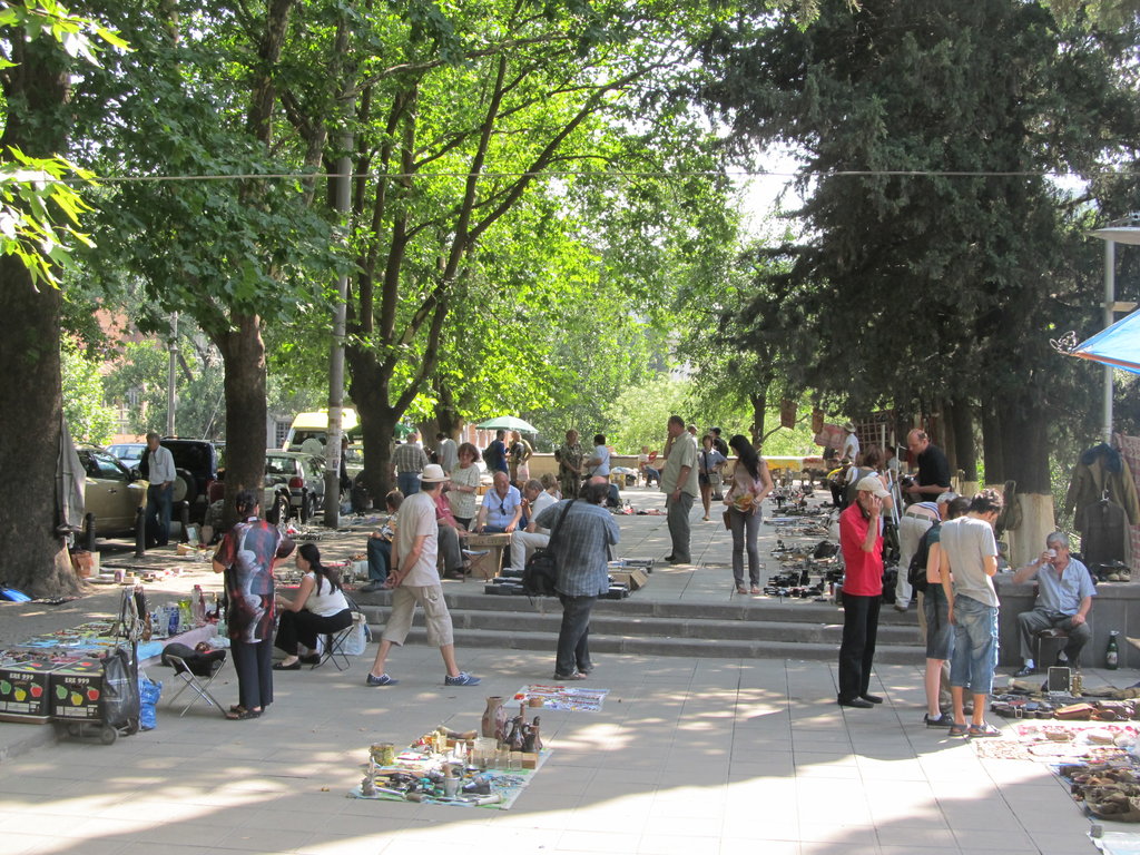
I’m still in Georgia’s capital. I’m getting itchy feet. Got to move on!
Got my Azerbaijani visa yesterday. The tyre’s not here yet, though.
I’m still in Georgia’s capital. I’m getting itchy feet. Got to move on!
Got my Azerbaijani visa yesterday. The tyre’s not here yet, though.
Shared a taxi to David Gareja today with Nena from Slovenia and a Polish couple whose names I have forgotten.
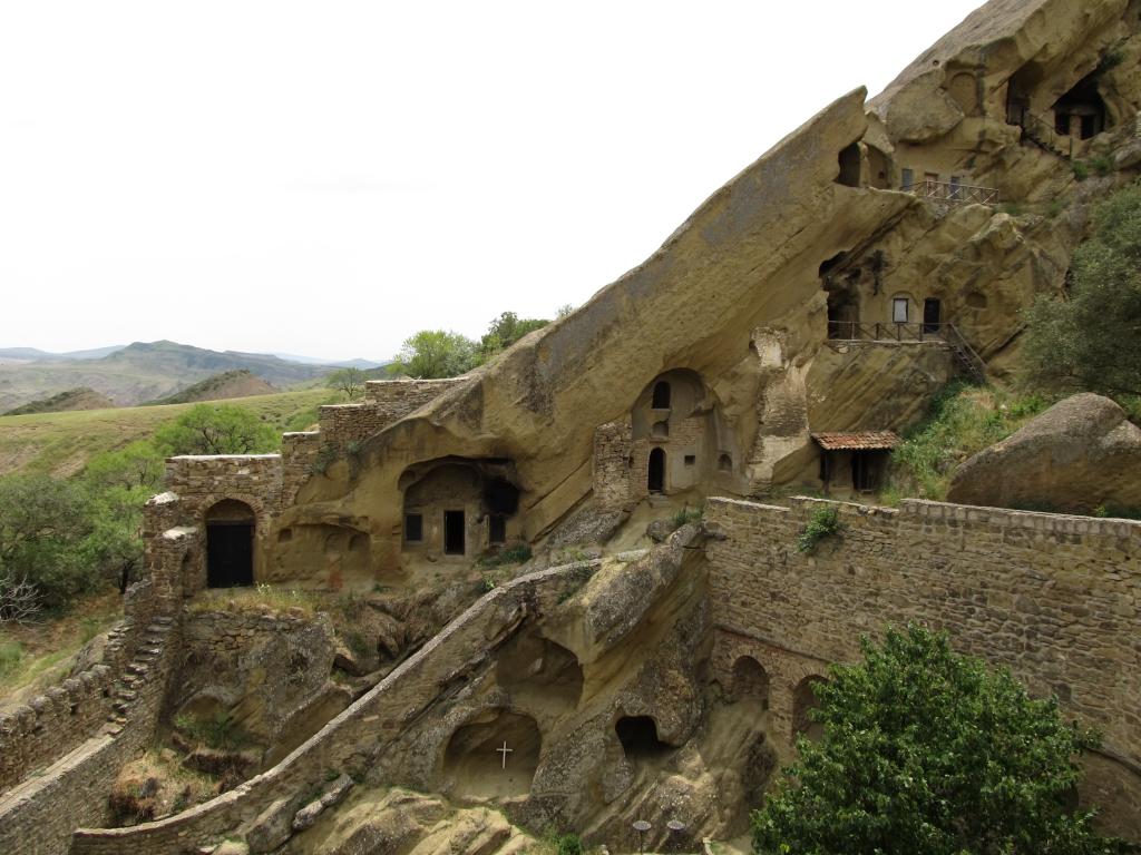
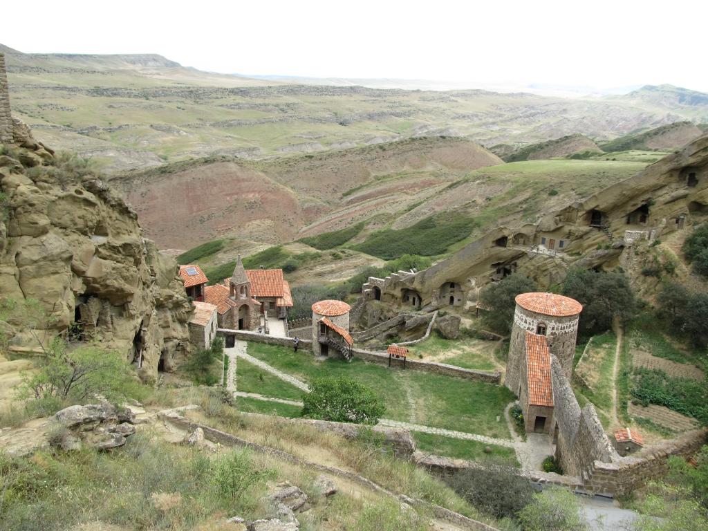
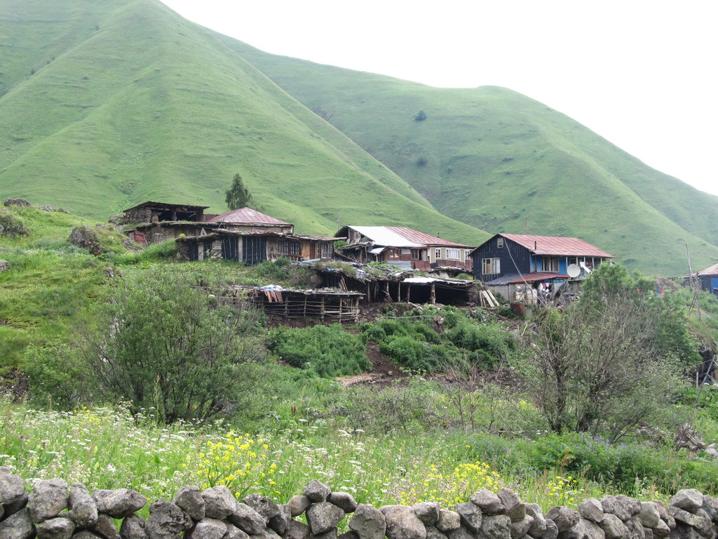
David Gareja was a monk who lived in the 6th Century AD and wandered to present-day Georgia from Jerusalem to found a monastery here and spread Christianity. The monastery is located about 60km south-east of Tbilisi, directly at the border to Azerbaijan, and was later named after its founder.
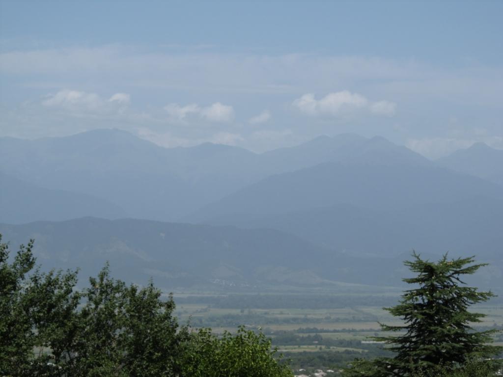
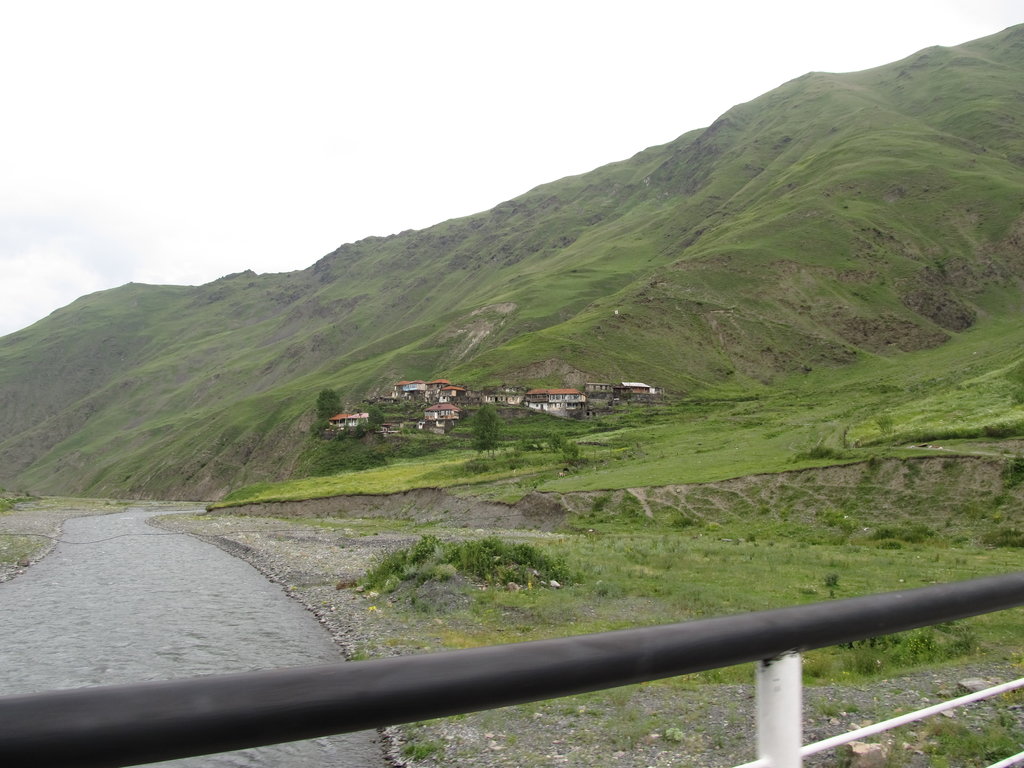
The countryside is almost steppe-like with no surface water nearby, which is very unusual for Georgia. There used to be water here, and maybe there still is at some time during the year, as the deep-cut valleys and river beds prove.
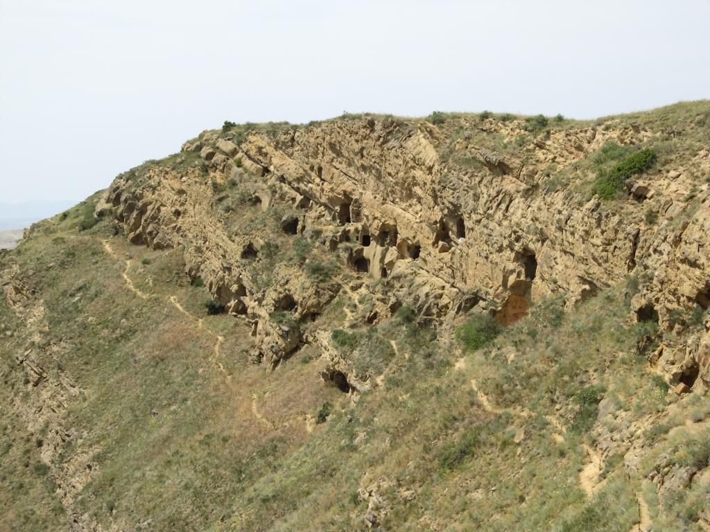
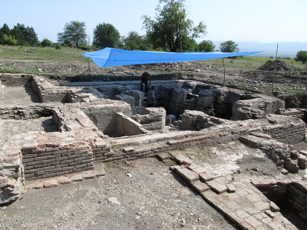
The present-day monastery, still – or rather, again, since 1991 – inhabited by monks, is partly hewn into the rock, partly built over the rock chambers on the eastern slope of a ridge. The border runs along the western slope, only few hundred meters away. Apparently, the monastic complex comprises of many more cells and churches spread across the neighbouring hills than are obviously visible to the casual tourist, and there is an on-going conflict with Azerbaijan about the exact border line. Based on uncertain grounds, Azerbaijan claims the David Gareja area as part of the historical Caucasian Albania (not related to Albania in the Balkans)
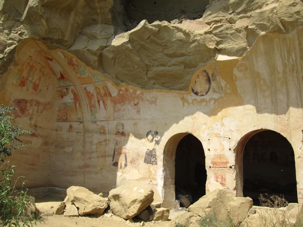
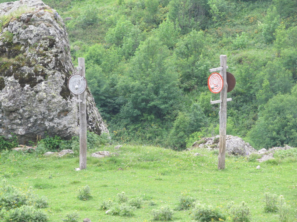
It is possible to climb up and wander along the David Gareja ridge, which extends for a couple of kilometers. Up there one has a splendid view over the adjacant Azerbaijani plains. There are also a number of unused artificial monastic caves to discover. In some of them frescoes can still be found on walls and ceilings. Additionally, there is a Georgian border post stationed there in the shade of a little church(!!!). That is, these guys have to hang out up there without much shelter from the weather. They didn’t want to be photographed by us. :)
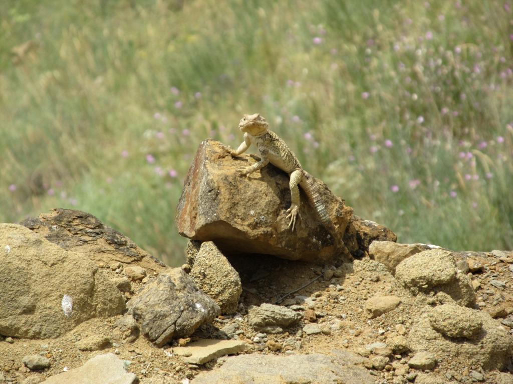
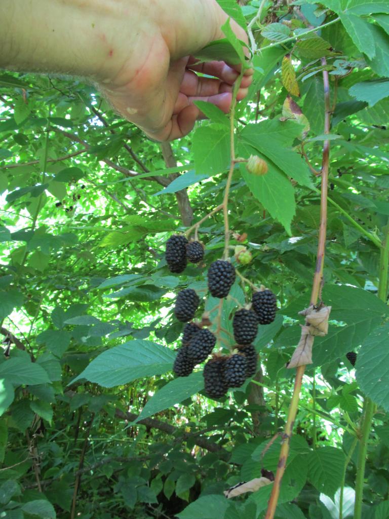
We spent some time up there, drank some wine, got a little sun-burned, enjoyed the tranquility and peacefulness of the place, and wandered around between the caves looking at the frescoes and watching out for snakes.
Our taxi driver had suggested a visit to the town of Sighnaghi for a minor surcharge. Sighnaghi is located above the Alazani valley (where that awesome wine came from). Georgia’s current president, Mikheil Saakashvili, took a liking in the place and ordered the renovation of its buildings. It is now very touristy (as touristy as a Georgian town can be) and I prefer more authentic places. However, it was good to have been there because I can now cross it off the list of places to visit in Georgia (which is still quite long).
Returned to Tbilisi for the night.
You may be confused about this post’s title, and rightly so. It’s easily explained: I have to do some work in Bremen and consequently had to take a break from the trip for a few days. I’ll be back in Tbilisi on Friday, July 22.
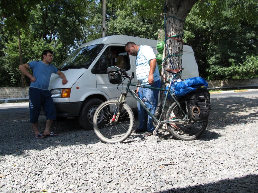
I’m back in Georgia since last night. Changed the bike’s tyre today and noticed that one of the spokes is broken. I packed my stuff and am now ready to leave for Azerbaijan tomorrow.
Met a couple of cyclists from Germany, France and the UK, and we might meet up in Iran next month.
Met a guy who knows the bass player of the Georgian ESC contestants. He may be able to hook me up with the guys for an autograph when I come back to Tbilisi soon.
It was a hot day today. That, and the fellow cyclists I chatted with for hours, made me leave the hostel only at 12:45pm.
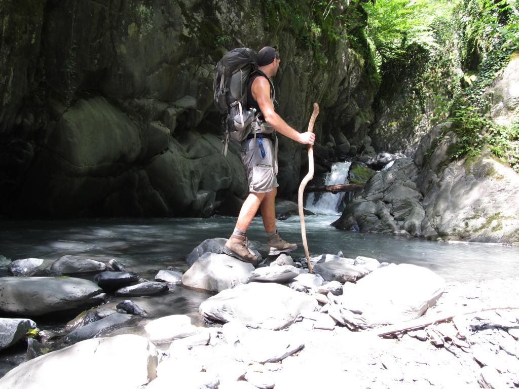
I left Tbilisi to the east, then turned northeastish. Unfortunately, that road to Telavi cuts through, ziggzaggs, and winds its way across the Gombori Mountains, located between the valleys of the Mtkvari and Alazani rivers. Temperures peaked at 48°C (in the sun).
The road crosses a pass at an altitude of approx. 1600m – but I didn’t get there, not by bike anyway. I’d brought only small amounts of food and there were only few villages and even less opportunities to buy some. No food, no good. I didn’t feel well at all and after 62km, just when the climb towards the pass started, I couldn’t go much further. I must have been in a pityful state, because a guy with a big SUV stopped and asked if he could be of any help. We managed to squeeze bike and luggage into his car and he dropped me off at a homestay in Telavi. The lady there revived me with a simple but good dinner.
Cycled: 62km
Hitched: 33km
Last night I lay awake for hours due to my still-upset metabolism before I finally fell asleep. Woke up late and decided to stay here in Telavi one more night. Spent most of the day sleeping.
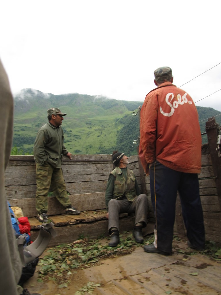
In the afternoon I walked down to Guram’s house, the guy who’d saved me yesterday. I met his family and his kids and their friends and was invited to dinner at a restaurant with them. His kids and their friends are in their early teens or younger and are a lively bunch. Many of them speak good English, some German, and/or French and they interviewed me about myself and my travels. Had a khinkali eating contest with Nino, one of Guram’s daughters, which I won (by one piece). :)
At night Guram was invited to a supra by friends and I joined him, though as his driver. I have no idea if my driver’s license is valid here… but it was fun to drive his SUV through the night and on Telavi’s horrible backroads anyway.
At the supra they had so much food on the table that I didn’t manage to finish it, even though I tried hard!
Well, it was a great day!
Managed to leave the guesthouse after an extended breakfast at 12pm and went to Guram’s place to say good bye. Well, I was force-fed with more bred, egg, cheese, melon … Took a fare-well picture of the family and myself and finally left their place at 2.15pm(!).
The first 10km were a pleasant down-hill ride into the Alazani valley. Then the road turned east and I followed the Alazani river, which flows towards Azerbaijan.
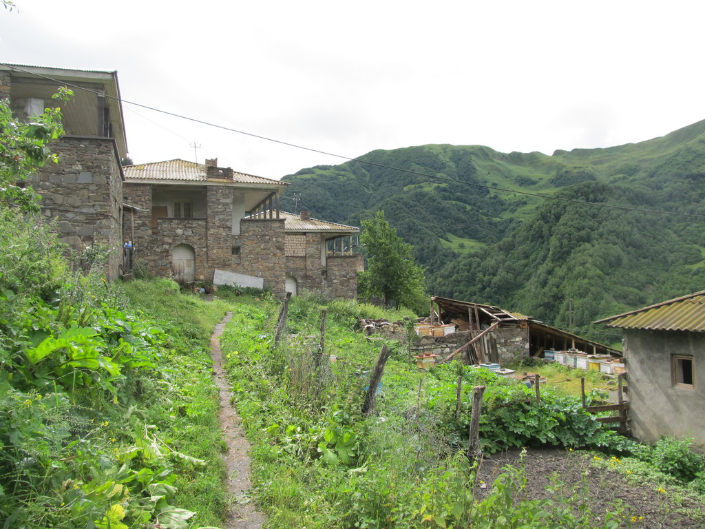
In the village of Akhalsopeli I stopped because it is going to be my jumping-off point to the confluence of 42°N and 46°E. That point hasn’t been visited so far.
I asked for a hotel (ok, that question was fake, I knew there wouldn’t be any in Akhalsopeli). The first guy I asked, owner of a car repair shop, offered me a bed at his place. I tried to explain from the start that I was going to hike to the mountains tomorrow, and that I’d like to stay another night after my return, and he partially understood, I think.
In town I met Heather from New Zealand and Stu from Scotland, a cycling couple on their way to Baku. Chatted with them briefly and exchanged phone numbers before Sura, my host, took me to his father’s place were a supra was held for/with me and I was drunk before I could resist. No further comments other than this: Georgia is awesome (to some degree ;) !
Cycled: 55km
Last night was awful. ;)
Today, Sura’s wife cooked khinkali for breakfast, and Sura and Dato, friend of Sura’s, washed them down with vodka shots and beer. At 9am.
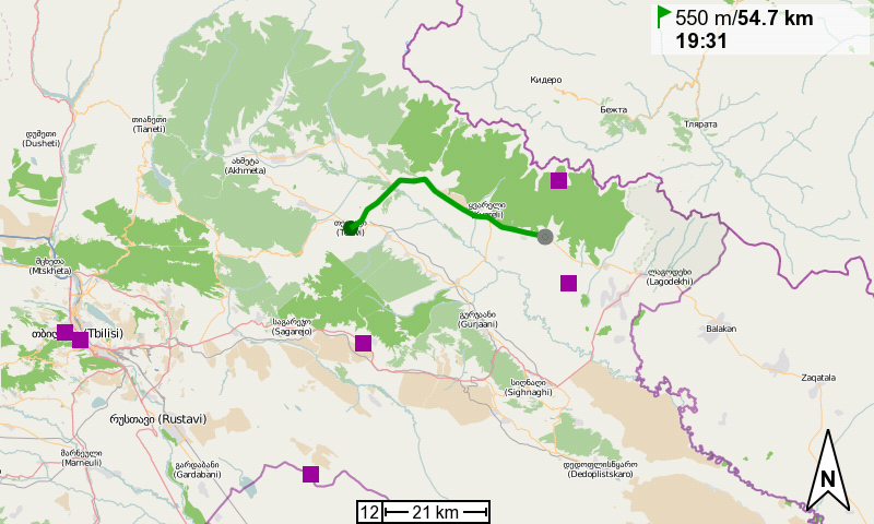
Then Dato (yes, the same guy) drove me to the starting point of my hike to 42°N, 46°E. There is a track that leads out of the village which shortened my walk by a few kilometers. The guys offered to pick me up again on my return, I’ll just have to ring them.
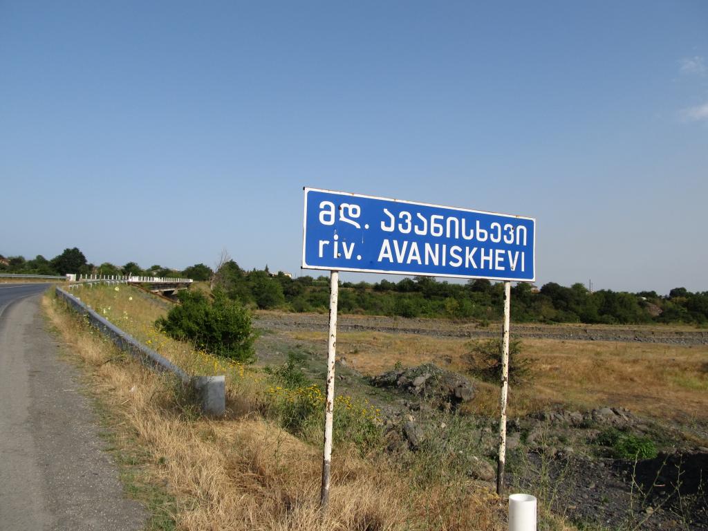
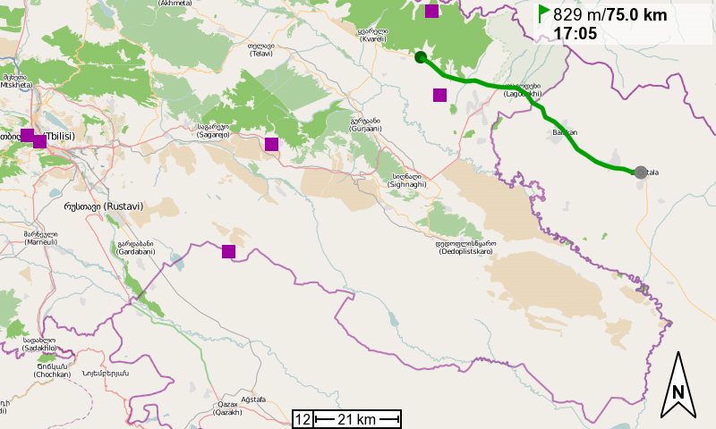
42°N, 46°E is one of the two unvisited Georgian degree confluences. It is located approx. 12km north of the Kvareli-Lagodekhi highway, towards the Dagestani/Russian border. The distance from the confluence to the border is 3km.
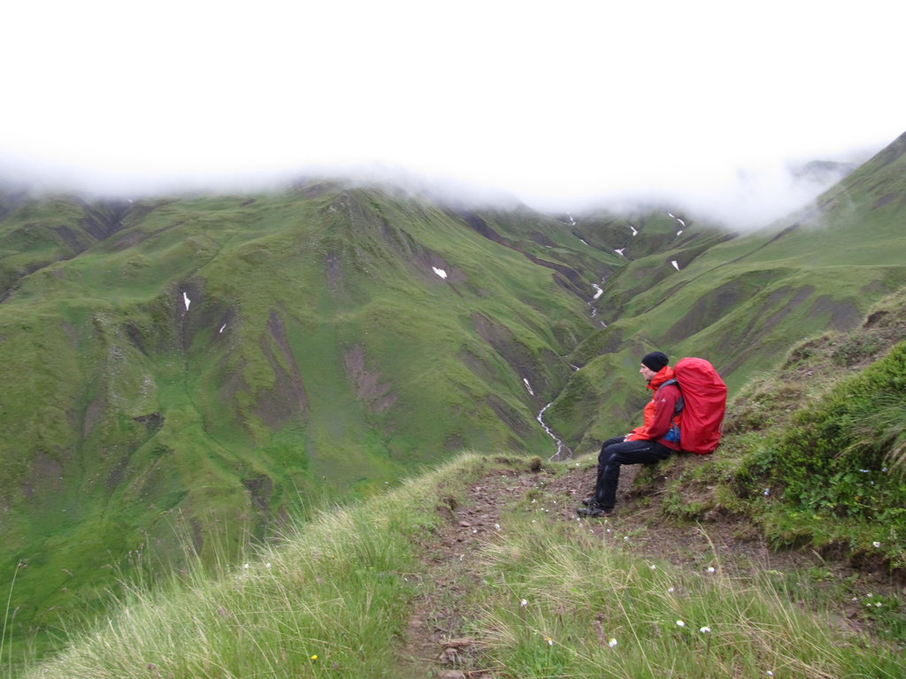
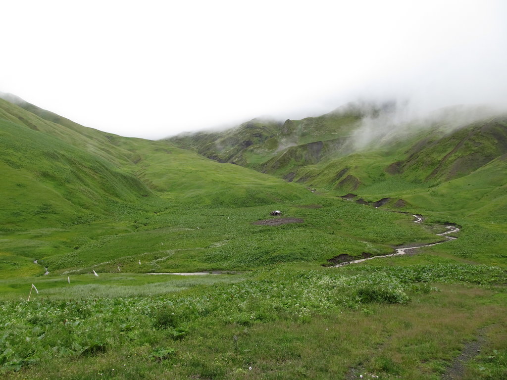
From the aerial footage I’d looked at I devised a route that follows the Avaniskhevi river for almost 9 kilometers in a northish direction, then turns southeast along a tributary for another kilometer or so. This is all uninhabited and forested wilderness and rivers and streams seemed to be the most viable ways to move forward along. Local lore has it that there are wolves, bears and poisonous snakes in the woods.
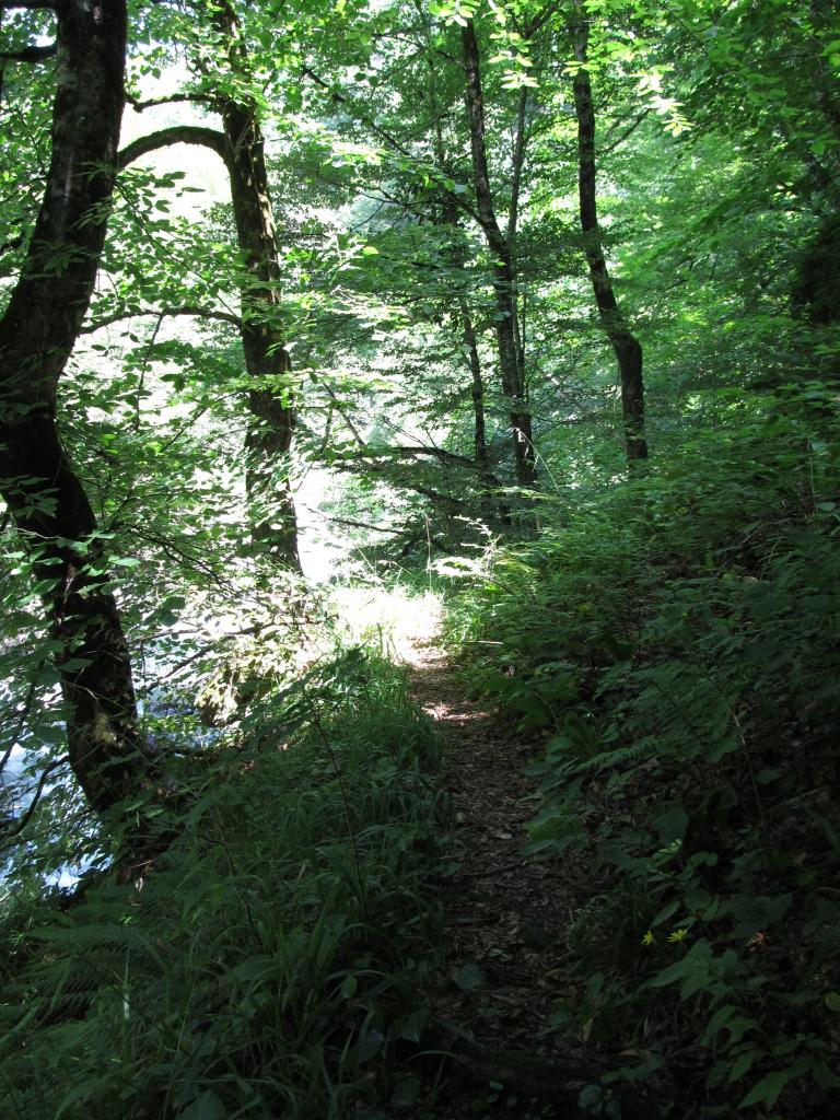
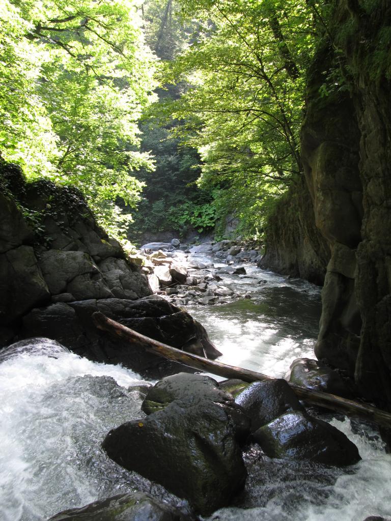
From the drop-off point I just followed the river for some time. Some time later I found a path! It was even wide enough for a car or ox cart, but it was of very bad quality. The track went more or less parallel to the river and ended at its bank after some time. I continued over stones and found a foot path that circumnavigated some impassable parts of the river bank. Who had made this path? I didn’t know. There were only two options, as far as I could tell. Either smugglers on their way to Dagestan, Russia, or hunters. I imagined it were the former, as that was certainly more exciting. I found foot prints in the sand and scratches from shoes on rocks, and I also found empty cigarette packets and resting places with remainders of food. They couldn’t have been here long ago. From then on I paid special attention not to leave any traces myself. And I became a master in reading and following their foot steps.
I had to cross the river a couple of times, first by jumping from stone to stone, later by wading through.
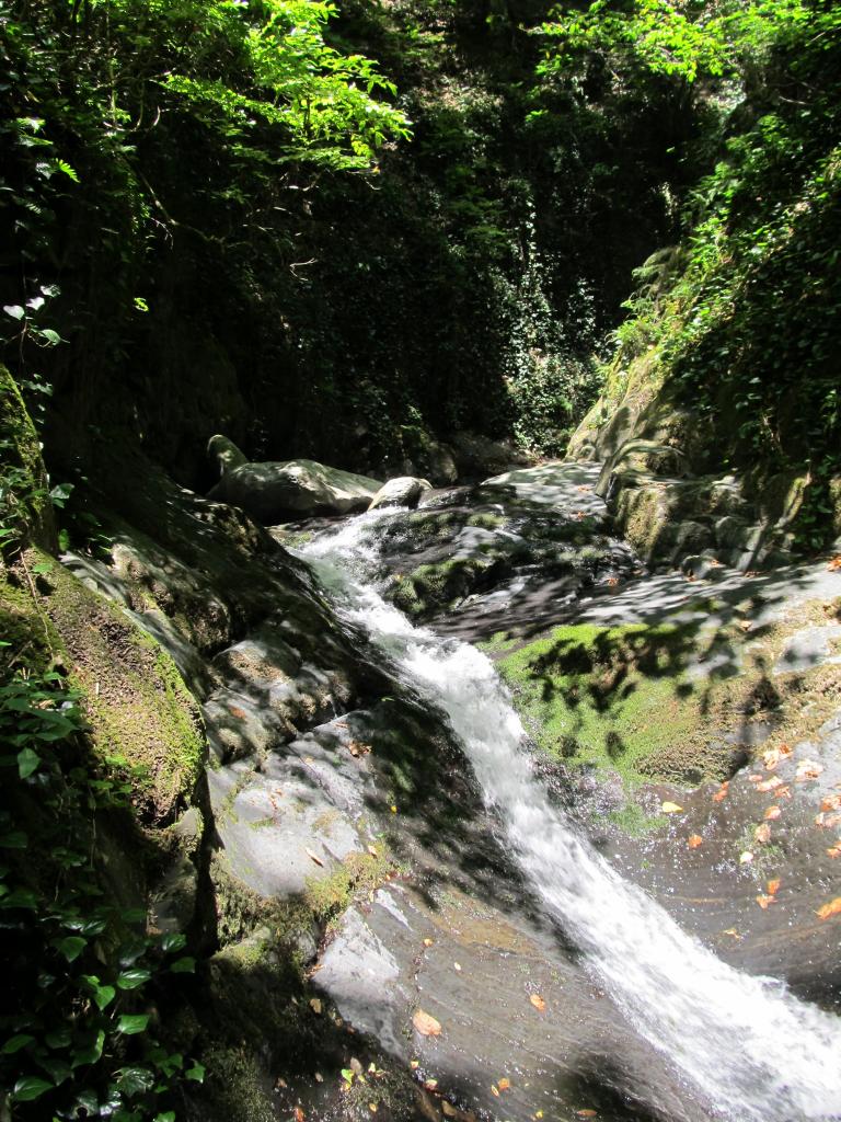
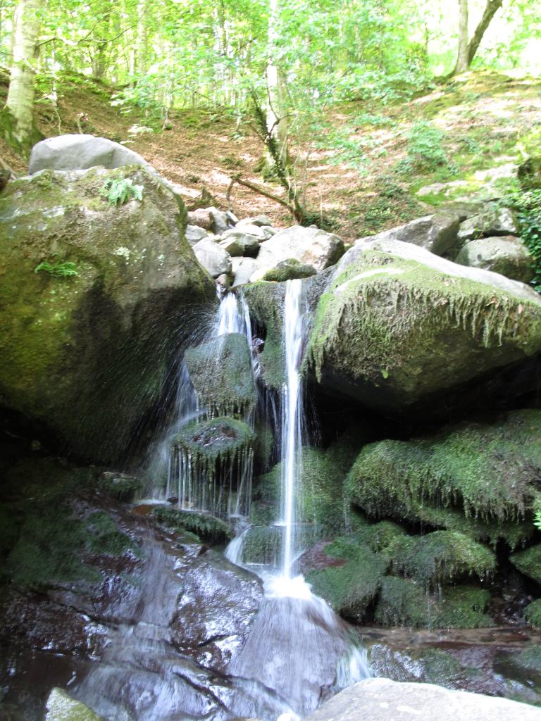
Then I hit a dead end. The river passed through a narrow gorge forming a waterfall. There didn’t seem to be any way to get through there. Also, there weren’t any paths leading up the sides of the gorge – they were too steep anyway.
I had a break there and took a refreshing bath by the waterfall, then climbed the rock that formed the gorge. It was easily possible! From that rock I could climb onto a dead tree that had fallen into an optimal position (or maybe was put there intentionally?) just above the waterfall. Then onto another stone and across I was.
Went back down to grab my stuff and actually did the crossing in no time and without any problems!
Later I had another break at the inflow of a small tributary. According to the aerial pictures, that tributary came pretty much directly from my destination, 42°N, 46°E, though I was still about 3 kilometers away from it.
I decided to follow that little stream, but it turned out to be a dead end for me. The hills left and right climbed steeply and were full of raspberry shrubs. I tried my best but gave up after a couple hundred meters (which equals about an hour of ‘walking’ in these conditions) and returned to the main river I’d been following (the Avaniskhevi).
It was 6pm when I got back there and I decided to stay there for the night. Pitched tent at a lovely spot on soft soil. Cooked some dinner on a large stone in the middle of the river and went to bed not much after 8pm.
What a day.
I woke up and, still half asleep, saw some ants crawl on the tent. “Ha!”, I thought to myself, “Me in here, you out there!”
Hm, some ants? Quite alot of them actually. I looked closer and saw that some of them were outside indeed. And some of them were inside! Hm, there is a tiny hole where the three zippers of the tent’s entrance meet. Yes, that’s were they had been coming in and still were coming in.
I must have pitched the tent on a nest or on an ant road. To make a long story short, the entire tent and all of my equipment was full of them, inside and outside. Luckily, they weren’t aggressive at all.
It was quite a pain and took a while to clean all my stuff.
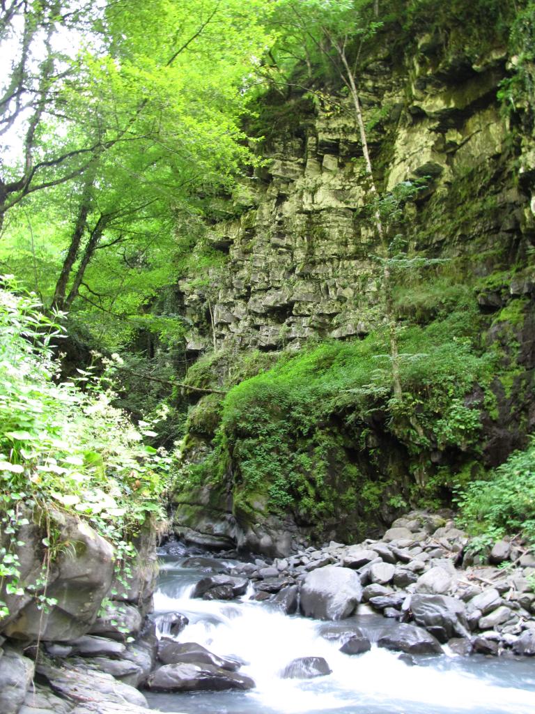
I continued along the river. It became narrower and faster-flowing but was easier to cross when necessary. Eventually I hit another dead end. A gorge, again, but this time there was no tree and no stone that I could use to climb across. There were still my smugglers’ footprints nearby, however I couldn’t figure out how they’d passed this obstacle.
Also, time was working against me. I’d told my host Sura and his friend Dato that I’d be gone for two days, but unfortunately I hadn’t told them what to do if I didn’t return in time or how long to wait before sending for help (dunno if they’d done that at all…).
So I decided to end the expedition here and to return to Akhalsopeli.
Of course, on the way back I was much faster and could phone Dato in the early afternoon to pick me up outside the village.
It was an unsuccessful visit to 42°N, 46°E, but it was a successful adventure nonetheless. I’m full of scratches and bruises, and I’m feeling very happy.
Sura and Dato seemed glad to see me and we had another supra with tasty mtvari (Georgian shashlik) as soon as I was cleaned up. I was tipsy at half past 4pm.
What else happened? More drinking. Dato introduced me to a group of Ossetians, showed me around a friend’s fish farm, and another friend’s winery, where I got three bottles of wine for free. Whereever we went there was alcohol. I tried and refused as much as I could. Got a hair and beard-do for free.
Later I had a chat with Sura’s wife (still don’t know her name) and kids (and later Sura, too) and was invited back to their place to celebrate New Year’s. Also, I should let them know should I want to attempt a visit to 42°N, 46°E again and they’ll try and hook me up with a local hunter who knows the mountains.
What an awesome day.
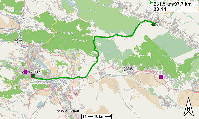
When I mentioned to Sura this morning that I was ready to leave, he called his wife and she prepared a magnificent breakfast. I was almost forced to eat more and more. I successfully refused the vodka Sura offered.
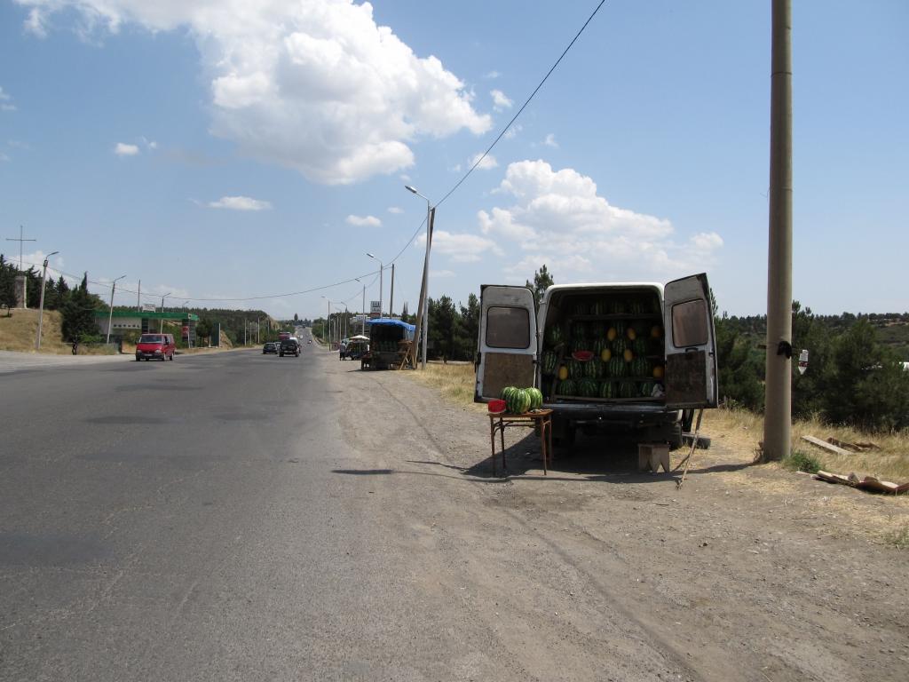
The ride along the Alazani valley was easy, the road goes downhill most of the time. Not far from the Azerbaijani border I was invited to a couple of slices of water melon by some guys at the road side. I happily rested and chatted for a few minutes, as temperatures where soaring high again.
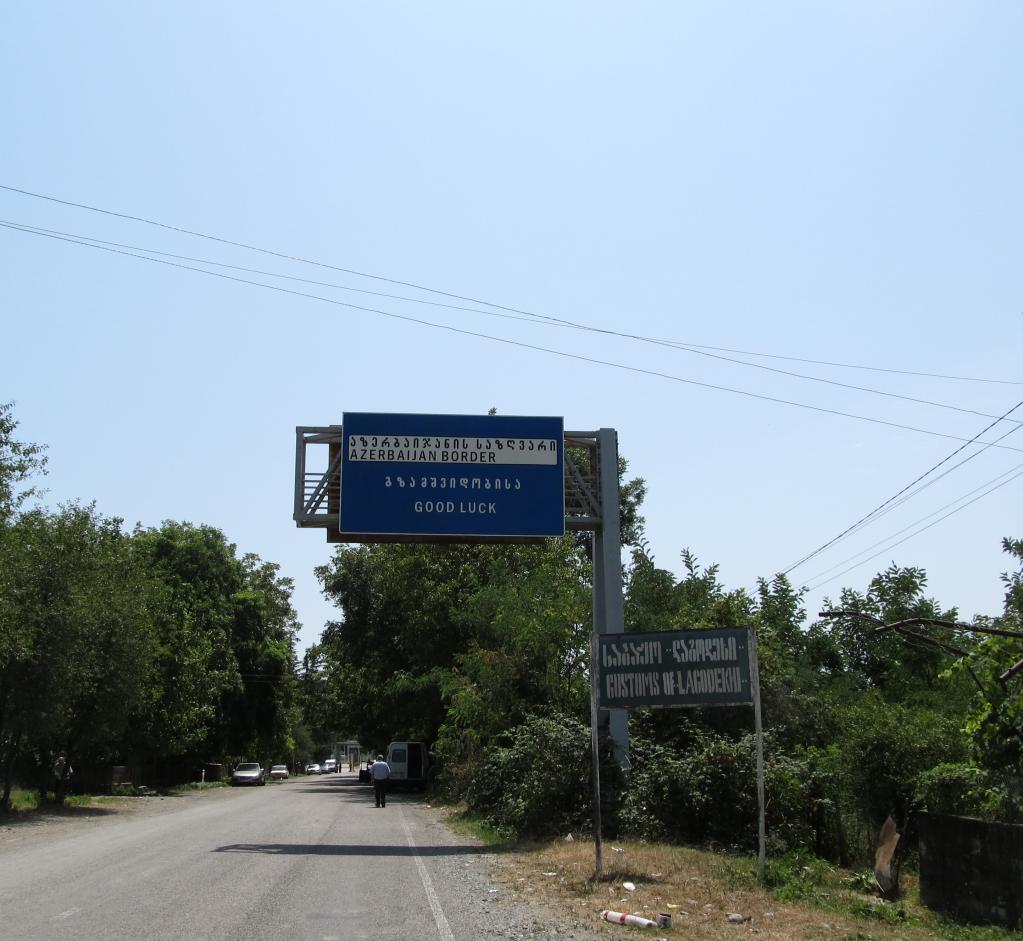
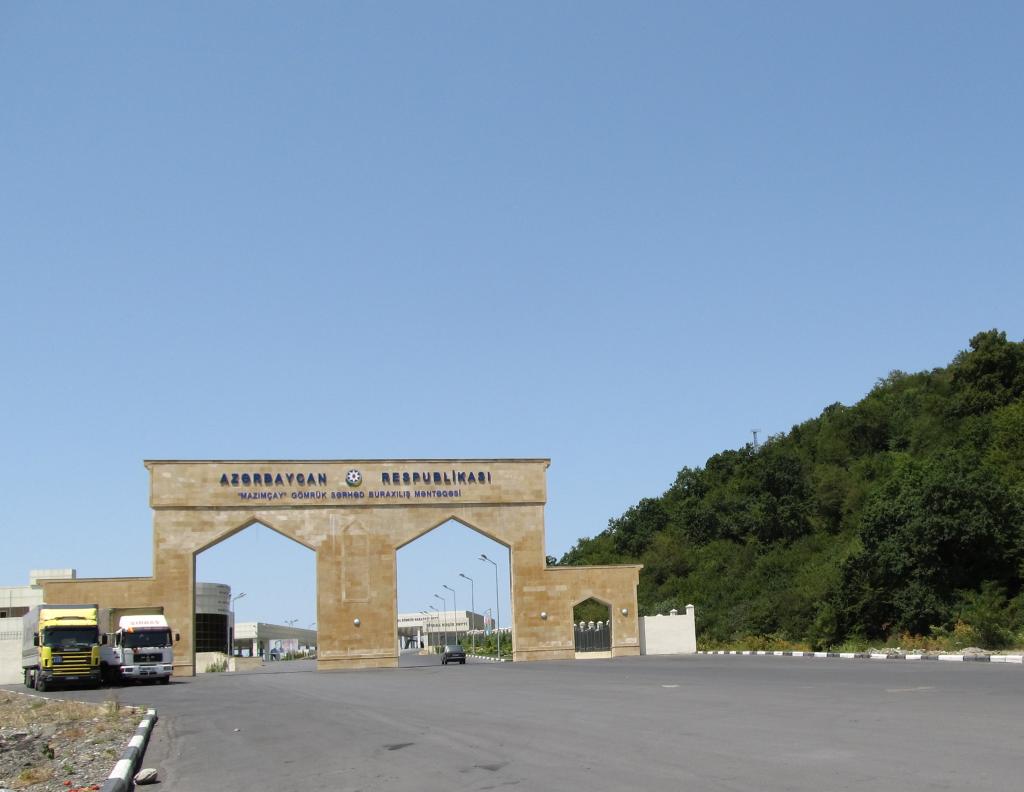
Rumor has it that guide books and maps that list the de facto-independent region of Nagorno-Karabakh separately from Azerbaijan will be confiscated if found by police. My Lonely Planet and my Caucasus map, both possible victims, were tucked away deeply inside my bags for today’s ride into Azerbaijan.
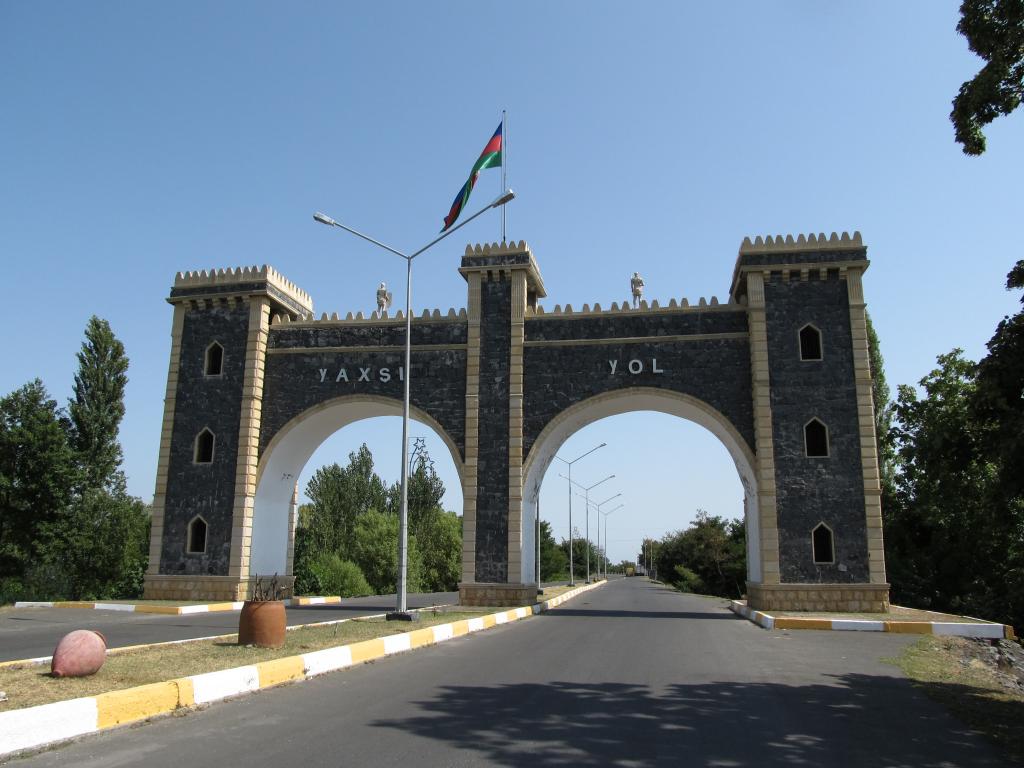
Well, crossing the border was easy. Three passport checks on the Georgian side, and two on the Azerbaijani one. No one was interested in my luggage.
The countryside is now considerably less lush than further north in Georgia. The rivers are almost dry. Temperatures reached 49°C (in the sun).
Had lunch in Balakən and then rode on to Zaqatala, where I’m staying for the night.
Azeris are extremely friendly. Many greet when I ride past (in contrast to the Georgians, who greet only after being greeted).
Cycled: 68km
In hindsight the route we chose to get to Yerevan is unnecessary complicated and time-consuming.
But we were looking for the cheapest option and therefore left very early in the morning for Amsterdam. Trains were on time and everything went soothly.
From Amsterdam we flew to Kyjiw, Ukraine, and from there to Tbilisi, Georgia. Unfortunately, Justus’ backpack didn’t make it to Tbilisi. Enquiries at Lost & Found revealed it’s still in Kyjiw. They (we, too!) hope it will arrive here tomorrow.
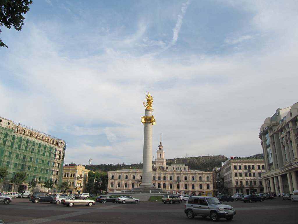
We’re staying in the Why Not hostel, the same one I stayed in last year. Not much has changed. Ben is still working here, which is great.
Where the heck is the guy going again, you might ask.
I’m on a short 2-week trip to Nagorno Karabakh, a de facto independent region in the Lesser Caucasus of Azerbaijan, which was shaken by a bloody war in the late 1980’s and early 1990’s, with Armenian and Nagorno Karabakh troops on one side, and Azerbaijan on the other side.
Nagorno Karabakh, also known as Mountainous Karabakh, declared independence when the Soviet Union fell, at the same time as Armenia and Azerbaijan. But since it used to be part of the Azerbaijan Oblast its independence declaration wasn’t recognized by Azerbaijan. A war ensued and most of the Azeri population was driven out.
There is a cease-fire in place since 1994 and the region is safe for independent travel. A few volunteers have created a hiking trail that crosses the region from North to South, and together with Justus it is our plan to hike a few days there.
Justus called the airport a couple of times this morning but nobody answered. Around noon we decided to go there and check ourselves.
We learned that the backpack was still in Kyjiw and would arrive with the next flight in Tbilisi (around midnight). They said they would deliver it immediately to our hostel.
We then did some shopping for groceries for our trip, as well as wine for tonight, and strolled around the city for a bit. We also changed our plans completely. Since our time here is limited we’re going to stay in Georgia and will try and hike from Kazbegi in the North to Tusheti in the East. It is a route that I wanted to attempt last year but ran out ouf time.
Later we went out for dinner with Ben to sample the gorgeous Georgian cuisine.
Another call to the airport at night revealed that Justus’ backpack had arrived, but they claimed not having enough drivers to deliver it tonight. It would be here by 7am, they said. We didn’t quite believe that and asked Irakli, the hostel’s taxi driver to collect it later at night when he was going to pick up other guests from the airport.
So, if the backpack is here in the morning we’ll head to Kazbegi tomorrow.


The backpack arrived with Irakli last night!!!
We’re ready to set out.
We took the metro to Didube station and hopped on a somewhat touristy marshrutka, together with two girls from Belarus and four Chinese guys, that took us to Kazbegi, north of Tbilisi close to the Russian border.
I slept for most of the ride, but what I saw of the countryside was stunning as almost always in Georgia.
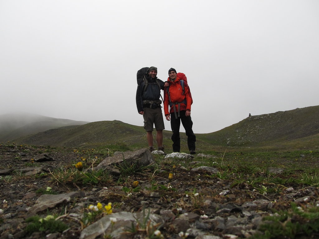
In Kazbegi we stocked up on locally produced bread and cheese and started walking towards Juta, the last village before the mountain ranges that separate the region of Khevi from the region of Khevsureti. We were soon approached by more or less official taxi drivers who asked for our destination and offered a ride. We had to haggle quite a bit and still paid a lot for the 20 km to Juta. Justus liked the idea of travelling in a Lada Niva very much, so it was worth it.
In Juta we met a guy and his kid, and and he recommended the northerly route across the Sadzelisghele Pass (3056 m), which was supposed to be snow-free, and not the route across the Chaukhi Pass (3338 m).
We followed the Juta river for a while. Or was it still the Snostskali? Anyway, we approached a military checkpoint and were stopped. The border with the Russian republic of Ingushetia was less than 3 kilometers to the north. We had to produce our passports and received a document permitting us to travel further.
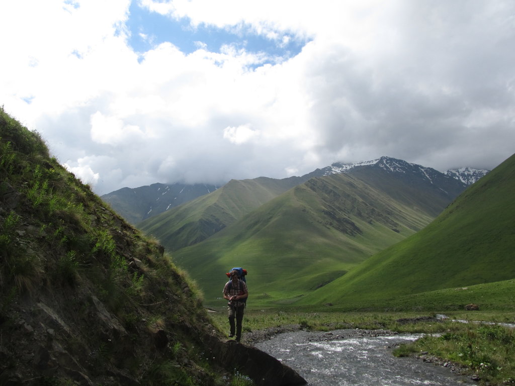
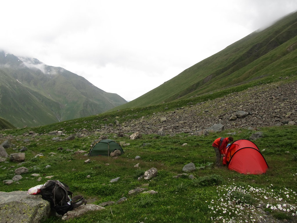
So we continued along the river, higher up the valley. The path branched and we decided to stop and pitch tents for the night.
Walked 10km.
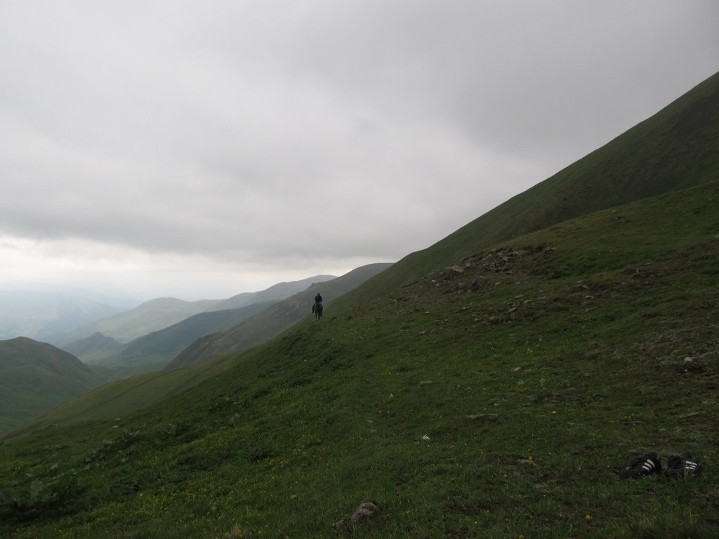
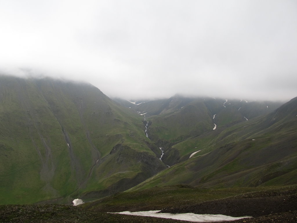
After a hearty breakfast of Georgian bread and cheese and German müsli bars we continued our hike. We started by wading through the river we were following yesterday. Our path climbed quickly towards the Sadzelisghele Pass (3056 m). The pass itself was free of snow but covered in low-hanging clouds. A chilly wind from an eastish direction brought cold drizzling rain. We had a quick snack and descended towards Roshka on a winding path. On the way down we met a guy, a Georgian, with a horse who asked us about the distance to Juta.
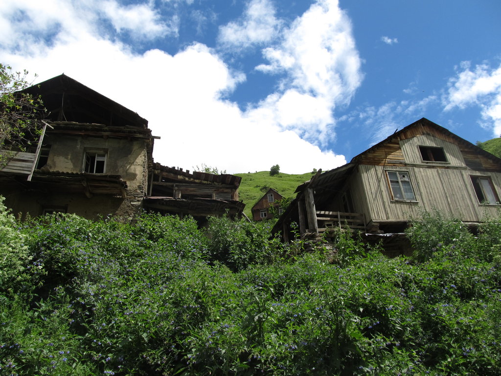
Roshka is a small village. We didn’t really stop but continued our hike on the track that connects Roshka with the main road between Tbilisi and Shatili. After a kilometer or two an old and massive Soviet-era truck came down the track from Roshka and we hitched a ride on the back. It started to drizzle and when they dropped us off at the junction it was pouring. At first we sought shelter under a tree and were hoping to hitch another ride towards Shatili, but when we realized that this part of Georgia sees very little traffic we rain-suited up and walked.
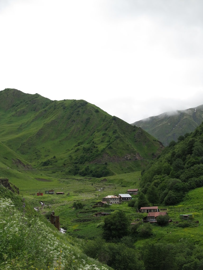
We made it to a crumbling structure made of concrete which might have been a bus stop decades ago. But at least it had a semi-functional roof. We waited until the rain stopped and then decided to have a look at Gudani’s guest house, for which there was a sign nearby. Best idea ever. The hot shower from the ancient-looking wood-fired bath boiler was amazing, and the dinner… beyond words. We had loads of khachapuri (Georgian cheese-filled kind of bread), butter, roasted potatoes, beef soup, fresh veggies, sulguni (Georgian cheese), pickled cucumber and onions, matsoni (Georgian yoghurt) with fresh blueberry(?) jam – everything fresh and home-made.
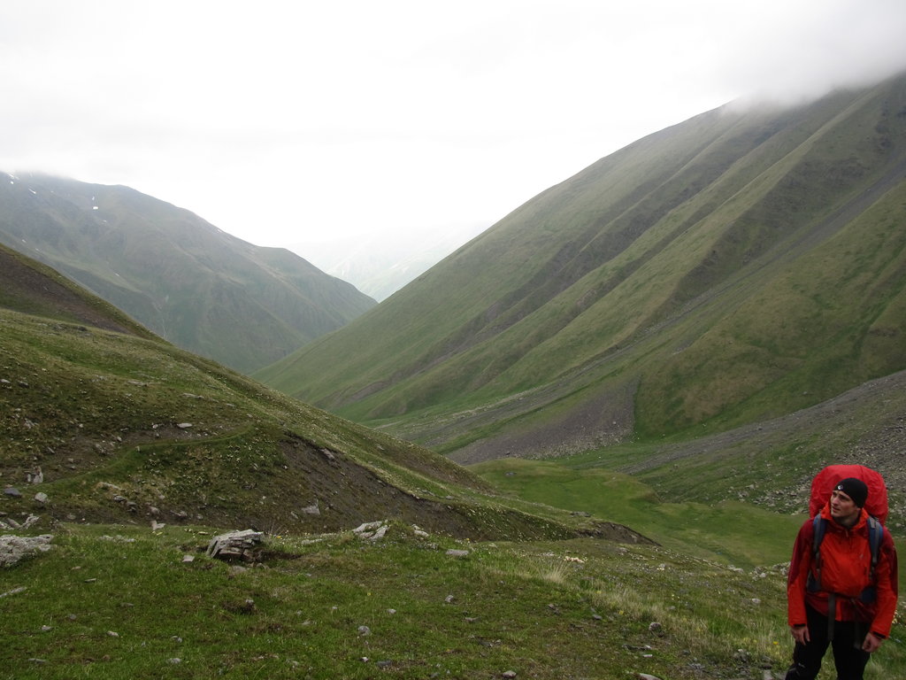
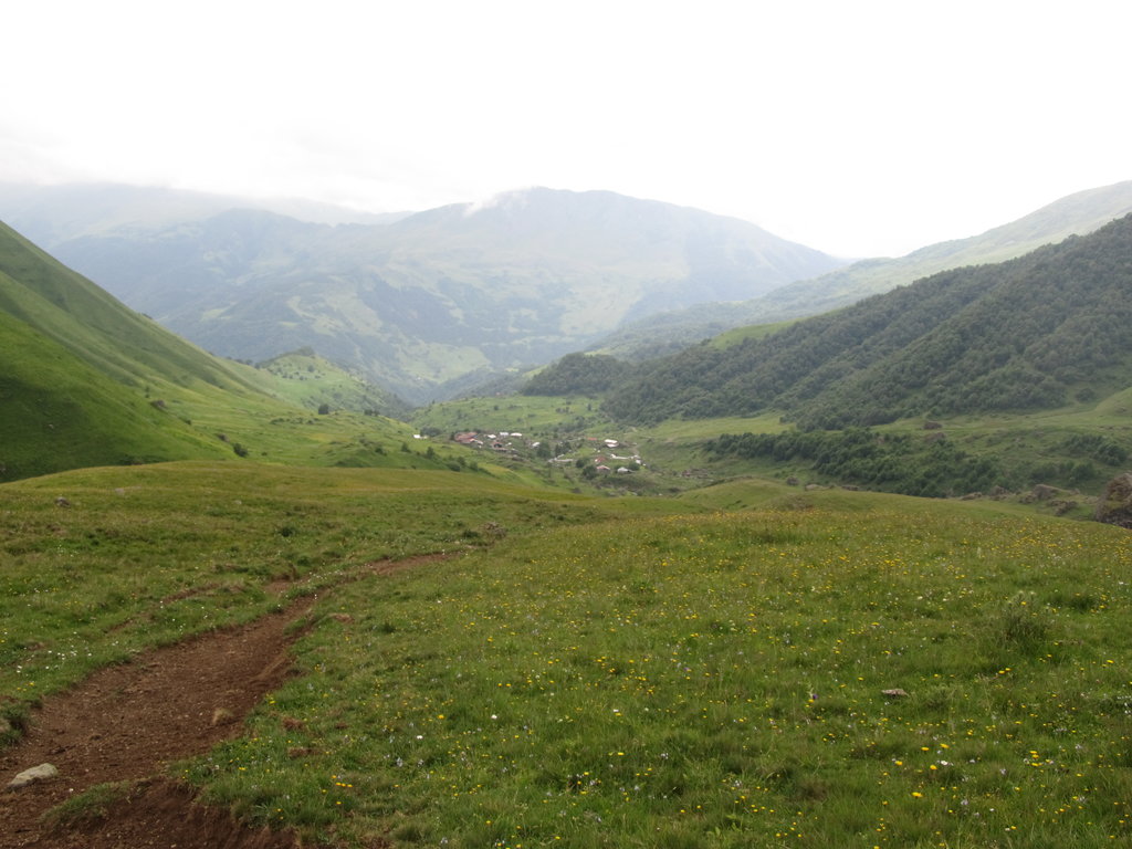
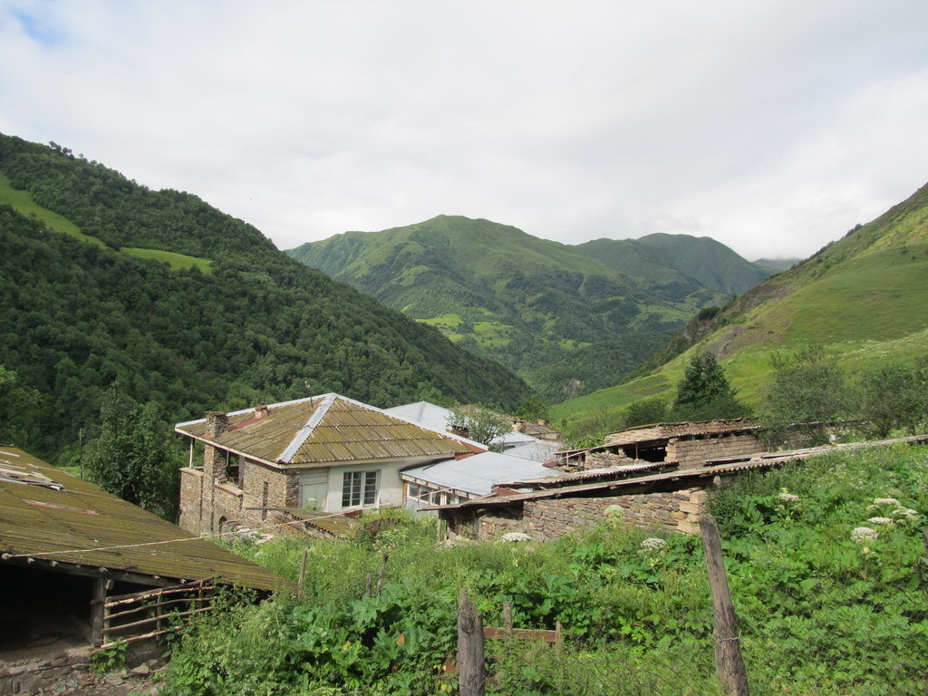
After an awesome Georgian breakfast we continued our hike towards Shatili. We passed by a few hamlets – Biso and Khakhmati – lying in the valley below the road. Traffic was low (i.e. almost non-existent). Eventually we spotted a marshrutka in the distance and were prepared to flag it down and hitch a ride to Shatili. The van was filled to the brim and didn’t even stop. At that point we realized that we would not make it to Shatili today. The original plan of hiking from there to Tusheti in the East was ditched due to timing constraints. Instead, we decided to keep on walking on the road until after we crossed the main Caucasus range via the Datvisjvarisghele Pass (2676m), then deviate off onto less trodden paths, cross another pass and descent into the Chanchakhistskali valley, then continue to Shatili from there. By now we were too proud of what we had already achieved to negate that achievement by using cars. From Shatili we’d take a marshrutka back to Tbilisi to arrive back there in time.
Datvisjvarisghele Pass was covered in clouds. On the way there we could hear a shepherd shout after his flock of sheep. We even saw him high above the road on a steep slope, until he was swallowed by the fog. We imagined the life these people lead here, always outside, always on the move, no matter what the weather is like, sleeping in tiny and cold huts.
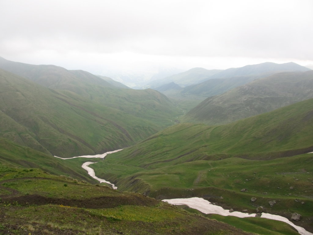
The wind blew coldly across the pass, but as soon as we had descended below the clouds again the view was breath-taking. The valley which the road followed was astoundingly beautiful. Green grassy slopes left and right, bare of any trees, a large flock of sheep grazing just across the valley. We were almost feeling sad about leaving road and valley behind. We walked down to its bottom, left the road, crossed the river Arghuni which has its source near by. Since we had just crossed the water divide, the Arghuni flows in a northish direction, towards Chechnya.
We continued eastish, climbing up to an unnamed (as far as I know) pass, on a narrow footpath, not far from the sheep mentioned above. The shepherd didn’t seem to care much, unlike his dogs. Two of them followed us for quite a while, barking, making sure we didn’t feel like having lamb for dinner. Eventually they decided to let us go scot-free, and we disappeared in the fog.
After crossing the pass, the Chanchakhistskali valley opened up beneath us, again stunningly beautiful. While descending towards the Chanchakhistskali river, we heard gun shots and voices shouting. However much we strained our eyes, though, we didn’t see anyone in the valley below or on the slopes across.
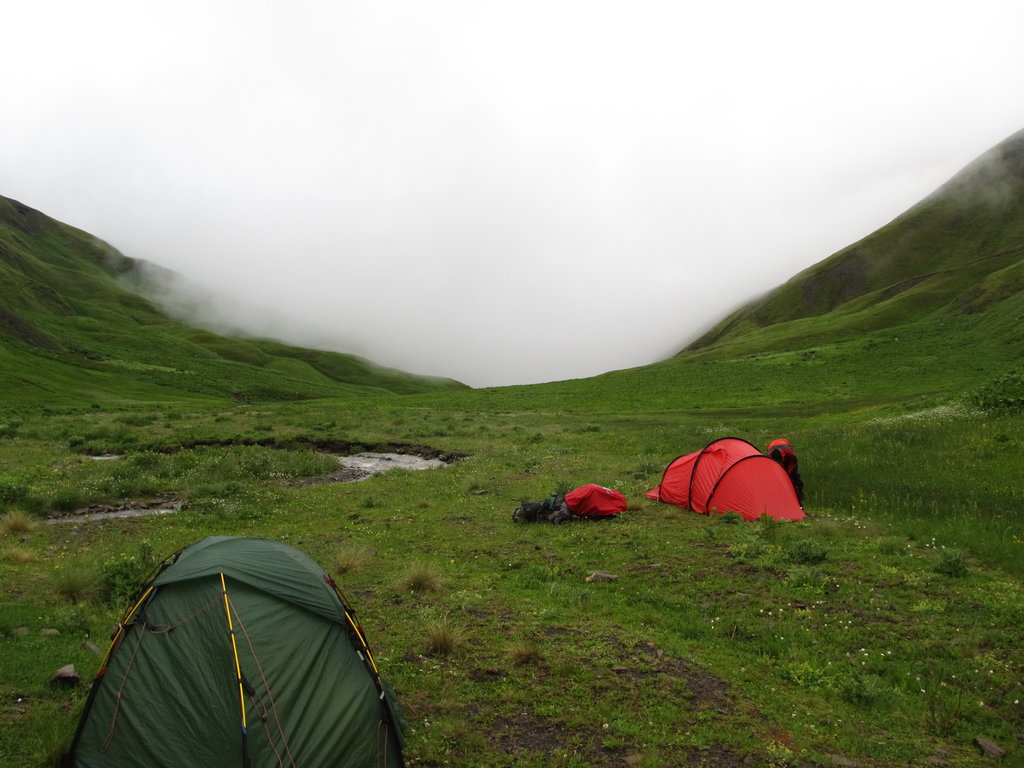
We followed the winding path and when we reached the river at the bottom we decided to call it a day. Fog crawled up the valley and we had just finished pitching the tents when the world around us disappeared.
Walked 23km.