Author Archives: todd

Ushguli – Confluence of Tskhenistskali and Zeskho rivers

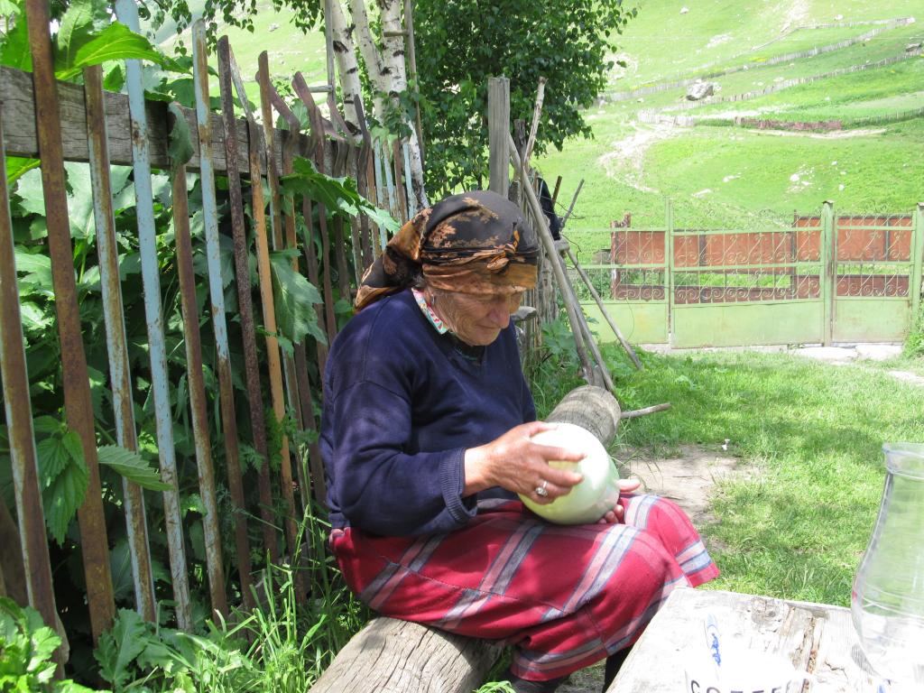
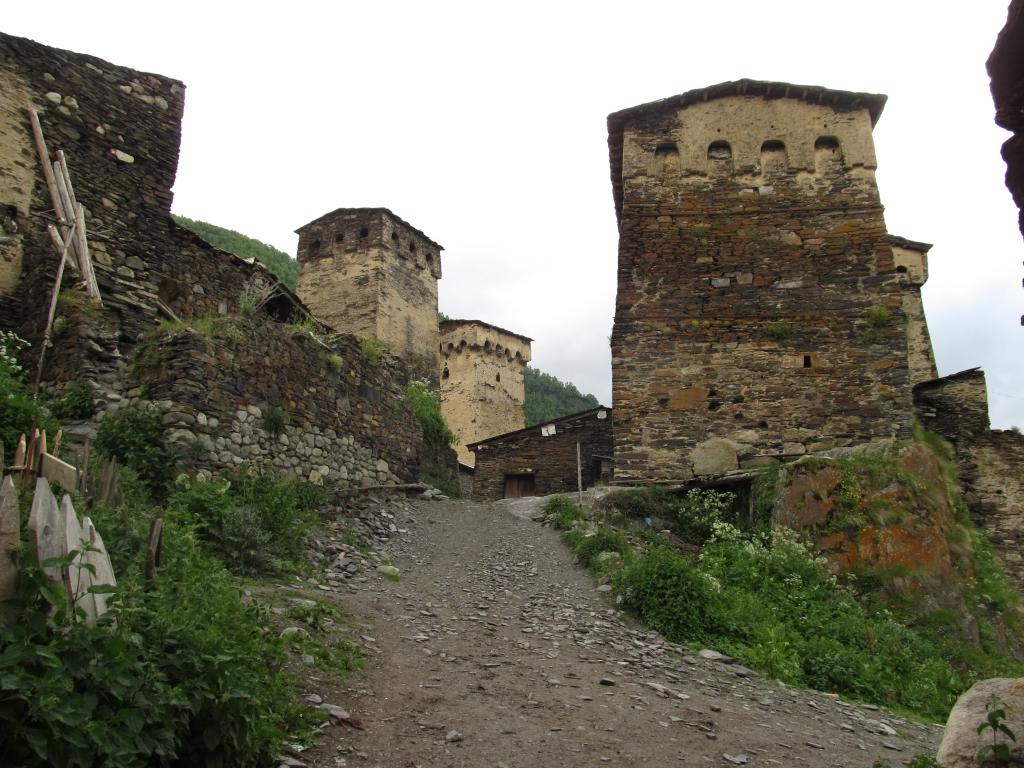
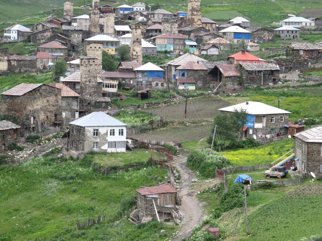
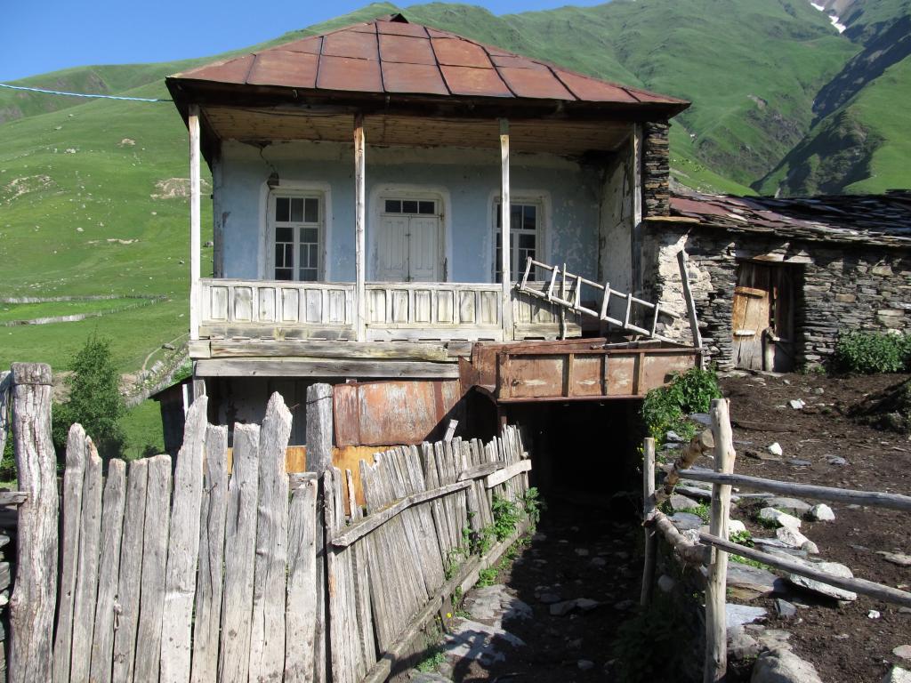
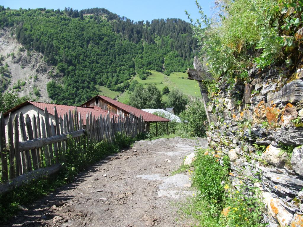
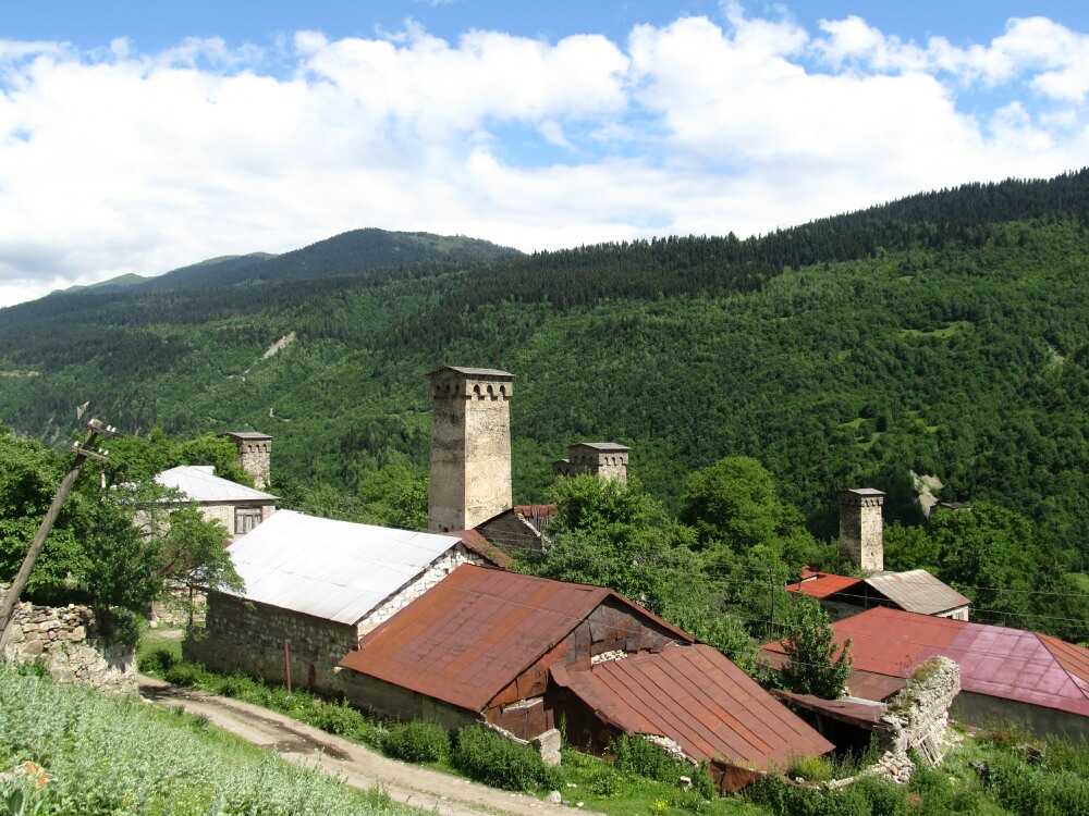
Left our lovely host family shortly past 10am and went to the local treasure museum, which was closed yesterday when we went there.

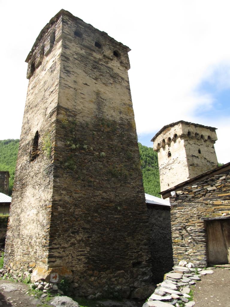
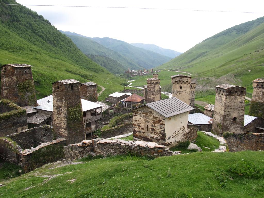
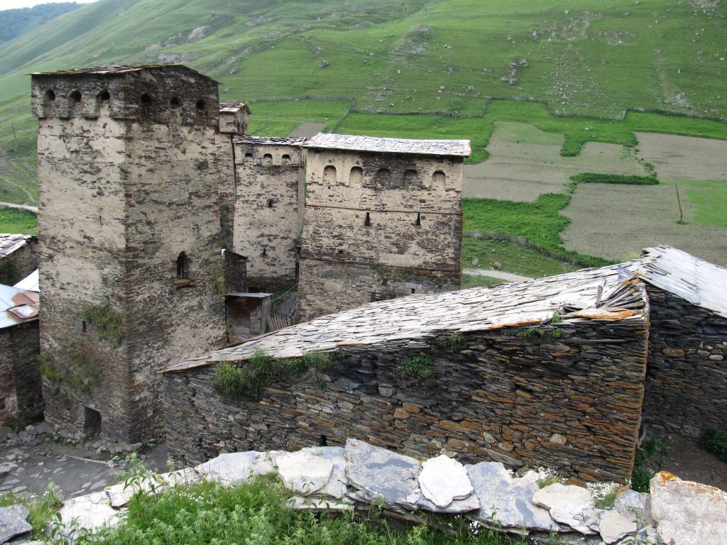
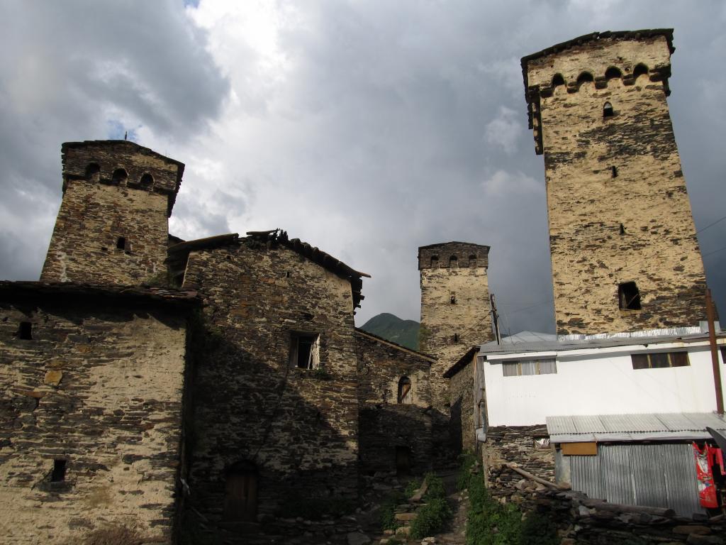
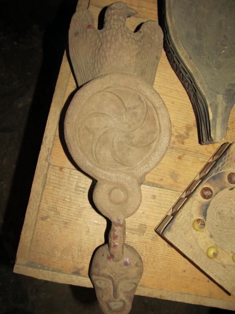
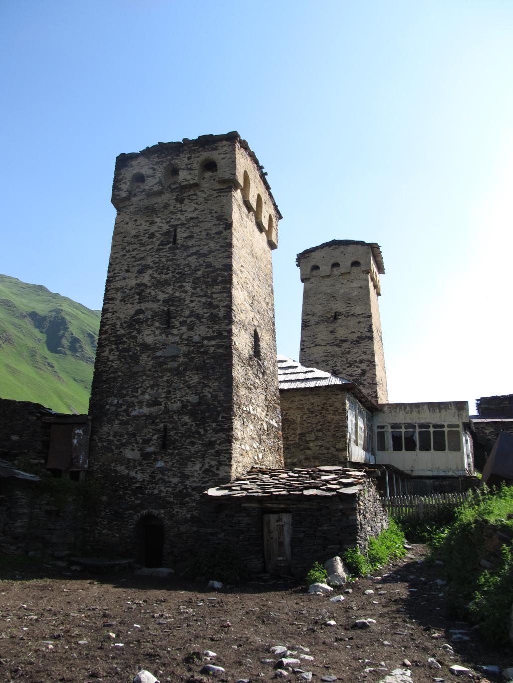
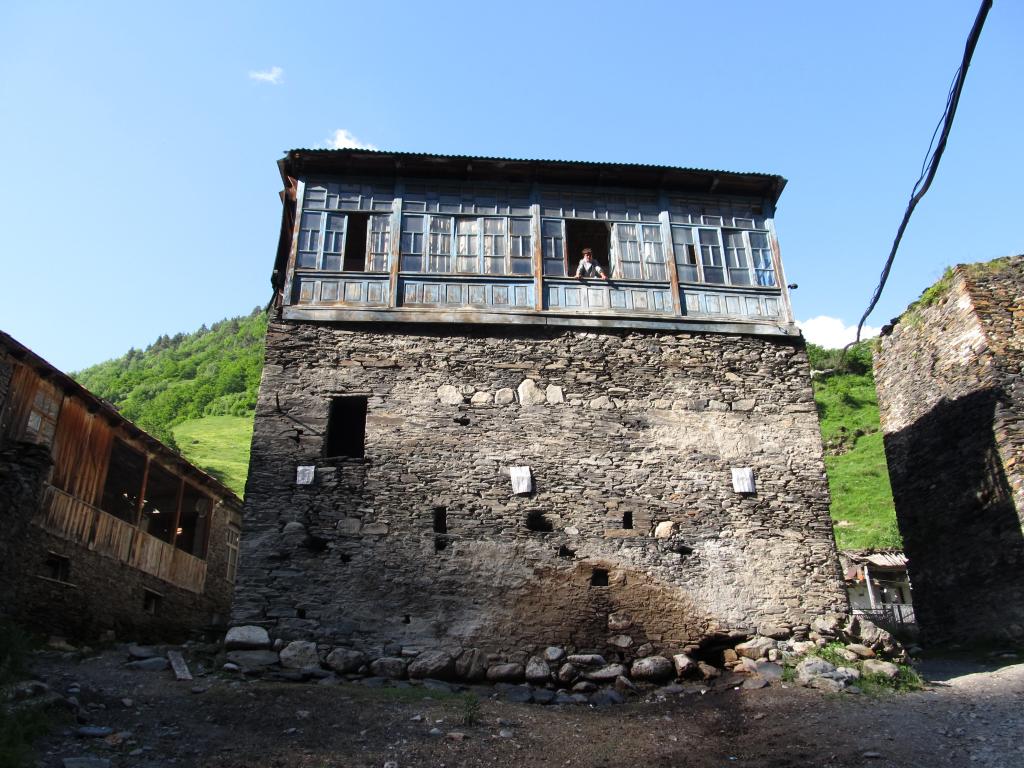
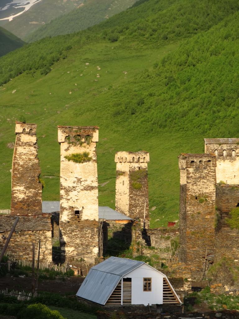
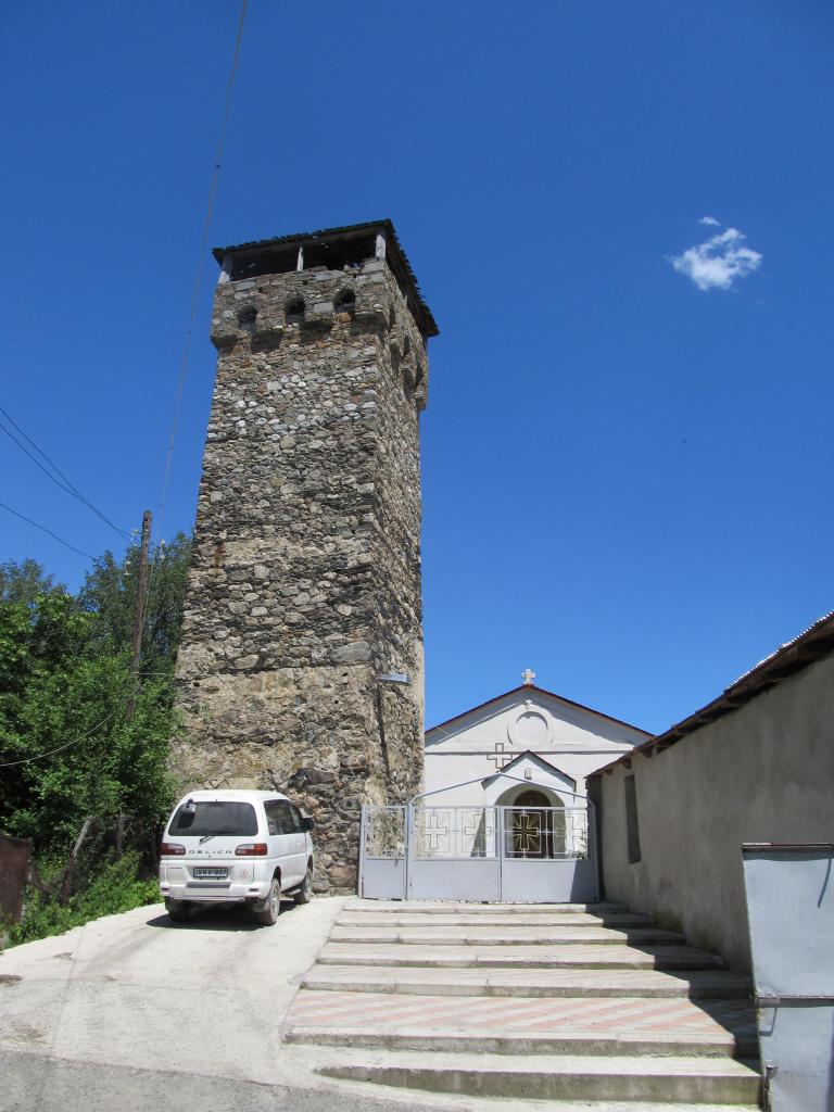
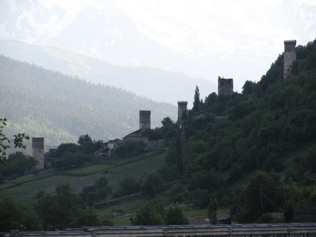
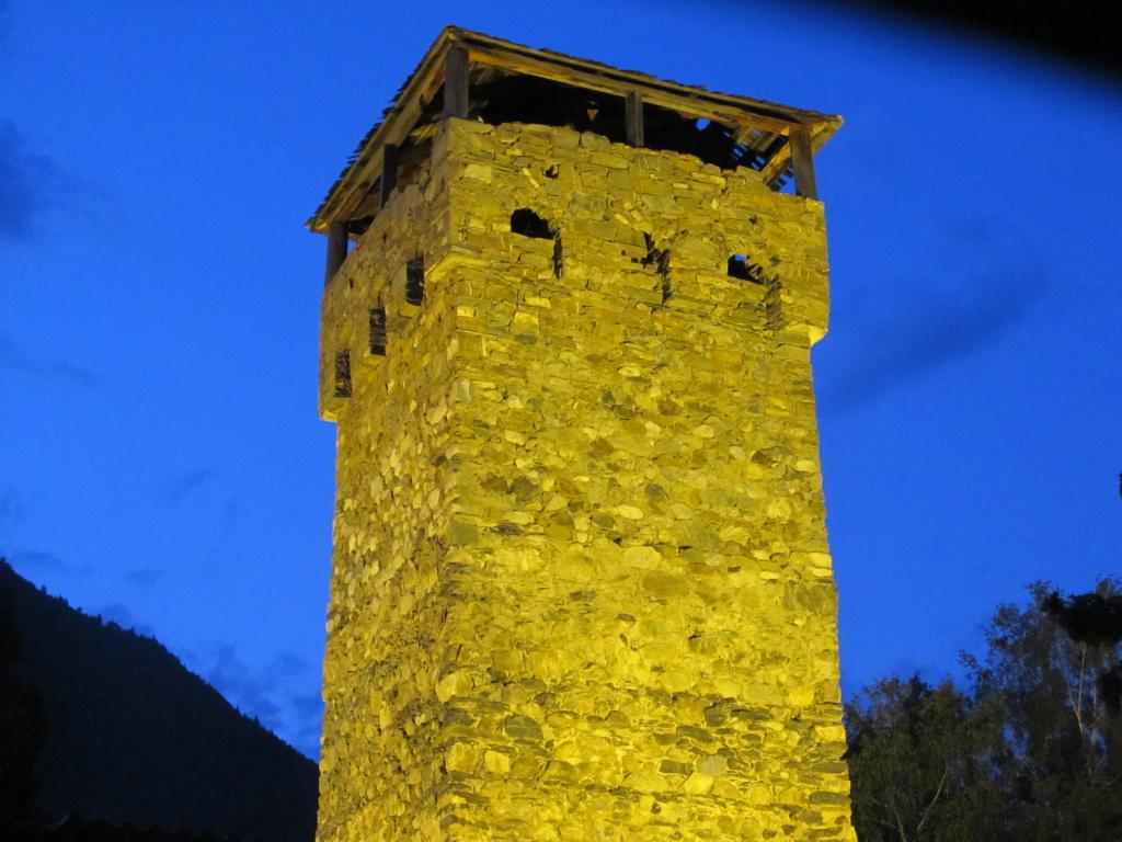
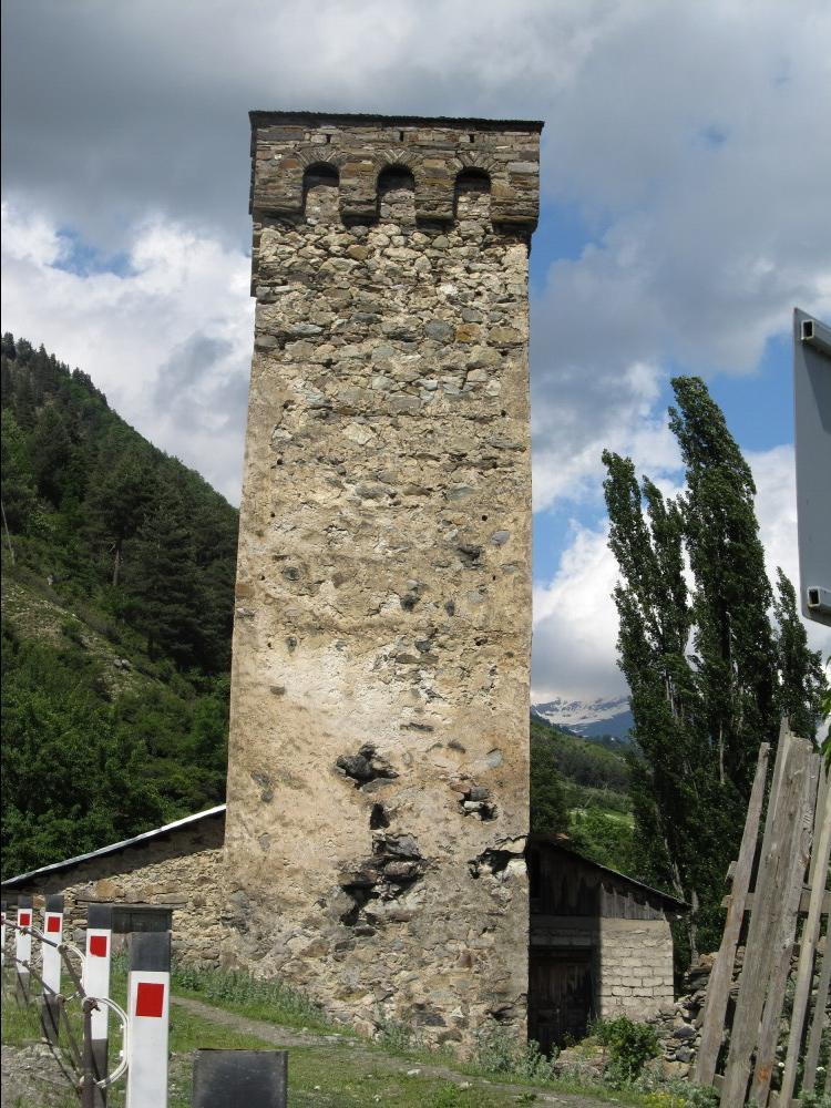
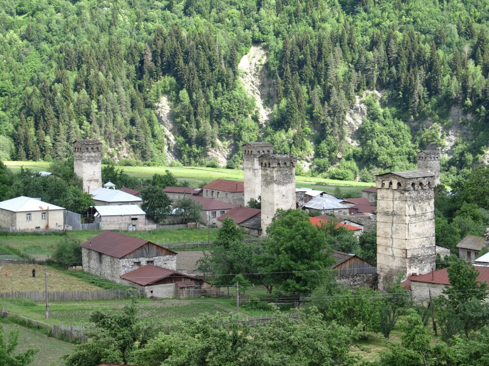
It was still closed and we had to wait for half an hour until someone heard our shouting and told the officials that there were visitors. The local police officer showed up with one key. He phoned the ‘director’ of the museum who brought the other keys to open the door (three or four locks in total). The museum is located in an old Svan tower. It has icons and crosses from Svaneti churches on display, some of them really old (many things from the 11th and 12th centuries, some from the 6th century, some even older). Taking pictures was not allowed.

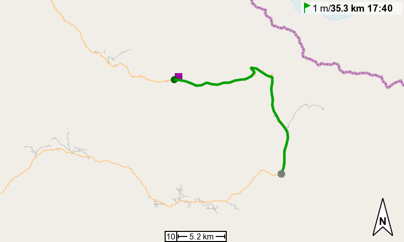
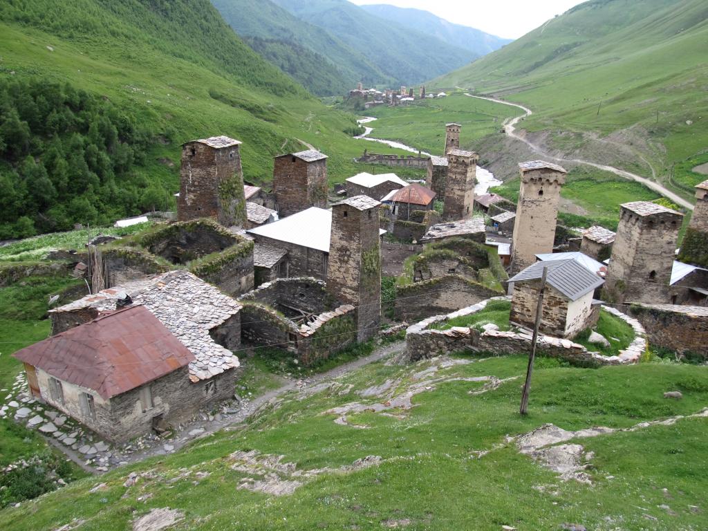
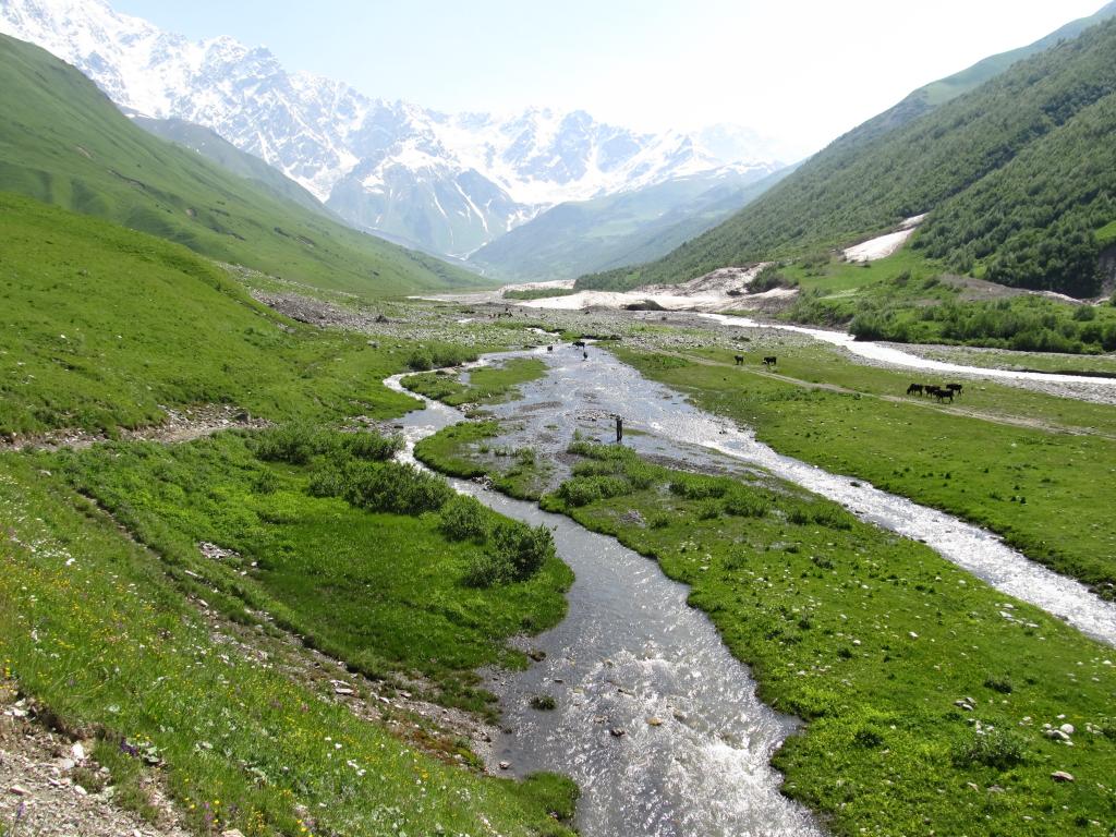
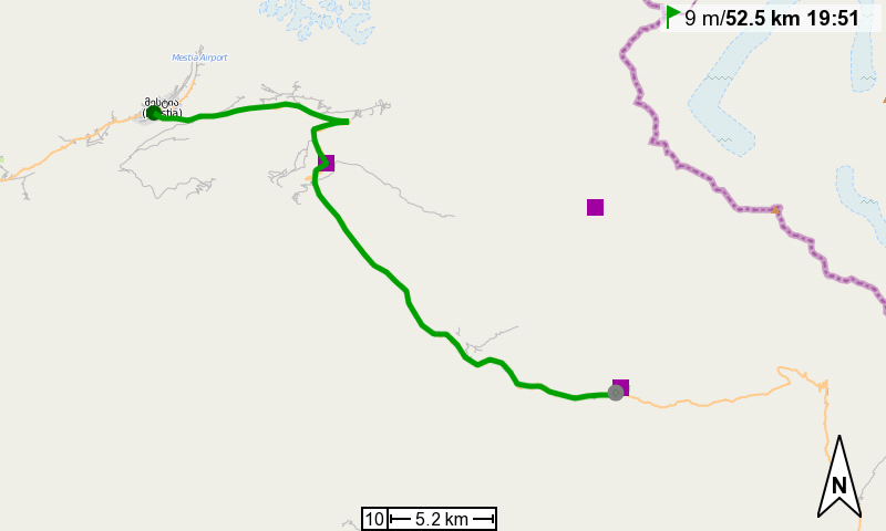
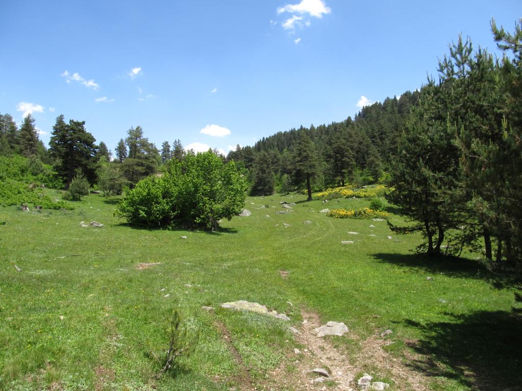
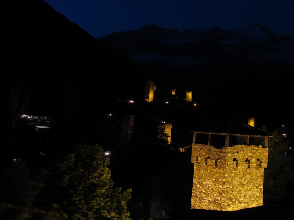
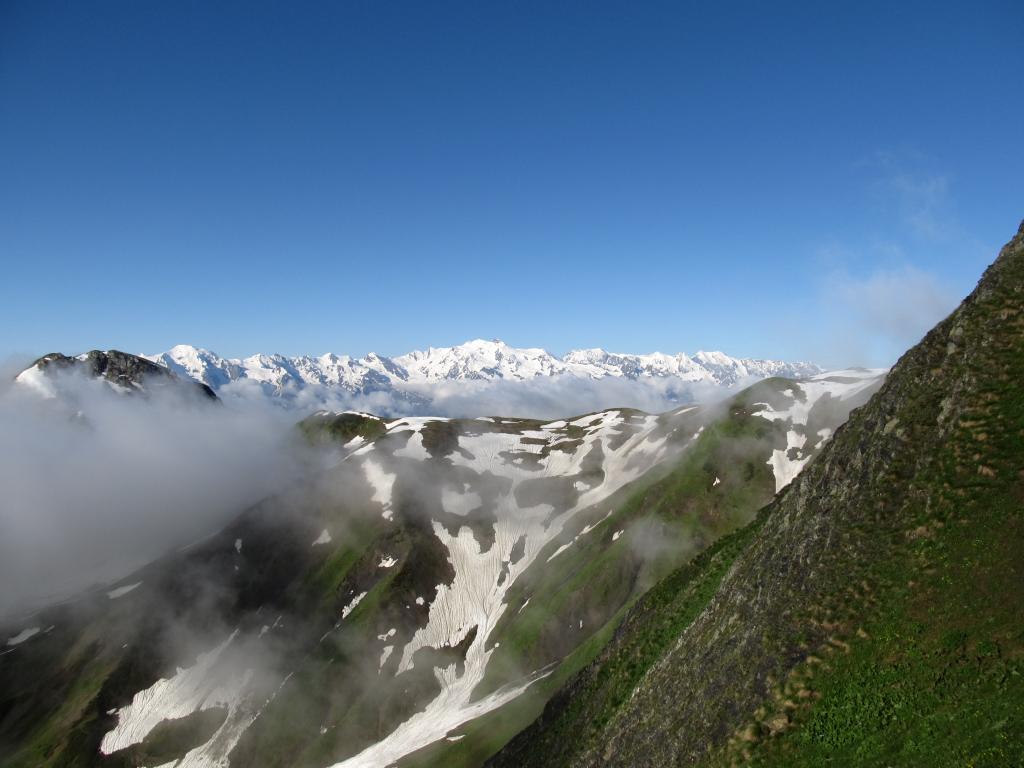
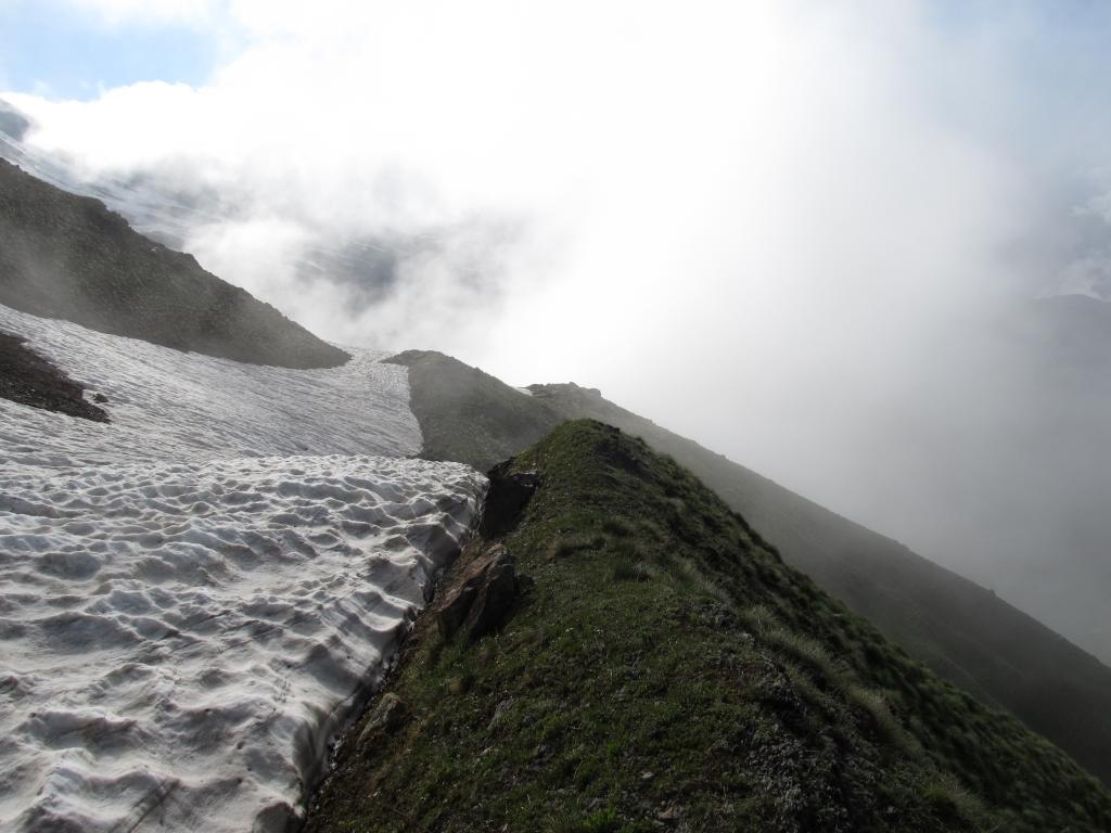
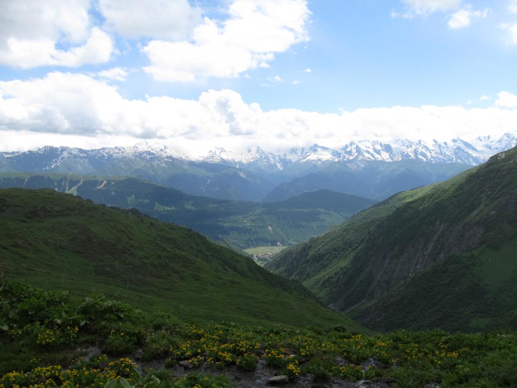
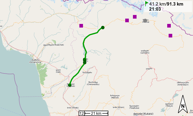
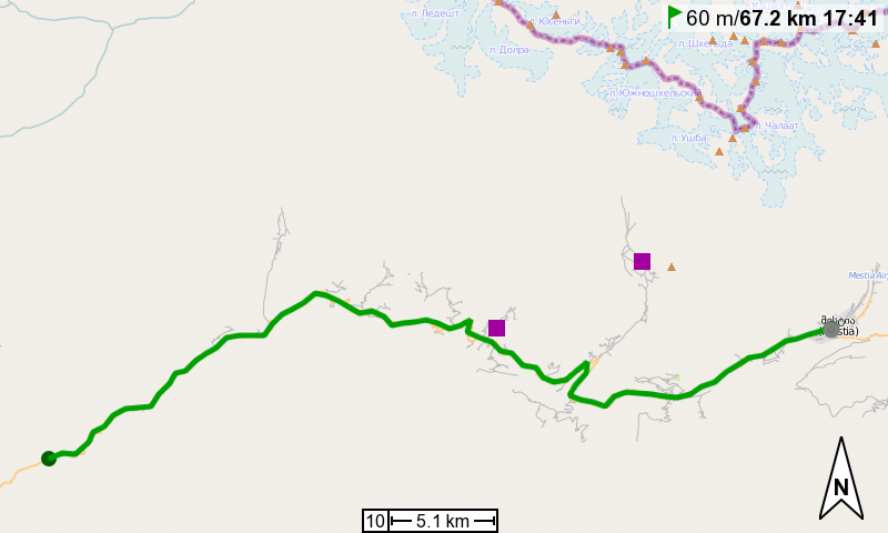
We left Ushguli almost half past 11 and cycled to the east. The road (read: track) climbed steadily and steeply towards the Zagaro Pass (2623m) which we crossed happily after about 9km. From then on we went downhill pretty much all the time. We’re quite happy that we didn’t attempt to go to Ushguli from this side. It is so steep it wouldn’t have been fun at all.

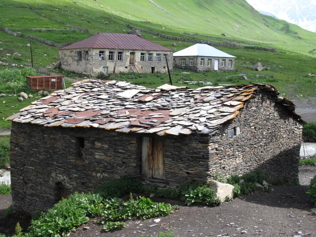
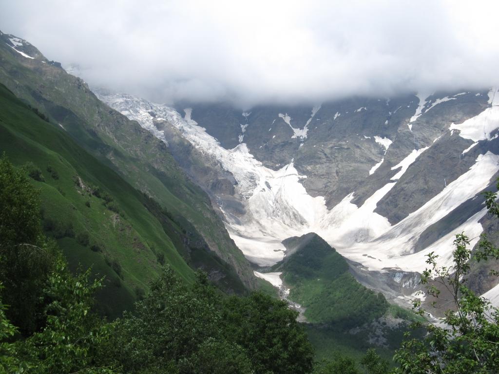
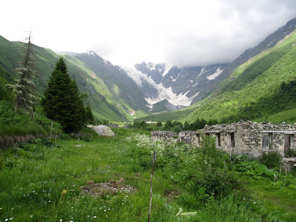
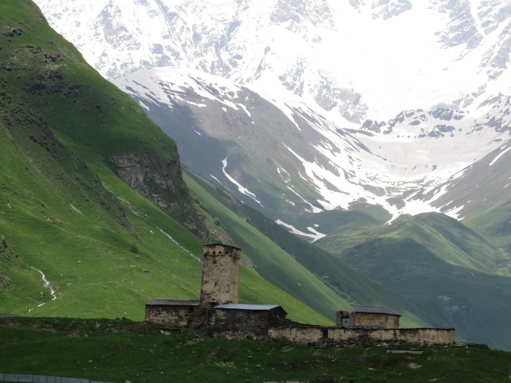
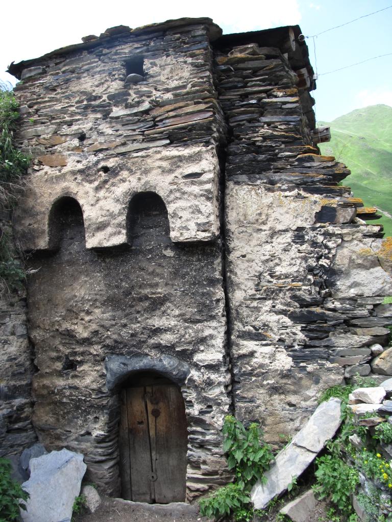
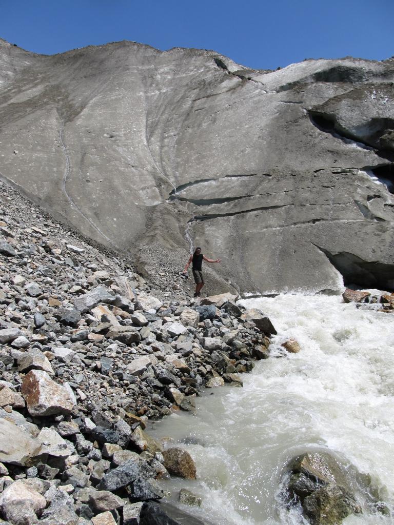
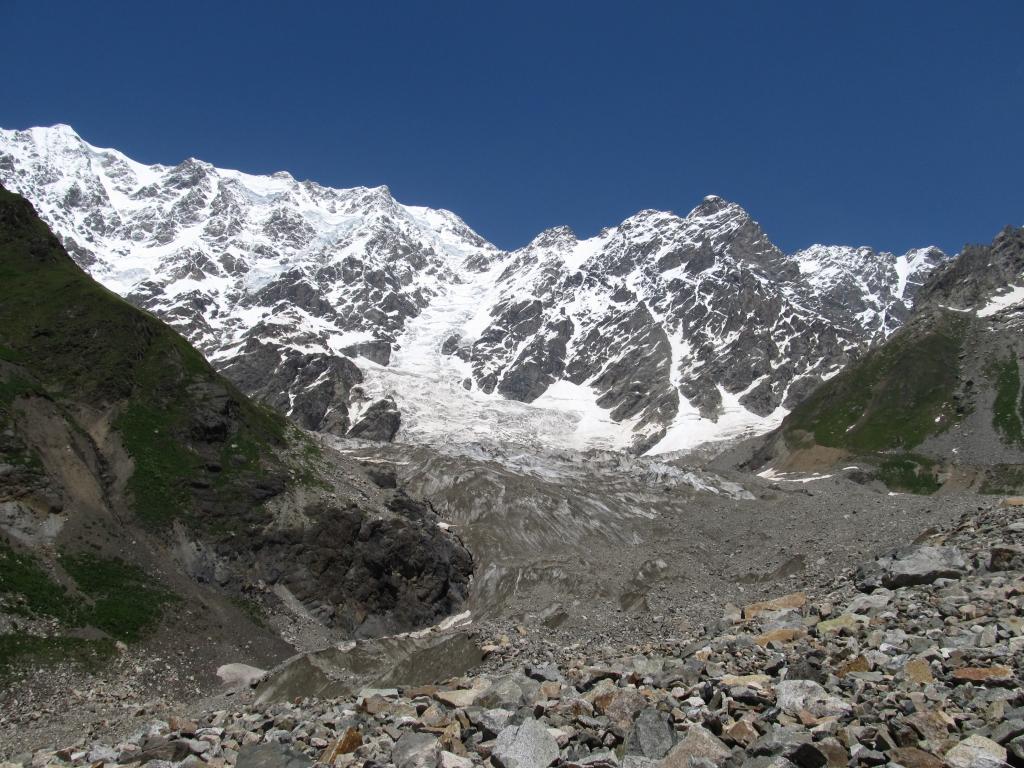
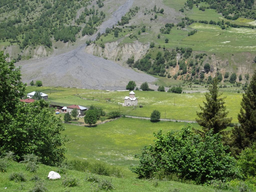
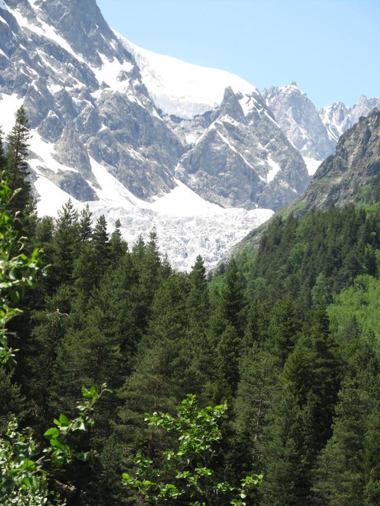
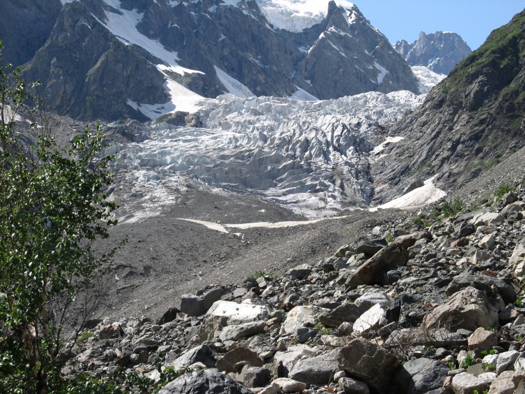
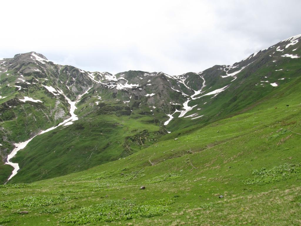
Came to a glacier on the south flank of the Ailama massif, which is the source of the Zeskho river. Explored a house in the abondoned hamlet (or maybe military base) of Koruldashi at the foot of the Ailama.

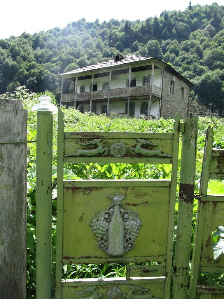
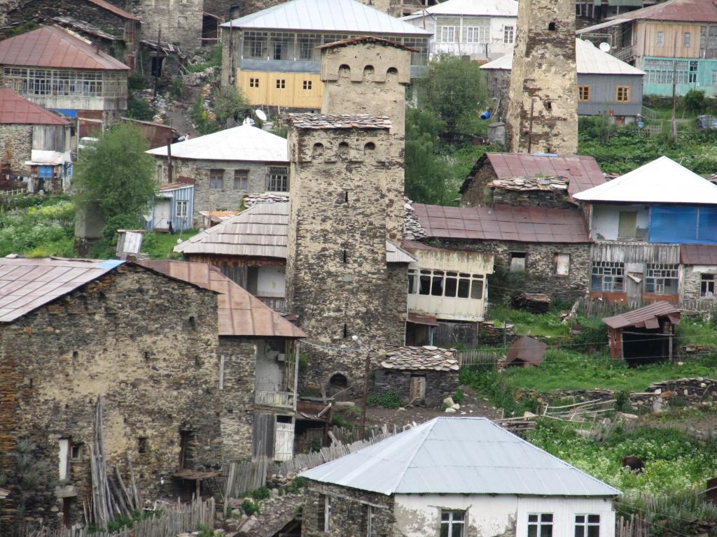
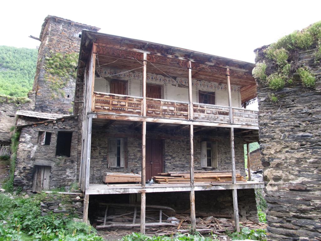
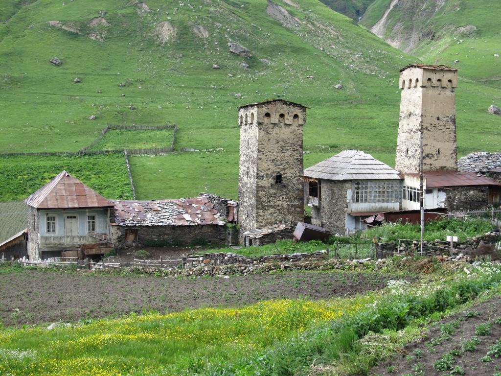
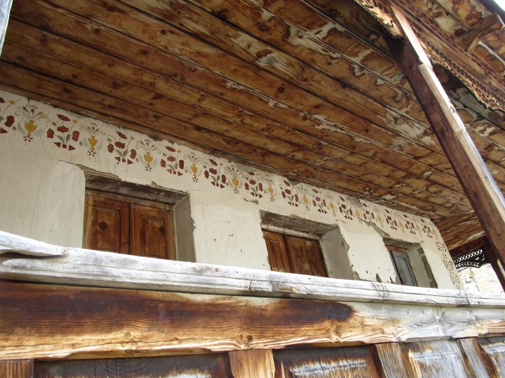
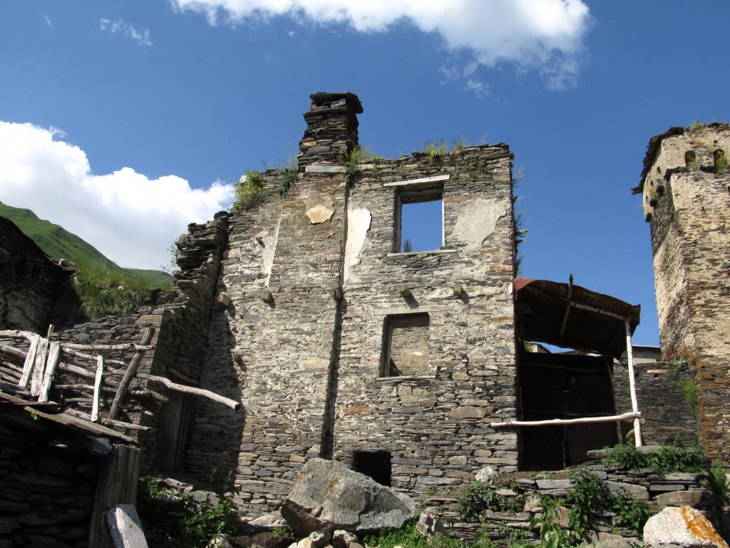
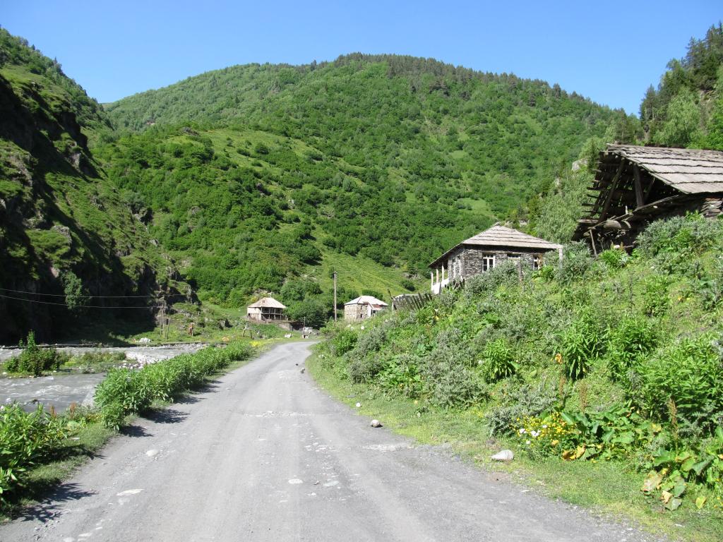
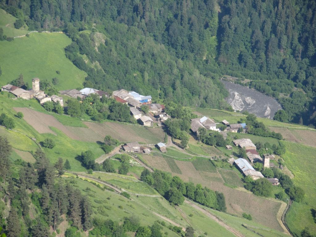
A few kilometers further we came to Tsara, a tiny village on the right bank of the Zeskho. At first glance it looked abandoned, too, and we crossed the river to have a closer look. Curiously, there are no defensive towers in Tsara. Found a couple of very nice-looking old houses, though. We also found people. They were strange, however. The first lady who spotted us didn’t care at all – kinda unexpected here. Then a guy followed us and we were asked where we were going. He pointed out that we were on the wrong side of the river, and said: “This is just Tsara”. It seemed obvious to us that he didn’t really want us to be there.

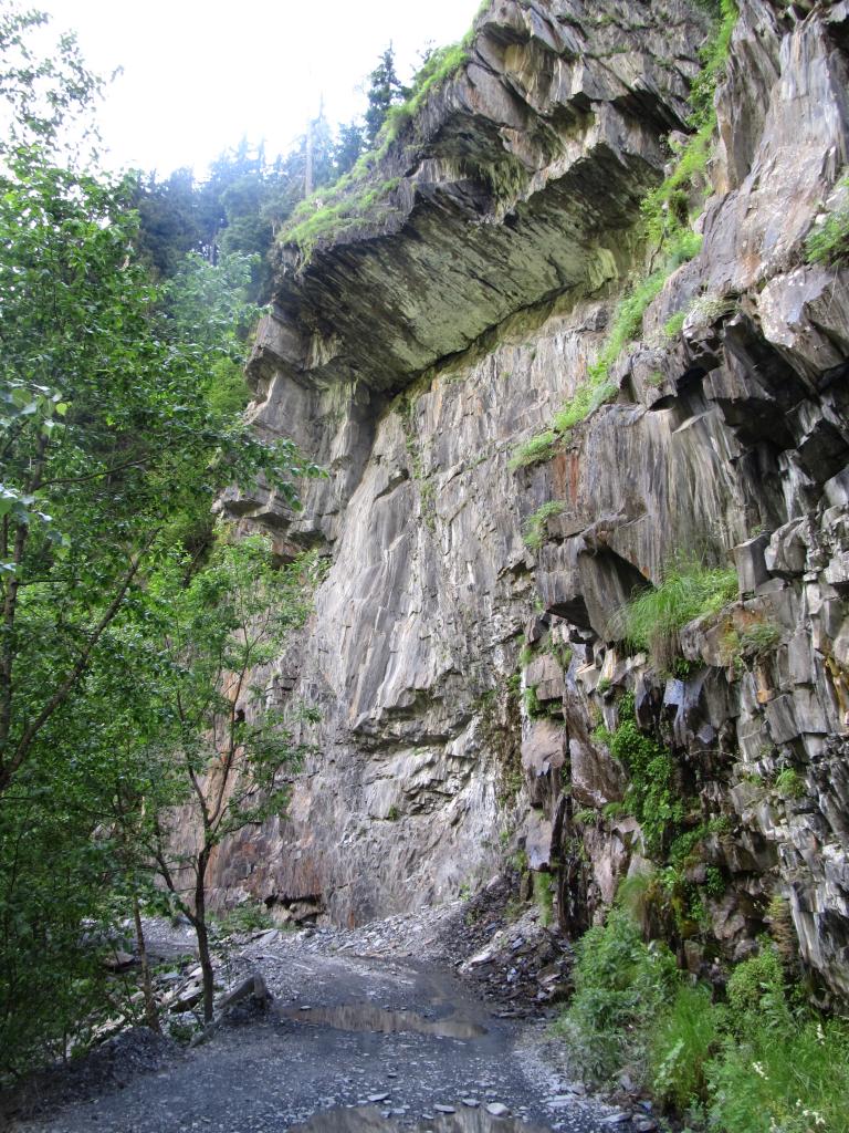
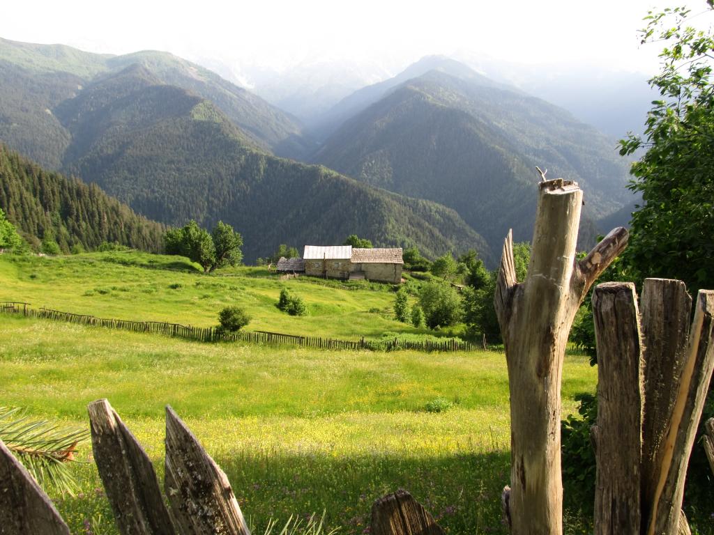
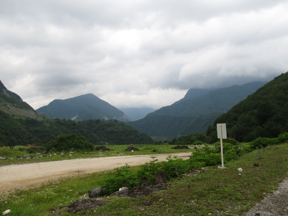
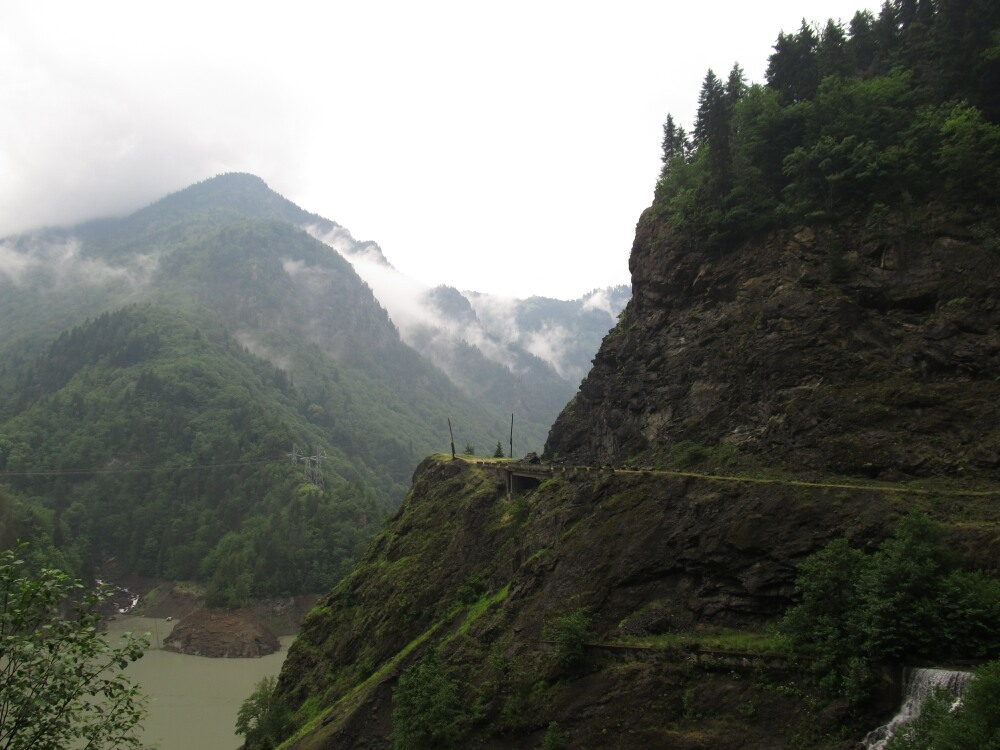
We continued along the Zeskho. The gorge it flowed through was amazing. High slate cliffs, thick forrest, little streams crossing the track, fabulous weather.

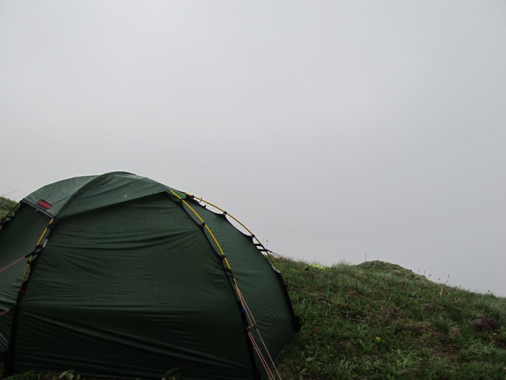
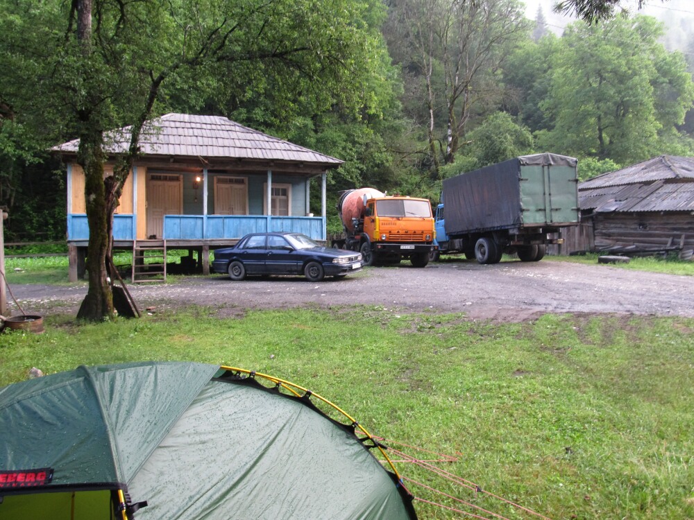
At the confluence of the Zeskho and the Tskhenistskali we noticed a bridge across the Zeskho that wasn’t on any of our maps. A bit curious, we crossred it and found a beautiful grassy place between the two rivers. We decided to call it a day and camp here.

Had a bath in the Tskhenistskali and lit a fire. I cooked some pasta for dinner.

We saw exactly one car all day: a Polish family traveling in the same direction as we did.
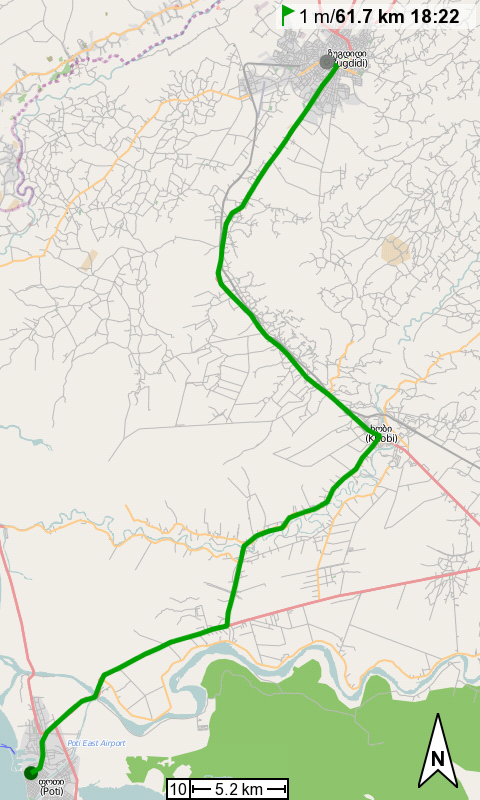
Cycled: 31km

Trip: To the Caucasus and Back | Country: | Comments Off on Ushguli – Confluence of Tskhenistskali and Zeskho rivers

Ushguli

Today was reserved for the community of Ushguli. We went to see two of the three local museums (one of which was a bit disappointing and expensive for what’s on display). The third one was closed by the time we got there. Walked around the hamlets and noticed that in the two upper ones, Chvibiani and Zhibiani, there is quite abit of refurbishing going on and there are actually a lot of guest houses (and an unexpectedly high number of tourists – we met 10+ or so). Not all of the guest houses seem as sympathetic as ours, though.

Wanted to rent horses to ride to the ruins of Tamar mepe (Queen Tamar) church, which is located on a hill overlooking the Enguri valley and all of Ushguli. After hiring the guide and horses he told us that the path would be too steep or whatever and that it wouldn’t be possible to go there by horse. Gna! Instead we were offered a ride to the Shkhara glacier where we’d been yesterday. For lack of options we accepted that route eventually.

I hadn’t really ever ridden a horse (other than once around a soccer field or so years ago) and I was looking forward to it now. The ride was short, though. At the avalanche we’d crossed yesterday the guide stopped and turned around, telling us that it wouldn’t be possible to cross it with the horses. Oh well, in other words, we got ripped off. ;)

Walked down to Chazhashi, the second lowest hamlet of the Ushguli community. Here there is less (re)building going on. Tracks between houses are narrow, twisted, bumpy, and dirty. The towers are mighty and strong, though deteriorating. I don’t think many of them are put to good use, and most are just rotting away slowly. Very sad.
If you ignore the satellite dishes in the backyards, this truly feels like having traveled back in time to the middle ages.

The only part of Ushguli we haven’t visited yet is Murkmeli, the lowest of the four hamlets. We’ve only seen it briefly from the road when we arrived here two days ago. It looked like it is the poorest and most rotten one.

At night we had a farewell supra in our family. It was short, fortunately, but the chacha was strong. The etiquette is very difficult to grasp, especially given the language barrier. Ours and their Russian combined only got us thus far. We never knew when we were supposed to reply to the toast, when to drink, and how much. Well, we managed anyway and had quite a bit of fun.

Trip: To the Caucasus and Back | Country: | Comments Off on Ushguli

Shkhara Glacier

When arriving in Ushguli yesterday we were almost immediately certain that the one day we’d planned to stay here would not be enough. We’d need at least one more day to explore the villages and churches that belong to the Ushguli community.

The plan for today was to hike to the foot of Mt Shkhara to have a look at the Shkhara Glacier, which is the source of the Enguri river, which we’d followed since the Ughviri Pass.

We set out at 9.30am and walked through Chvibiani and Zhibiani towards Mt Shkhara, approx. 10km to the northeast. The villages are exceptional; I felt set back to the middle ages. It wasn’t always a pleasant view, of course, but a fascinating one nonetheless. There is some kind of sewage system for the houses, but pigs, sheep, goats, cows and horses use the paths between the houses, including for being fed and milked. Houses and towers are deteriorating. Quite a few are abandoned.

Outside the villages the track went across colorful meadows, was crossed by numerous streams, and blocked by an avalanche. We met a group of four Israeli-Americans and a Canadian on the way.

At the glacier we had a bath in the ice-cold waters of the Enguri directly where it gushes out from under the ice, with rocks falling down from the glacier cliff above every now and then. We explored a cave in the ice, climbed up the glacier and enjoyed the view over the ice masses and toward Mt Shkhara (5068m), which was just a few hundred meters (guesstimated!) away. At that point we were at an elevation of approx. 2600m, just half of that of Mt Shkhara!

Returned the same way we’d come.

The family we’re staying with consists of three generations: grandpa and grandma, both in their 70s, Giorgi and Tiko, in their late 20s/early 30s, and Lika, their three year old daughter.

Walked: 20km

Trip: To the Caucasus and Back | Country: | Comments Off on Shkhara Glacier

Mestia – Ushguli

Yesterday we felt that we’d been in Mestia long enough and that it was time to move on. Our next destination was Ushguli, a community of four villages in the remote northeastern corner of Svaneti.

What is so special about Ushguli? First and foremost it is said to be beautifully located high up in the Caucasus. Second, it boasts about 20 Svan towers and numerous old houses, which have been listed as world heritage by the UNESCO. Third, at an elevation of approx. 2100m, it claims to be the highest year-round inhabited community in Europe(!).

So we left Mestia around 11am. The road, which is now merely a track (though a pretty good one most of the time), follows the Mulkhura river eastwards towards a few hamlets, then crosses the Ughviri Pass (1922m) and from then on follows the Enguri river. We had a short break before climbing up the pass when a police jeep stopped next to us. The first question was about our nationality. We answered and the police officer started babbling away in fluent German! Amongst other things we learned that the road from Ushguli to Lentekhi is impassable for cars, but we wouldn’t have any problems with our bikes.

We crossed the pass and from that moment on the landscape was of an otherworldly beauty impossible to describe in words.

We came to the hamlet of Bogreshi and visited the St. George’s Church of Nakipari nearby. Bogreshi and Nakipari where the first places we’d seen that were truly out of the loop. That is, there are no shops there, no tourism worth mentioning, no jobs, no future for the people living there other than doing what they’ve done for centuries: subsistance farming and herding.

Many houses are really old, exceptionally beautiful, in a bad state of disrepair, and/or abandoned.

We continued along the Enguri and were wow’ing and aaah’ing constantly, about the beauty of nature or about location or architecture of houses and towers. Our cameras were busy all the time.

Visited the St. Barbara Church of Khe, a tiny chapel in a tiny hamlet. The key keeper’s family invited us to cheese, bread and matsoni (yoghurt), which was a much appreciated gesture. The situation got a bit awkward at the end when Alex tried to pay for the food, but neither of us was sure if that was appropriate, and how much would be a sensible sum. They did accept the money.
Khe, just like Bogreshi and Nakipari, is out of any loop as well.

We finally arrived in Ushguli at almost 8pm and were again awestruck by the views. The truly old buildings, towers and ruins were illuminated by the setting sun.
Checked into a Lonely Planet-recommended guesthouse, or so we thought.

It’s only about 45km to Ushguli but that distance took us 5 hours of net riding time (excl. breaks). In total we spent almost 9 hours on the road (incl. lots of photo breaks, etc.).

Cycled: 46km

Trip: To the Caucasus and Back | Country: | Comments Off on Mestia – Ushguli

Almost Mt. Zuruldi & almost Eli

Lazy morning.

In the afternoon I jumped on the bike to cycle to the village of Ieli (or Eli). According to our guide books Ieli is the only place in the world where people still use sheep skins to filter streams for gold.

Left Mestia to the south and started riding up Mt. Zuruldi. After a few kilometers I came to a T-junction with two signs. Right: Ieli 8km, left: Ieli 8km. I took the left option as it was tarmaced and not on my map.

The road continued uphill and after a few more kilometers I hit a dead end: A hotel and a ski lift. Backtracked a bit and found a track that branched off the road. It was a bit muddy at times but mostly ok to ride on. After a while it got worse, though, and eventually it was almost entirely overgrown and only a footpath remained. Then all of a sudden it terminated at a freshly bulldozed track that seemed to be a maintenance track for the ski lift. I followed that track. It was so muddy and steep that I had to push the bike.

Eventually I reached the ridge near the ski lift’s hill station. Just like the track, everything in its vincinity was bulldozed without love, and very muddy. I cycled eastward until I could see Ieli – far down below in the valley! No path or track visible from where I was. So I turned around (and thereby unintentionally missed out on the summit of Mt. Zuruldi which was just a few hundred meters further down (up) the track).

The (muddy) track went downhill on the western slopes of Mt. Zuruldi and I came to the abandoned village of Heshkili, beautifully located at an elevation of about 2000m, amidst alpine meadows.

Here I met the other option coming from the T-junction, the track going to Ieli. It was quite late already and still a few kilometers to Ieli, but I decided to try and follow the track for a bit, at least until I could have a glimpse at the village again. When I did see it, it started to rain and I turned around to return to Mestia.

It was an awesome downhill ride, going down from almost 2000 to 1400m.

Too bad I chose the ‘good road’ earlier. I’d have reached Ieli for sure had I used the track to Heshkili immediately.

Cycled: 32km
Max. Speed: 60kph

Trip: To the Caucasus and Back | Country: | Comments Off on Almost Mt. Zuruldi & almost Eli

Mestia

Alex and I had planned to go to another glacier, the Leghziri glacier, today but this morning I decided I’d have a rest day, so Alex set out on his own.

I spent some time reading on the veranda of our guesthouse and had lunch with the American/Australian couple staying here, too.

In the afternoon I went to the tourist information to get some maps of the region and of Georgia (check), to ask about an Internet place (no check), to tell them that the markers for the hike across Guli Pass are incomplete (half check, I don’t think the guy fully understood what I wanted to tell him), and to find out where the local ethnographical museum is located exactly (no check, it’s closed and being renovated).

Interestingly, in the narrative on the back of the maps the disputed Georgian areas of Abkhazia and South Ossetia are simply not mentioned. For example, for the Kazbegi region (central north of Georgia) only the northern (Russian) and eastern and southern (Georgian) neighbouring regions are listed, the western neighbour (South Ossetia) has been silently omitted. Maybe one reason is that it is quite difficult (or impossible) to categorize South Ossetia in terms of nationality, as was done for the other neighbouring regions. The area is currently not under Georgian control, but occupied by Russian troops, and claims independence from both countries. However, almost no other countries recognize it as independent. Pretty much the same story holds true for Abkhazia.

Finally visited the Svan tower in our host’s backyard. Amazing. The first floor is approx. 3m above the ground. Inside there are four more storeys, all of which, including the first one, can only be reached by means of removable wooden ladders. The roof is partly open so that we could climb out and have a splendid view over Mestia.

Like every evening, the host’s dog is trying to hump the local cows, doggy-style.

Trip: To the Caucasus and Back | Country: | Comments Off on Mestia

Chalaati Glacier

Had a lazy morning. After lunch Alex and I jumped onto the bikes and cycled to the north, towards the Russian border, along the river Mestiachala. The track is rough and rocky and every now and then a stream crosses, or both track and stream use the same bed for up to a few hundred meters. We got wet feet but it was fun to ride through the water.

After about 9km the track ended at the confluence of the Mestiachala and the Chalaati rivers. We left our bikes behind and crossed the Mestiachala over a narrow Soviet-built suspension bridge. Near the bridge there is a border control post. The soldiers there welcomed us with lots of ‘my friends’ and ‘welcome to Svaneti’ (the name of the region here).

Then we continued along the Chalaati river on a well-trodden path for about 2km to the foot of the glacier. The river emerges from under the ice. Not just a few drops. It’s a full-blown river right from the start. It looks awesome. We walked around on the ice directly on top of the river for a bit. Everything is covered by small rocks and big boulders that have fallen down from the melting ice.

Returned on the same way we’d come.

Cycled: 19km

Trip: To the Caucasus and Back | Country: | Comments Off on Chalaati Glacier

Somewhere near Guli Pass – Mazeri Mestia

The night was pretty horrible. Temperatures dropped to 3°C inside the tent. They must have been around 0° or even below outside.
I’d put on all the clothes but was still freezing and didn’t sleep much. A couple of times I dreamed that I was very close to some village, with a proper path across the pass.

Around 5.30am the sun rose and started to warm up the tent a bit, so I dozed off properly. At 6.15 I heard the foot steps next to the tent again, and suddenly realized what it was: rocks falling down from the cliffs above.

I was out of my sleeping bag and had packed everything in no time. (The tent was half covered by a thin layer of ice.) Luckily, the stones sought some other way down and didn’t come too close to my camp site.

So, what were my options? Continue towards the pass from where I was? Didn’t seem possible. Go back the same way I’d come? Certainly not. Go back to Mestia? This seemed like the best idea.

I backtracked a few hundered meters on the way I had come, then ziggzagged down into the valley below. Almost half-way down I crossed a little path and my adventurousness flickered back to life. Would that path take me to the pass? It went in the right direction!

I gave it a try and emerged on not-so-steep slopes a few hundred meters right below Guli Pass! All I had to do was cross a couple of snow fields and climb up some meadows and more snow fields. It looked easy enough!

Well, I made it to approx. 100m below the pass. Then I didn’t dare go any further, the snow fields were too steep.

Had a break and explored other options without the backpack, to no avail. Eventually I turned around and descended back into the valley. On the way back I found the way markers again and followed them in reverse direction, towards Mestia, to find out where I had gone wrong. It was indeed yesterday in the gully where I had climbed up between the two streams. I should have crossed them both as well as a third one, but the markers had been washed away and the remainder was not visible to me.

I returned to Mestia where I arrived at 5pm, totally exhausted. :)

Guli Pass has beaten me. This time.

Trip: To the Caucasus and Back | Country: | Comments Off on Somewhere near Guli Pass – Mazeri Mestia

Hiking from Mestia to Mazeri somewhere near Guli Pass

Last night Alex and I talked about our plans here in Mestia. They are as follows: Alex will do two or three single-day hikes and I will attempt a two or three-day hike from Mestia to Etseri via Mazeri. Then we both want to hike to Ushguli, which may take three to four days.

The first sections of the walks chosen for today matched and we left around 10am to hike up to ‘the cross’, just to the north of Mestia. From there we turned northeast along the Lamaaja ridge. At some point I turned west and followed a hollow while Alex continued on the ridge. The walk was easy and well-marked until I came to a gully and the confluence of two streams. It was still covered in snow and it looked like landslides had possibly destroyed the guideposts/markers. I could see the Guli Pass (2960m) which I had to cross in front of me, but the walls of the gully were quite steep and I didn’t see an obvious way out other than climbing up between the streams (partly over the snow fields, partly up and along the walls), which also seemed to be the suggested route based on the markers I found. Sometimes the underground was so muddy and loose that I had to make really quick steps to have my feet moved away before everything gave way under me. I felt a bit like in a cartoon where the protagonist tries to avoid the inevitable fall by trying to run in the air.

So I climbed and climbed and didn’t find any more way marks. I realized that by now I was seriously going in the wrong direction, so I decided to try and reach the ridge above and to the west of me, hoping that it would have a maneuverable connection to the pass.

With every few meters I ascended and moved closer towards the pass it became more and more difficult to go on. Around 6pm, at an altitude of approx. 2850m, clounds and dust started to drift fast across the ridge I wanted to reach. There was no way I could continue if visibility got any worse. Luckily I was just at a place that would allow for pitching my tent, and the options for moving on were slim. The available space was tiny, just enough for my 1-person tent, and high above the valley that I apparently was supposed to climb up in. Thunder started rolling above me and it started to rain. Put up the tent and moved in.

Temperatures dropped considerably and the rain turned into hail and later snow. Heard something that sounded like footsteps passing by – but that was pretty much impossible up here, wasn’t it? I peeked out of the tent – and visibility was NIL. The entire valley below and all the peaks around me were covered in fog/cloud.

Trip: To the Caucasus and Back | Country: | Comments Off on Hiking from Mestia to Mazeri somewhere near Guli Pass

Lakhani – Mestia

Left around 8am. The road’s surface switched back and forth between muddy track, cobbly stones, and freshly paved every couple of kilometers. And it climbed.

Had a short break after 20km and when I turned around – I saw a touring cyclist! Alexander from Switzerland, on his way to Mestia. He’d started his trip in Istanbul and is on a tour around Georgia, Armenia, and Azerbaijan. We cycled on together. Small world: Alex is the Swiss cyclist who the Polish guy had told me about back in Batumi.

Beautiful vistas along the road. The first snow-covered peaks in the distance. Deep gorges. Beautifully situated villages. Great weather.

And: the first Svan defensive towers! Impressive, amazing, old. Some of them have been built between the 9th and 13th century AD. As you may remember, these towers where one of the main reasons why I’m on this trip.

We finally arrived in Mestia. Took us some time to find a welcoming homestay (I wouldn’t recommend the one that was recommended to me), but we ended up in a lovely farmstead – and they have their own Svan tower in the backyard!

The Russian border is just 10km to the north.

Mestia’s roads are a catasprophe in its own right. Whatever type of bad road I’ve seen on the 140km from Zugdidi to here – it is also represented within the single kilometer or so of Mestia’s main street. Whatever type of good road I’ve seen – it is not here. Contrary to what I would have expected, there’s a Toyota Eclipse (a kind of sports car) driving around and women proudly take their high heels out for a walk in the mud. :)

Cycled: 62km, which took me almost 6 hours of net riding time! (Including about 2km just inside Mestia – we now know the main street like we’ve been living here for years!)

Trip: To the Caucasus and Back | Country: | Comments Off on Lakhani – Mestia

Zugdidi – Lakhani

More heavy showers during the night. My room was not entirely water-proof.

Left Zugdidi around 11am, had breakfast outside the city at a little shop.

The road was still flat until close to Jvari, where it descended into a wide valley which it followed to the northeast. On the other side of the valley the Greater Caucasus rises.

In Jvari it started to rain. I sought refuge under the roof of an abandoned petrol station for a few minutes, then cycled on. The road crossed the valley and then climbed into the mountains. First it followed a gorge, which was so steep and deep that at times I couldn’t see the river at the bottom. Then it crossed a pass and slowly descended towards an artificial reservoir lake, which it followed for the next couple dozen kilometers.

I came through tiny settlements and was a real attraction for everyone. A few days earlier, in Batumi, a Polish guy had told me that he’d met a Swiss guy on a bike who was going to Mestia, too. So I thought that maybe cyclists weren’t such an unusual sight here.

The rain finally stopped in the late afternoon. The countryside is magnificent. A steep forrested mountain side going up on one side of the road, and another one going down to the lake on the other side. The road was mostly good, except where it has been destroyed by fallen rocks or full-blown landslides (which appear to go down quite often, judging from the holes the road had).

Looked for a potential camp site but didn’t find much mostly because there was no room! Eventually I asked some folks (Giorgi and a friend) sitting in front of their house in a tiny village (about two or three inhabited houses) whether I could pitch tent on their lawn. Went to bed early.

Approx. 65km left to Mestia.

Cycled: 81km

Trip: To the Caucasus and Back | Country: | Comments Off on Zugdidi – Lakhani

Poti – Zugdidi

Torrential rain fall continued until noon. Electricity was an on/off thing.

Headed for a restaurant near the police station where I was ‘caught’ yesterday. Had a delicious breakfast/lunch made of salad, eggs, sausages, bread and cheese khinkali (Georgian dumplings).

Left the hotel at 3pm(!) and cycled towards Zugdidi, northeast of Poti. The countryside here is really flat, almost like in northern Serbia. And after yesterday’s rain everything is flooded or at least swampy. A couple of pigs drowned during the night. I’m happy I followed the police’s ‘advice’ and didn’t camp here… Well, it would have been difficult to find a quiet spot anyway. There’s houses, fields or meadows everywhere along the road, and cows, pigs and horses walk about everywhere, including on the road. I don’t think there was much uninhabited/unused land next to the road today. Some of the villages stretched along the road for many a kilometer.

Arrived in Zugdidi at 6pm. The city is very close to the border to Abkhazia (approx. 6km from the city center), one of Georgia’s two Russian-backed break-away regions. The other is South Ossetia further to the east. Police and military presence is considerably higher here in Zugdidi than in e.g. Batumi, but not excessive.

Stopped at the curb of what seems to be the central boulevard to evaluate my options for the night. The weather was ok during the afternoon, but low-hanging dark clouds were always close by. Two youngsters on bicycles started talking to me. They were interested in my bike. Eventually they escorted me to a hotel that was just a tad more expensive than yesterday’s but looked like it might actually be water-proof.

From what I’ve seen on the TV news, the rainfalls have had quite a devastating impact in the mountains, with landslides destroying roads and villages. I have no idea where that was exactly, though, and whether or not it will effect my travels.

Cycled: 60km

Trip: To the Caucasus and Back | Country: | Comments Off on Poti – Zugdidi

Batumi – Poti

It rained all night and all morning. Thomas left for Turkey and the Polish couple left for the ferry to Ukraine, which curiously is called ‘Greifswald’.

Accidentally met Bori, who’d come to Batumi with her Youth in Action-group.

Finally left for Poti and beyond. The countryside reminds me a bit of Madagascar’s east coast. Though, of course, flora, people and buildings look a bit different. Stopped at another Roman fortress, Petra, which is in less good shape than the one at Gonio, but it’s located on a spectatcular site on a clifftop above the Black Sea. Otherwise the ride was quick and uneventful.

Came to Poti and decided to have a look at the city and find a place to have dinner, then possibly to go on a bit to find a place to camp. Also stopped at an ATM to withdraw copious amounts of cash for the following weeks in the mountains. Who knows for what it’s going to be useful…

Near Poti’s port, Georgia’s most important one, by the way, I cycled past a police station. Interestingly, flag poles at most police stations carry the Georgian as well as the EU’s flag. Was stopped by three civilian-clad (and armed) guys who tried to interrogate me about my travel and sleeping plans. They didn’t speak English so one of them phoned an English-speaking colleague or whatever to do the questioning. I had to explain where I was going (“Mestia”) and where I wanted to spend the night (“Camping” – “What is camping?”). He then told me I’d stay in a hotel and that someone would bring me there – “so you are safe”. I asked why that was necessary and whether Poti was dangerous. He just repeated that it’d be better and I’d be safe there. So I had to follow two police officers (in uniforms this time) who drove their car to a house more or less right around the corner. The guy on the phone had told me that the escort was necessary because it would be too difficult to explain how to get there and I wouldn’t find it.
The police officers made sure that I checked in and even waited outside until my bike was tucked away in the garage.
I have no idea if all that was just friendly service, or paranoia, or good advice and necessary precautions. My guess and hope is it’s a mix of the former two options.

The place is strange. There are three large rooms with living room furniture and a couple of beds each, with one or two rooms branching off that look a bit more like hotel rooms. The girls working(?) here had no clue about the price and had to phone their boss. I probably got the rate for westerners.

Anyway, they invited me to dinner, which was much appreciated after the ride. There’s Indian music videos on TV here – Shah Ruk Kahn rulez, eh?

Heavy rain and thunderstorm after nightfall. Some of the windows are broken and it’s raining in.
At 10pm electricity died. Yes, in the entire town.

Cycled: 70km

Trip: To the Caucasus and Back | Country: | 3 Comments

Gonio Fortress & … Batumi

Ok, didn’t leave today either.
Instead I went to a Roman fortress in a town nearby called Gonio with Simon and Stella, an English couple staying at the hostel. The fortress is quite well-preserved (well, the outer walls are) and impressive.

Solved a problem I had with my on-bike phone charger. Now I’m really ready to set off tomorrow. Thomas, the guy from Munich who I swapped Lonely Planets with is leaving, too. We agree that almost a week of hostel life is more than enough. And by now I really, really want to go and see all the stuff I’ve been reading about so much.
Thomas is hitch-hiking home along the southern Black Sea coast and got inspired by my ‘Kackar Mountains’ book to do some trekking on the way in Turkey.

Had a hair-cut and a shave for 5 lari (less than 2.50 Euros).

Got invited by Lasha to his parents’ place near Lagodekhi (which is located at the other end of Georgia) when I pass through there (approx. 4 weeks from now).

Had a weird evening with the people at the hostel. A 45-year-old American showed up. He almost drove some people crazy with his attitude (“all Germans hate Turkish people”) and was indeed challenging to have around after the first polite where-from/where-to phase (I went to dinner with him…).

I finally prepared photos to upload to the blog but then the Internet died. Yes, the entire Internet.

Anyway, Batumi is a really nice city and I had a lot of fun here. And I can definitely recommend the ‘Batumi Hostel’. It’s small and simple, and the staff/owner are exceptionally friendly.

Trip: To the Caucasus and Back | Country: | Comments Off on Gonio Fortress & … Batumi

Batumi Botanical Garden & Batumi

Woke up too late and was too lazy to leave today.
Instead went to the Batumi Botanical Garden with Thomas. Bordering the Black Sea north of Batumi and stretching across a number of hills and valleys, it is a nice mix of well-kept flower beds and managed wilderness.

Met a Polish couple who’d come here by motorbike. They said that they’d heard from other travelers that the track from Ushguli is not yet passable due to snow. I hope it will be by the time I get there.

Did some planning and read quite a bit in the Georgia/Armenia/Azerbaijan Lonely Planet I’d swapped for my Turkey one with Thomas/Roland. I now have a pretty good idea about where to go and what to do here in Georgia, and I even have a rough idea about the amount of time this is going to require.

Spent a lively evening with almost all the guests from the hostel, which is pretty much booked out for the weekend.

Trip: To the Caucasus and Back | Country: | Comments Off on Batumi Botanical Garden & Batumi