Trip Archives: Day Trips

A collection of trips that last from a few hours to a full weekend.

Taking the singlespeed out

The sun has been out a few days now. It is dry and somewhat warm when the sun shines, though it’s still chilly at night and in the shade.

Yesterday I had started planning a couple of potential trips I’d like to do in the coming weeks. Ranging from 55km to approx. 200km, they’re all easily doable in less than a day.

So today I started with the shortest one, from Bremen down to Syke and back via Emtighausen and Dreye. The weather was lovely and the bike did an excellent job. Though the bottom bracket may need to be changed, it makes funny noises. With a top speed of approx. 30kph it doesn’t come near the abilities of a road bike, but it’s a whole lot of fun nonetheless. It was its first ride outside Bremen.

Trip: Day Trips | Country: | Comments Off on Taking the singlespeed out

Second Outing

Today I took the singlespeed out for the second ride to the countryside around Bremen. The route went east to Delmenhorst and then northeastish to Oldenburg. I live in Bremen for a couple of years now. Amazingly, though, I never got to see some of the nearby towns and cities. For example, I have never been to Oldenburg. This town strikes me as really beautiful. Especially the city center is very nice, with a huge pedestrian zone and pretty houses. Also, people there seem to have the right attitude! :)

The pizza I had for tea was expensive, though.

From there I cycled a bit further to the north, to Rastede. I turned west at the Rastede racecourse, took a forest track, cycled along the quietest of back roads, walked the bike through a nature reserve, rode on on more dirt tracks, and finally emerged back in civilization a bit south of the town of Elsfleth at the river Hunte. From there it were some quick and easy 30km back home.

In total I cycled a bit over 110km in exactly 6 hours, including breaks!

Trip: Day Trips | Country: | Comments Off on Second Outing

Visiting degree confluence 53°N, 9°E

Have you heard of the Degree Confluence Project (DCP)? It’s a website that records integer degree confluence visits. If that sounds a bit geeky… well, it probably is.

Anyway, degree confluence 53°N, 9°E is just around the corner and since I had a bit of spare time today I paid it a visit.

The ride with the singlespeed was lovely. The confluence is located just south of Achim, a small town just 20km east of Bremen, inside a grain field. Accidentally, I found a geocache there, too. On the way back I practiced following cycle path signs. ;)

According to DCP, 53°N, 9°E has been visited a couple of times. I plan to attempt a couple of first-time confluence visits during my upcoming summer trip, though.

Trip: Day Trips | Country: | 1 Comment

Not Visiting degree confluence 53°N, 8°E

It was time for another degree confluence visit. 53°N, 8°E is located 65km west of Bremen and a wee bit south-west of the city of Oldenburg. Consequently, the return trip is about 130km.

The weather was sunny but not really warm. I left Bremen towards Delmenhorst, where I stopped for some breakfast, then continued eastward along minor roads to Dingstede (where I had a look at a reconstructed thingstead; the name Dingstede is derived from Thing/Ding) and Munderloh.

In Munderloh I noticed that my phone/GPS’s battery was almost drained. Without it I would be lost! So I decided to turn around early and cycle back on a more southernly route, via Ganderkesee and Varrel.

All in all a nice ride of roughly 85km, even if I missed the original goal.

Trip: Day Trips | Country: | Comments Off on Not Visiting degree confluence 53°N, 8°E

Blockland and umzu

Another 3-hour ride today in beautifully sunny weather. I rode to the northeast this time, to Tarmstedt, along the marsh Blockland on good-quality cycle paths. From there I went to Worpswede on minor roads.

Worpswede is a small town with a large artistic community. Surprisingly, for me anyway, it is located on (the slopes of) a hill – the Weyerberg. I tried to find an open bakery or some other place for a snack there – to no avail.

Ritterhude was next, almost back in the federal state of Bremen. Then I cycled back home, along the river Wümme and through the Bürgerpark. Total distance: 74km

Trip: Day Trips | Country: | Comments Off on Blockland and umzu

First spring ride

A short 75km ride that took me to the villages of Oyten, Posthausen, Ottersberg and Fischerhude east of Bremen. The first half was easy and quick, but the second half was a bit of a pain due to headwind and hunger. :)

Trip: Day Trips | Country: | Comments Off on First spring ride

Two hours in the snow

My travel bike has had quite a long break now and it was time to remove the dust and get it in shape for the next trip. Two spokes needed to be fixed that I hadn’t fixed after my last cycling trip. I did that a few weeks ago, only to discover the next day that 4 more had cracked over night. All of them broke somewhere in the middle, not near the rim or the hub.

I fixed them yesterday and left for a test ride at 9pm. We’ve had a bit of snow over the last two or three days and I was looking forward to the ride in the dark and cold; temperatures were around -4°C.
In the end it wasn’t overly spectacular, though still very enjoyable. There was not a lot of snow left and the paths I rode on were partly covered with ice instead. On the other hand, it hadn’t been freezing long enough so that the soil on the fields was still soft and puddles under the thin snow cover weren’t frozen. I got stuck in the mud a few times. As soon as the rims got wet they developed a coating of ice that prevented the brakes from working properly.

On the way back another spoke snapped and I found yet another broken one this morning. I need to work on my wheelbuilding skills.

Cycled 32km in about 2 hours, partly off-road.

Trip: Day Trips | Country: | Comments Off on Two hours in the snow

Creag Leacach and Glas Maol

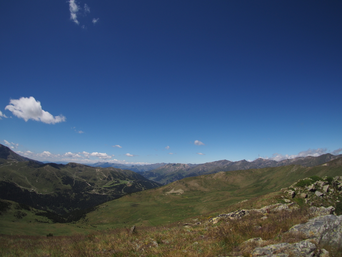
I had grand plans for today and wanted to attempt to climb up to six Munros in the Glenshee area. Starting with Creag Leacach (987m) and Glas Maol (1068m), I wanted to cross over to Cairn of Claise (1064m), potentially taking in Tom Buidhe (957m) and Tolmount (958m), before returning to A93 via Càrn an Tuirc (1019m).

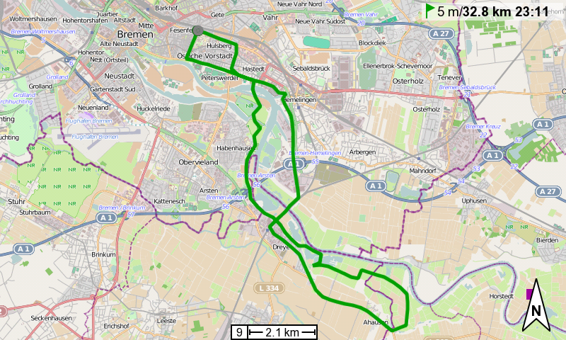
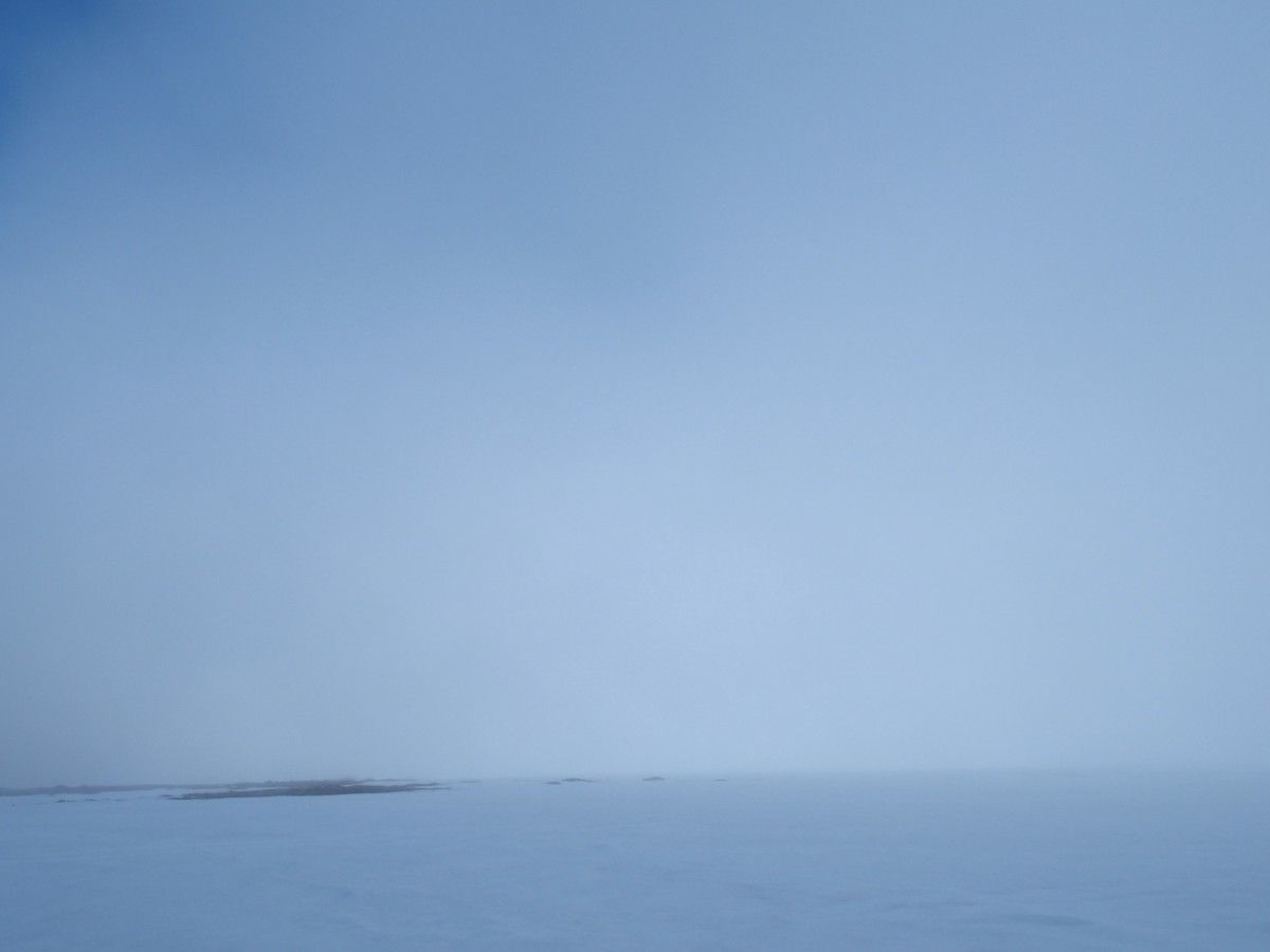
The weather wasn’t particularly great and I couldn’t see any of the hill-tops around me, they were all covered in a dense layer of grey clouds. So I also didn’t see that they were all properly snow-covered (though I guessed that from the snow patches on the hillsides – and the time of year). I had a good map, compass, and GPS with me, though.

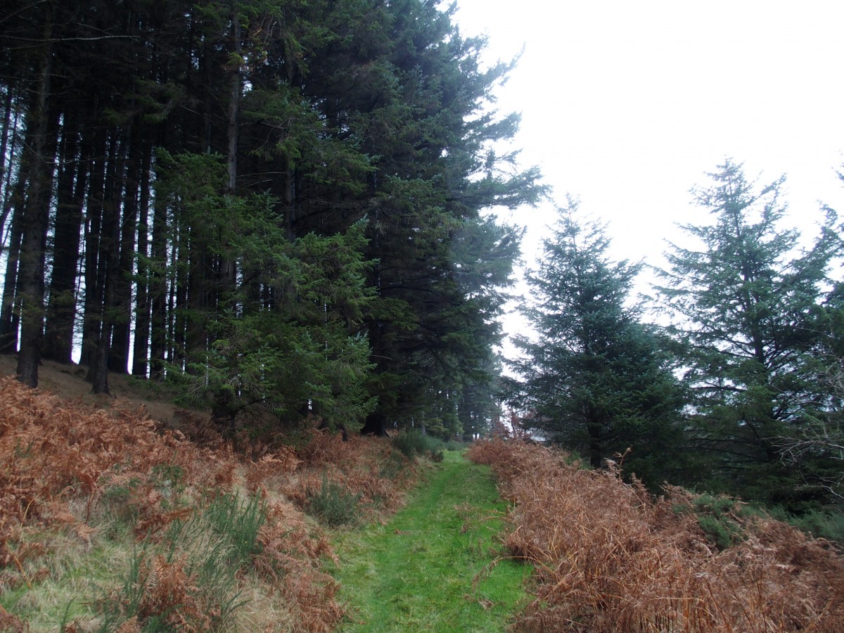
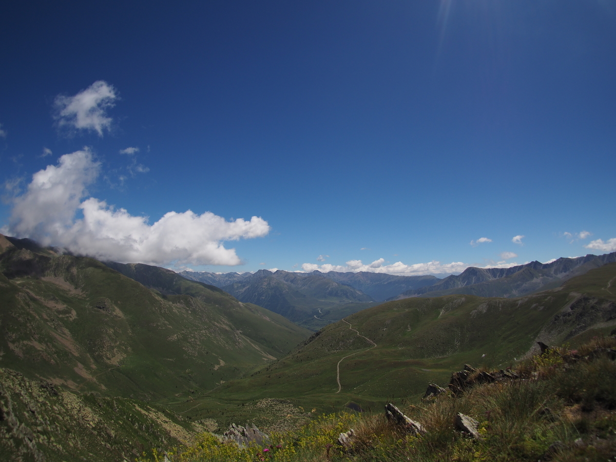
I parked on the central car park of the Glenshee ski area and walked down the A93 to begin my walk with the ascent of Creag Leacach. In hindsight, following the descending road south added an unnecessary climb to the walk. If memory serves right, some of this could have been avoided by leaving the road quite early on and crossing over to Creag Leacach’s base via a parallel ridge. Anyway, whether that would have been faster is an entirely different question. And the ascent wasn’t so bad in the end.

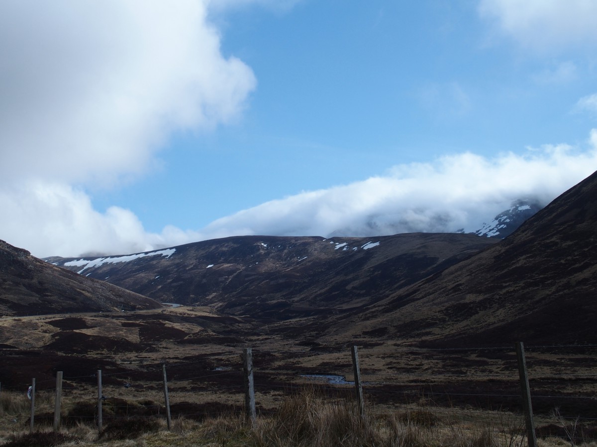
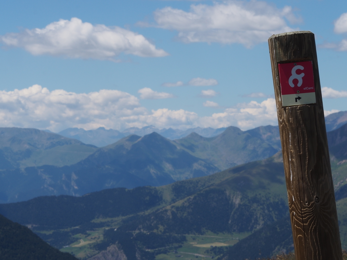
Visibility soon went downhill while I walked up. Interestingly, the boundary between the council of Angus and the council of Perth and Kinross follows the crest between the peaks of Creag Leacach and Glas Maol (and from there the boundary between Kinross and Perth and Aberdeenshire follows over to Cairn of Claise and Tolmount), and additionally, is marked by a somewhat derelict drywall. This wall was visible for the last part of the way up to Creag Leacach already, and was easily followed thereafter as well, as it’s crown often peeked through the snow.

Not far from Glas Maol my path was crossed by a kind of snow mobile which was unexpected and faded away in the fog as quickly as it had emerged, but reminded me that Glenshee is a ski resort.

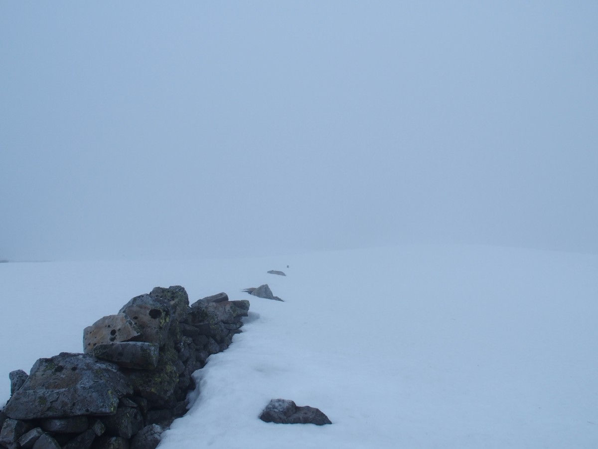
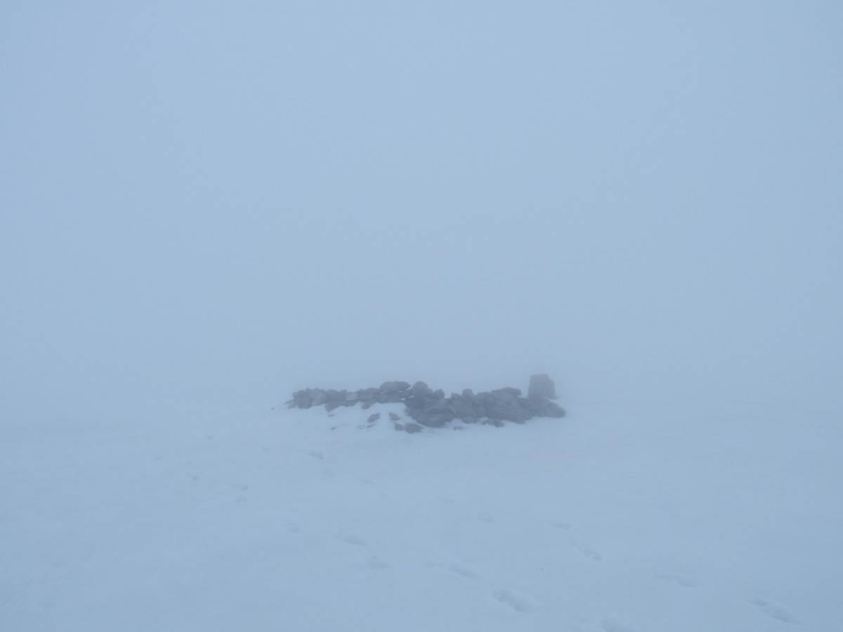
Both Creag Leacach and Glas Maol were easily reached. From the latter, however, it became more difficult to march on. Owing to white clouds on white snow, visibility was seriously poor and at some point both compass and GPS started to display gibberish. I was indeed lucky that there was snow, which allowed me to retrace my steps.

Having lost quite some time trying to find my way, I decided to call it a day. Walking towards the other Munros would have led me further away from the road and given the weather conditions and the flaky navigational aids that didn’t seem like an exceptionally smart thing to do. I descended close to the ski slopes and wished I’d had a snowboard with me.

Trip: Day Trips | Country: | Comments Off on Creag Leacach and Glas Maol

Across the Isle of Man

I happen to be on the Isle of Man for a few days. This morning I hopped on a random bus, which brought me to Peel on the western side of the island. I spent an hour there and had an early lunch, and then took another bus north to Ramsay. I got off about halfway though, in Kirk Michael. And somehow I decided to walk along Baltic Road and across a hill from there. Halfway through it started to rain and the wind got stronger, and somehow I decided I’d walk all the way through to the other side of the island.

The path I had followed deteriorated to almost ;) Malagasy dimensions. It soon ended and my only choice was to cross private land to reach Druidale Road further down in the valley.

On Druidale Road I reached Druidale Farm, from where a footpath leads to the head of Sulby Reservoir. Here I joined Sulby Glen Road, which climbs along the hillside of Snaefell (621m), the highest mountain on the island. The weather got worse; rain, fog and a heavy-heavy head wind (I should have done this in the other direction) made the walk somewhat difficult. Visibility had decreased to less than 50m and sometimes I walked side-ways to evade the heaviest of gusts. With rain in my face and wind in my ears I didn’t hear my camera’s screams for help – it drowned unnoticed in my jacket’s pocket (water-proof apparently means: the water that’s inside won’t get out any more).

When darkness fell I reached Bungalow, a station on the Snaefell Mountain Railway at the junction of Sulby Glen and Mountain Road. The railway doesn’t run during the winter, so what could be more obvious than to use it’s tracks to reach Laxey, especially since there is no other direct road or path available?

The walk on the tracks was almost pleasant and about an hour later I emerged in Laxey on the eastern coast of the Isle of Man. Only when I sat down in the bus that brought me back to Douglas (the capital of the Isle of Man) I realized that my clothes were more or less completely soaked and I started to get cold. Nothing a hot shower and a warm dinner couldn’t fix, though.

Trip: Day Trips | Country: | Comments Off on Across the Isle of Man

Up An Stac

A short walk/climb up An Stac, an 814m hill not far from here.

It was chilly as I approached the hill from the north-east, in the shade. The sun was already past the zenith – I started the walk in the early afternoon. In some sections near the summit I had to use my hands to scramble a few metres, but mostly it was an easy’ish walk.

The view from the top was spectacular, though, as you can see below.

I descended on the ‘sunny’ side and was back down at the road long after nightfall.

Trip: Day Trips | Country: | Comments Off on Up An Stac

Hiking in Andorra

I happen to be in the French Pyrenees for some hiking with friends. Due to some knee trouble I decided to chicken out and let the others finish the hike on our planned route. I, on the other hand, took train and bus to Andorra yesterday, that tiny landlocked country between Spain and France, to have a look at it and try my luck with a day hike without backpack.

So today I left Pas de la Casa to the north to follow the Haute Randonnée Pyrénéenne (HRP), a hiking trail along the entire length of the Pyrenees, for a few hours. It took me an hour to climb out of the valley and leave the noise of the city behind. ‘City’ is a bit of a euphemism here. There are three things prevalent in Pas de la Casa: hotels, duty-free shops, and ski resorts.

Anyway, from then on it was beautiful walking over grassy slopes and the occasional scaling of a hill’s summit (e.g. Pic de Maià, 2615m). The HRP was joined by La Volta a Andorra, a circular trail around Andorra, and I followed both for a while, not without coming across the occasional marmot. Before the trails separated again they led me into a most beautiful valley, that of the Riu Siscaro. I can’t describe it in words, and the photos won’t do it justice either. The same goes for the following traverse, to the valley of the Riu de Juclar. They looked almost wild and unspoilt, except that the nearest road and settlement was never more than 1 or 2 kilometers away, of course.

Near the latter river’s source (?) is a refugi at an artificial lake, Estany Primer de Juclar, that I briefly visited before heading down along the Riu de Juclar towards Andorra’s main road.

Though impoverished until the 1950s, from what is left of old architecture and roads, Andorra must have been an amazing-looking country. Tourism brought money but spoiled the beauty. Quite a catch 22, eh?

Walked: 18.5km or so

Trip: Day Trips | Country: | Comments Off on Hiking in Andorra

Introducing Lutske

After a few days of sailing on the Baltic Sea I spent a night in the German state of Mecklenburg-Vorpommern. I had Lutske with me, an inflatable Stand-Up Paddle board and new tender to Balkonia, and wanted to try and see how she would perform on some ‘long-distance’ paddling with light luggage.

I had picked a short canal between the towns of Bützow and Güstrow, aptly named the Bützow-Güstrow-Kanal, for the trial. The canal was built as part of a larger route between Berlin and the Baltic Sea at the end of the 19th century, which was – unfortunately – never finished. It is only 14 km long. The stretch I had picked for paddling was even shorter: 10km from Bützow to the historical draw bridge near Lüssow.

The canal is beautifully located and quiet. The weather was amazing. Lutske performed well. However, being new at SUP paddling, I certainly didn’t manage to release her full potential.

After 5.5 km the canal started to be quite infested with weeds which the aft fin got entangled in and subsequently slowed me down a lot. I removed it from the board. This helped with speed but not with directional stability. The experiment ended after 6 km and approx. 2 hours. In my defense, this included a few photo stops as well as two portages.

Trip: Day Trips | Country: | Comments Off on Introducing Lutske